
How to create a cross-section using an ordnance survey map
The extract from the map below includes a transect line (A-B). We are going to create a cross-section of this transect.
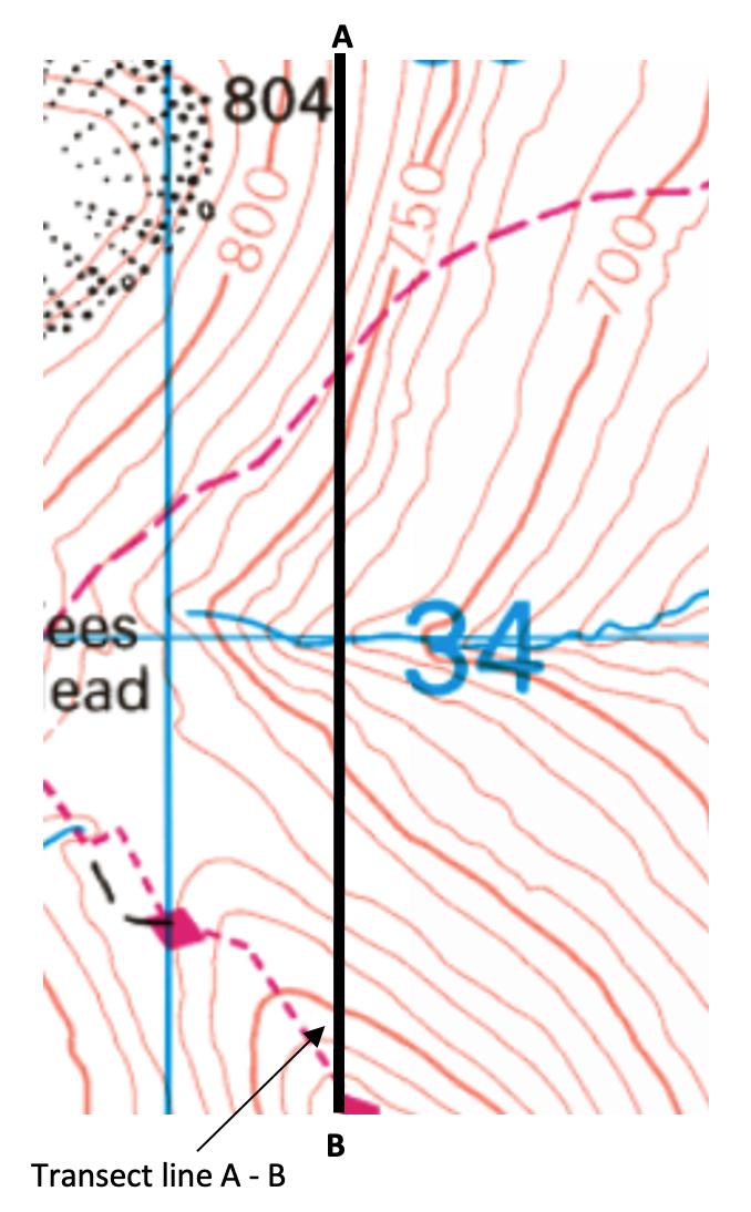
The OS map extract shows the line we will create a cross-section for
Take a strip of paper. Mark A at the start of the transect and B at the end. Place a mark where a contour line crosses the transect. Record the height. Also, mark any roads/rivers etc.
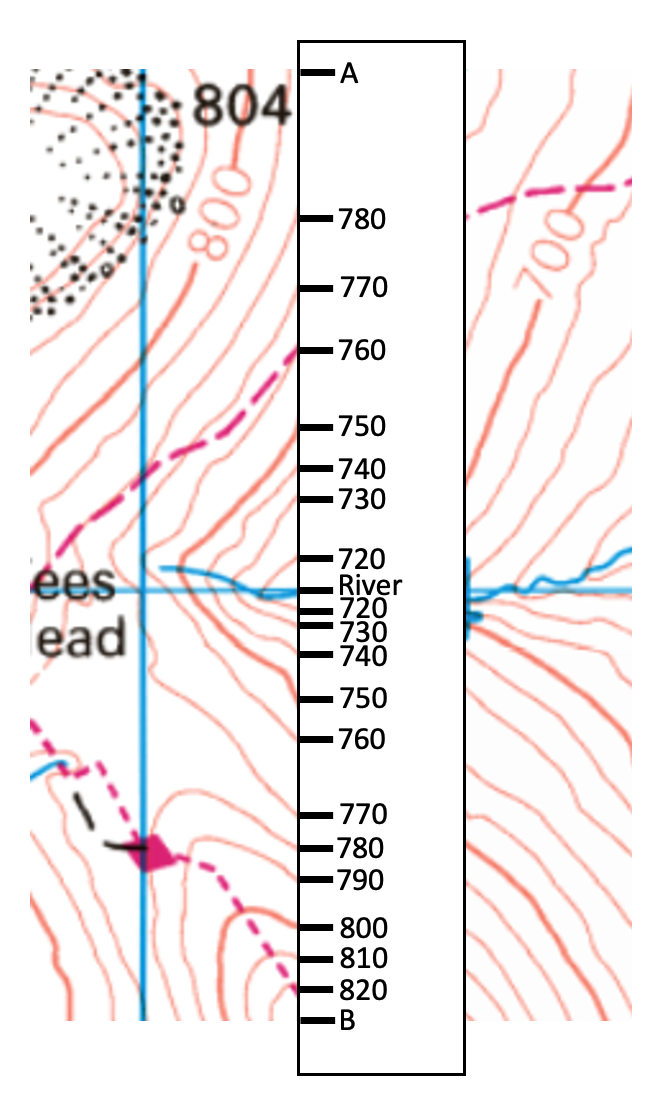
Using a strip of paper, mark each contour that crosses the transect line
On graph paper, draw the horizontal (x ) axis, the same length as the transect, using a pencil and ruler. Check the maximum height of the contours along the cross-section, then create an appropriate Y-axis scale. Label the Y axis. Use your strip of paper to plot the heights as shown below.
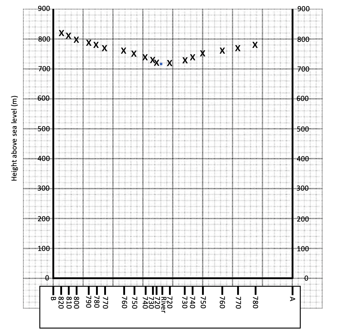
Plot the points on the graph. Remember to join the crosses to complete the cross-section.
Use a pencil to draw a smooth line connecting the points you have plotted.

Top Posts and Pages
Latest Blog Entries

 AQA GCSE Geography Pre-release Resources 202424 March 2024 - 10:27 pm
 GCSE Geography Mind Maps14 March 2024 - 2:02 pm
 Statistical Techniques in Geography Poster26 February 2024 - 2:11 pm
 How do I revise GCSE Geography?19 February 2024 - 12:33 pm
 Britain’s Most Desirable Towns8 February 2024 - 2:19 pm
 Revision Resources on Internet Geography Plus3 January 2024 - 12:37 pm
 2024 Sea of Japan Earthquake2 January 2024 - 1:55 pm