
Nyiragongo Case Study
This case study has been developed to support students studying Edexcel B GCSE Geography.
Tectonic Setting and Location
Mount Nyiragongo is a composite volcano located in the east of the Democratic Republic of the Congo (DRC). The volcano consists of a huge (2km wide) crater, usually filled with a lava lake, and is only 20km away from the city of Goma. Nyiragongo is currently classed as active (2020).
Nyiragongo is located on a divergent plate boundary where the African plate is being pulled apart into the Nubian plate (east) and Somali plate (west), causing lava to rise between. Eruptions are non-explosive as the lava is basaltic, with a low viscosity, which means it is runny and fast flowing (up to 37 mph).
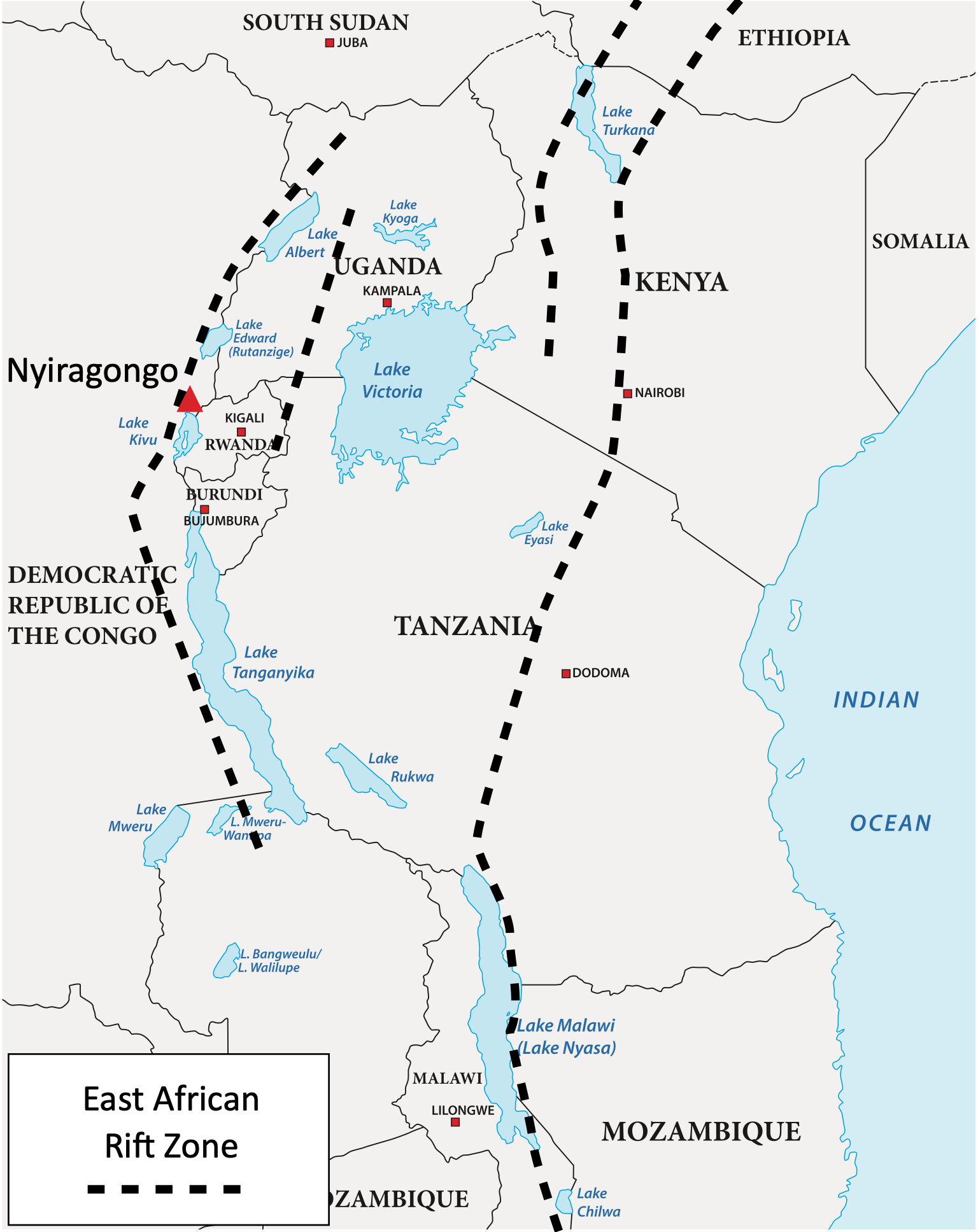
A map to show the location of Mount Nyiragongo
What are the Primary Impacts of Nyiragongo?
The eruption of Mount Nyiragongo in January 2002 had a significant impact on the surrounding area due to huge lava flows.
The primary effects of a volcanic eruption are those caused instantly. These are directly linked to the type of volcano and eruption.
The primary effects of the January 2002 eruption include:
- The lava flow and earthquakes triggered by volcanic activity destroyed 12,500 homes.
- At least 15% of Goma was covered by lava, with one-third of the city being destroyed.
- 80 per cent of the airstrips at Goma International Airport were covered in lava.
- The majority of the 200 deaths were caused by carbon monoxide poisoning from the eruption (this continues to be a threat today).
- The lava flows destroyed crops, and many livestock were killed.
- There were drinking water shortages due to the disruption caused to main water supplies.
- 400,000 people were evacuated from their homes to avoid the lava.
What are the Secondary Impacts of Nyiragongo?
The secondary effects of a volcanic eruption are those that occur in the hours, days and weeks after an eruption.
The secondary effects of the 2002 Nyiragongo eruption include:
- Acid rain fell due to the reaction of volcanic gases in the atmosphere, damaging farmland.
- Refugee camps were overcrowded as many of the 120,000 homeless could not afford to rebuild their homes.
- Overcrowding and poor hygiene conditions led to the spread of cholera in refugee camps.
- The economic impact of the eruption was felt across the region as businesses and shops were destroyed.
- After people evacuated Goma, looting broke out.
How are Nyiragongo’s Hazards Managed?
Management of volcanic hazards includes short-term relief (shelter and supplies) and long-term planning (trained and funded emergency services), preparation (warning and evacuation; building design) and prediction.
Short-term relief
Approximately 400,000 people were evacuated from the vicinity of the volcano. The pace of evacuation was slow until plumes of smoke from the volcano were visible. The evacuation plans were very limited, many residents had not experienced a volcanic eruption. This led to people heading to the volcano to see the eruption, slowing the evacuation process. As a result, around 50,000 inhabitants of Goma became trapped between two lava flows.
The damage to Goma’s airport disrupted the arrival of international aid.
The United Nations sent 260 tonnes of food to the affected area within a week of the eruption. Families received 26kg of rations each.
UK Oxfam sent 33 tonnes of water-cleansing equipment for 50,000 people in refugee camps. The £150,000 package mainly contained water purification kits to provide clean water for drinking and sanitation. This stopped people from drinking contaminated water from Lake Kivu and helped to reduce the spread of cholera in some refugee camps.
The World Health Organisation and Médecins Sans Frontières (MSF) conducted emergency measles vaccinations to 28,000 children to stop the spread in refugee camps.
Refugee camps, made from scrap metal, were set up to house the displaced populations.
Communication was poor between agencies and refugees. Many people began to travel back to the affected area within a few days to collect belongings and supplies from their homes, even though it was not yet safe. Some walked across hot lava that was not yet solidified and cooled to get home.
Governments around the world gave $35 million in aid to support refugees.
Long-term planning
Preparation
Thirty new signs that detail the early warning signs of a volcanic eruption have been put up in high-risk areas. Evacuation routes have also been mapped.
Communities and schools now have evacuation drills to prepare people for future eruptions.
Leaflets have been distributed to vulnerable people containing information on evacuation routes, shelters and advice on what to do in an emergency.
The International Federation of Red Cross and Red Crescent Societies has expressed a need for more funding to release further educational materials to communities in need.
Planning
Officials have been retrained and provided with evacuation plans; each has a designated community to support.
Community officers have been trained to relay information to vulnerable communities if an eruption occurs.
Prediction
Knowledge from similar volcanoes has encouraged vulcanologists to measure carbon dioxide emissions from the volcano and within Lake Kivu to predict if levels will become lethal (as people can die from carbon dioxide poisoning).
An observatory for the volcano, The Observatoire Volcanologique de Goma, constantly monitors the volcano.
The large lava lake in Mount Nyiragongo is visible from above, so its levels can be carefully monitored to see if an eruption is impending.

Related Topics
Use the images below to explore related GeoTopics.
Topic Home
Next Topic Page
Top Posts and Pages
Latest Blog Entries

 AQA GCSE Geography Pre-release Resources 202424 March 2024 - 10:27 pm
 GCSE Geography Mind Maps14 March 2024 - 2:02 pm
 Statistical Techniques in Geography Poster26 February 2024 - 2:11 pm
 How do I revise GCSE Geography?19 February 2024 - 12:33 pm
 Britain’s Most Desirable Towns8 February 2024 - 2:19 pm
 Revision Resources on Internet Geography Plus3 January 2024 - 12:37 pm
 2024 Sea of Japan Earthquake2 January 2024 - 1:55 pm