Grid References
Grid references help us locate places on a map.

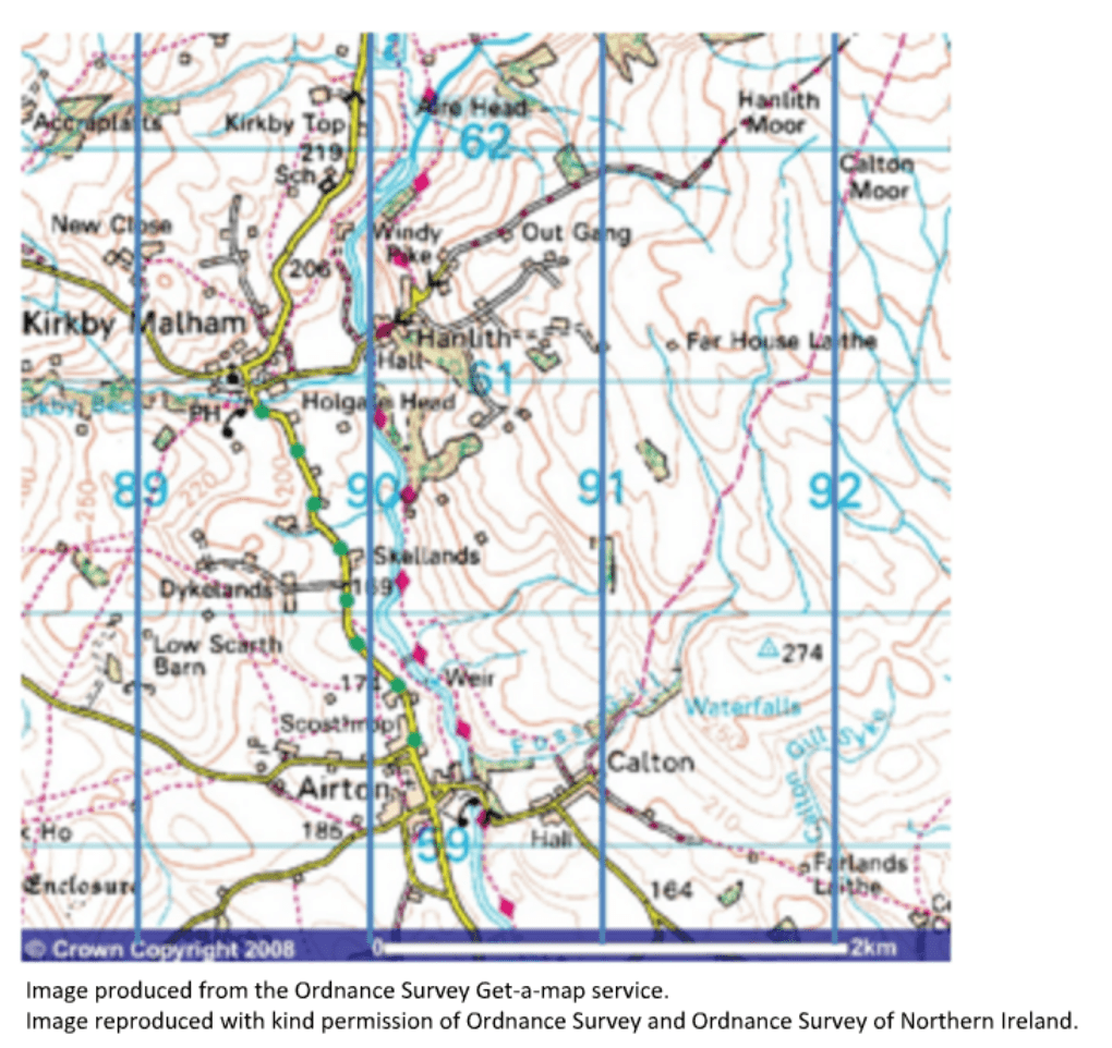
Look at the Ordnance Survey map below. Notice the blue squares that overlay the map.
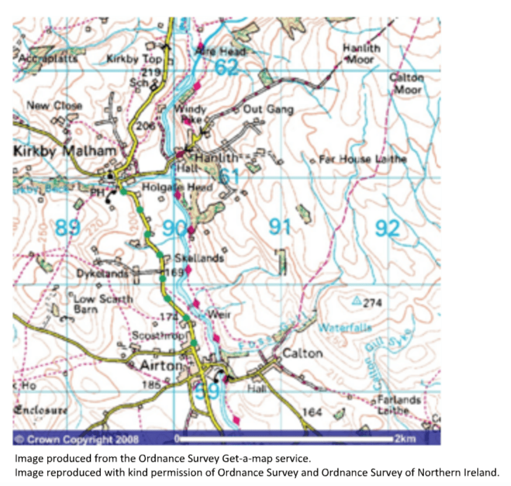
Eastings are the lines that run from the top of the map to the bottom. They show you how far east you must go.
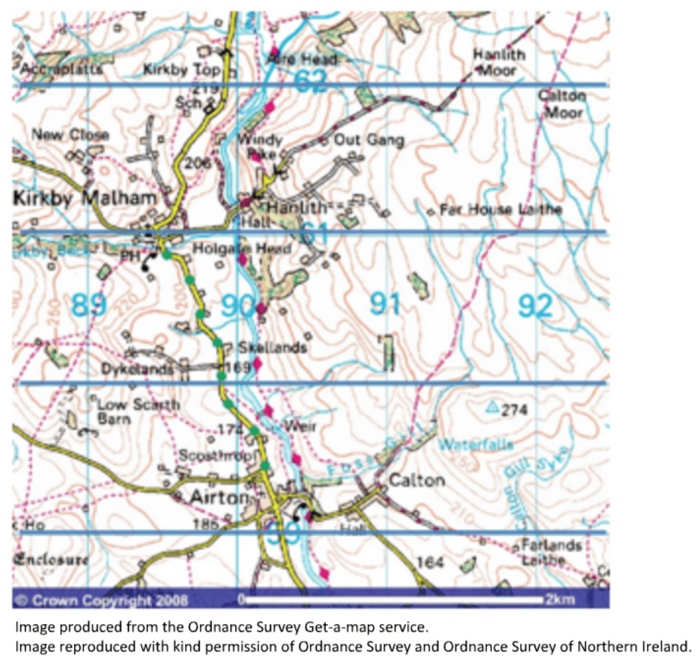
Northing are the lines that run from the left to the right of the map. They show you how far north you must go.
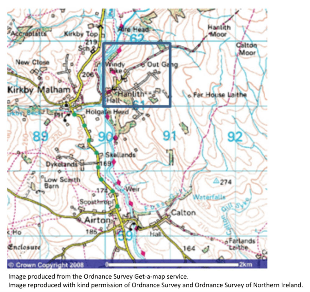
When giving a grid reference the eastings are given first, followed by the northings. The four figure grid reference for the square below is 9061.
Six figure grid references allow you to identify an exact location within a grid square. Let’s zoom into 9061 to find out how these work.
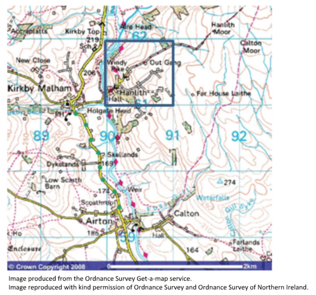
In order to identify a six figure grid reference we need to imagine another grid on top of the existing square.
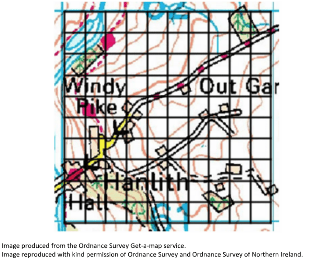
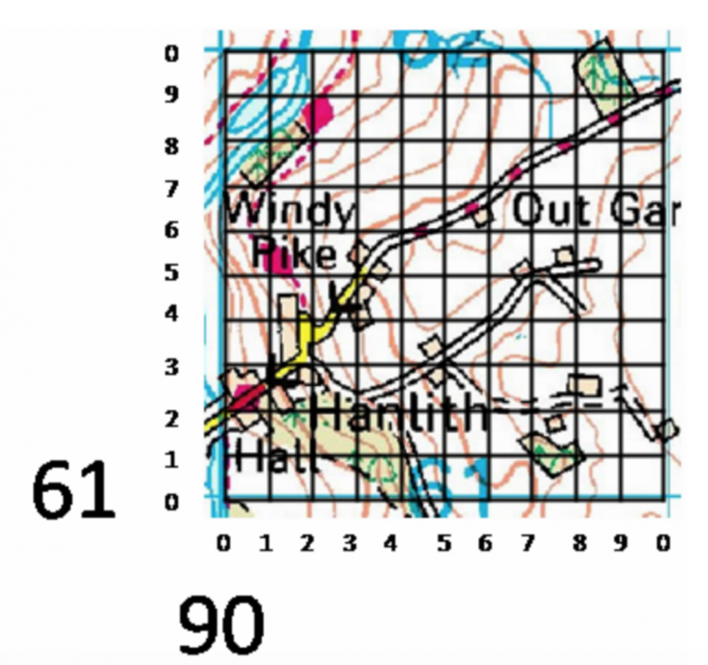
These are then numbered as below.
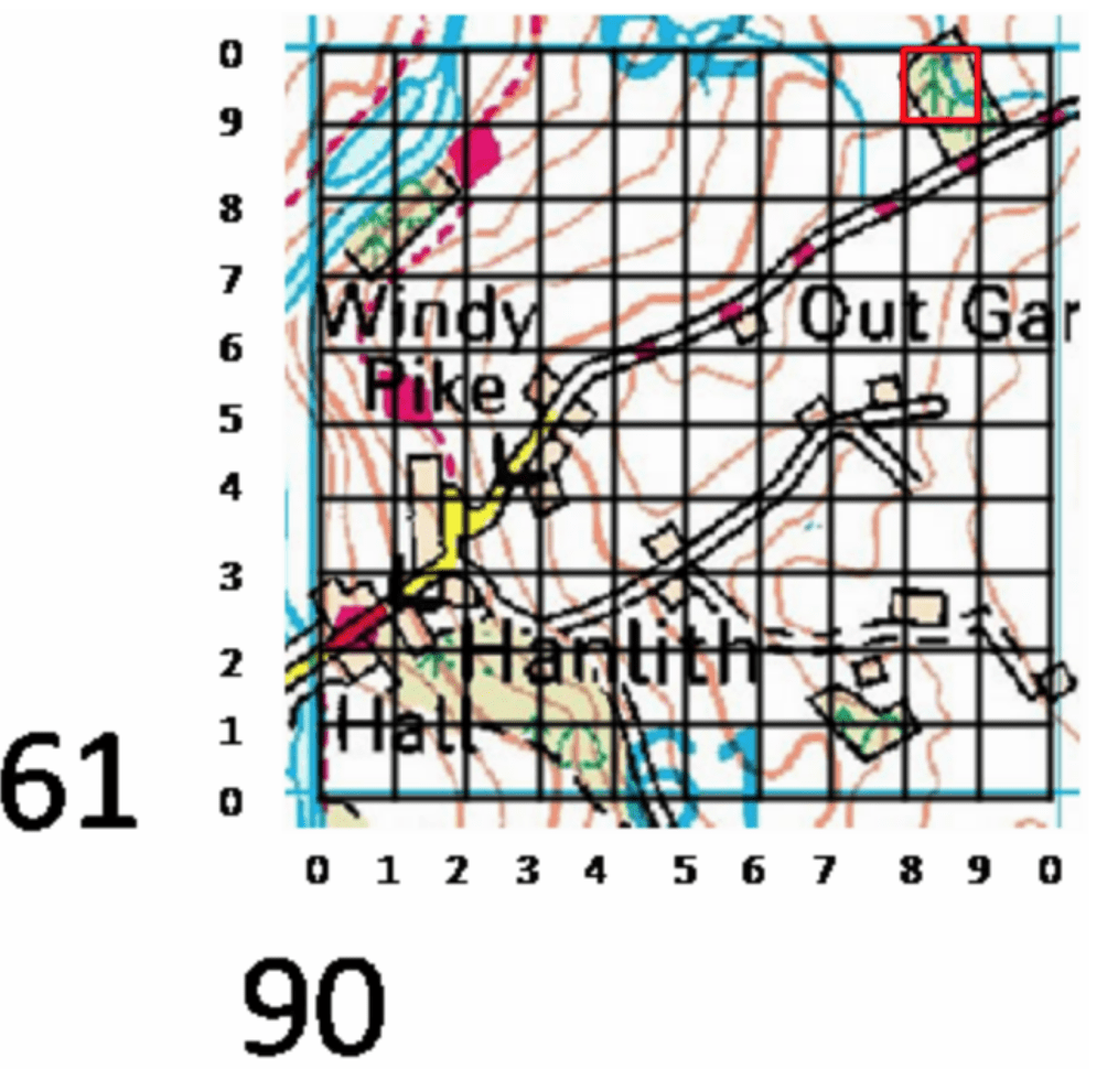
The six figure grid reference for the coniferous forest shown below is 908619. Again, the eastings come before the northings.
Use the images below to explore related GeoTopics.