
Glacial landforms in the Lake District
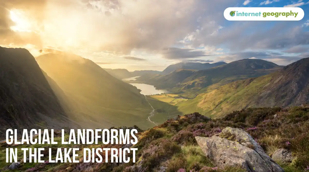
The Lake District in north-west England is one of the best examples of a glaciated upland landscape in the UK. Its high mountains, deep valleys and long narrow lakes have been strongly influenced by glaciers.
During the last ice age, ice accumulated in the uplands of the Lake District. Glaciers developed in hollows on the mountains before flowing down existing river valleys. As the ice moved, plucking and abrasion eroded the landscape. Glaciers transported large quantities of eroded rock and sediment, which were deposited as the ice melted.
Today, the landscape contains clear evidence of both glacial erosion and deposition.
Why was the Lake District affected by glaciation?
The Lake District contains some of the highest land in England. During the last ice age, its altitude and colder climate allowed snow to accumulate in the mountains.
Over time, the snow was compressed into ice. Glaciers formed in upland hollows and eventually became large enough to flow into the surrounding valleys.
Ice flowed outwards from the central Lake District in several directions. As the glaciers moved, they widened and deepened valleys, cut into mountainsides and transported large amounts of rock.
When the climate warmed and the glaciers melted, they left behind the glacial landscape we see today.
Corries
Corries are deep, armchair-shaped hollows found high on mountainsides. They have steep back walls and an over-deepened hollow, often with a rock lip at the front.
There are several good examples in the Lake District. Red Tarn, on the eastern side of Helvellyn, occupies a corrie that was eroded by ice during the last ice age.
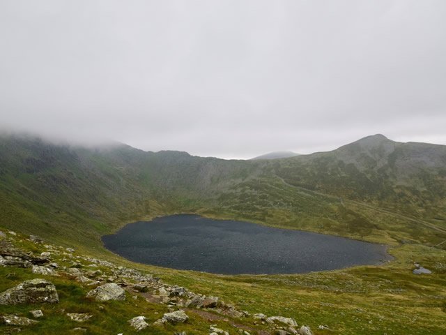
Helvellyn and Red Tarn
Snow accumulated in a hollow on the mountainside and was gradually compressed into ice. As the ice moved, plucking and abrasion deepened the hollow and steepened its back wall. When the glacier melted, water collected in the hollow to form Red Tarn.
Arêtes
An arête is a narrow, steep-sided ridge formed when glaciers erode the land on either side.
Striding Edge on Helvellyn is one of the Lake District’s best-known arêtes. It forms a narrow ridge leading towards the summit of Helvellyn.
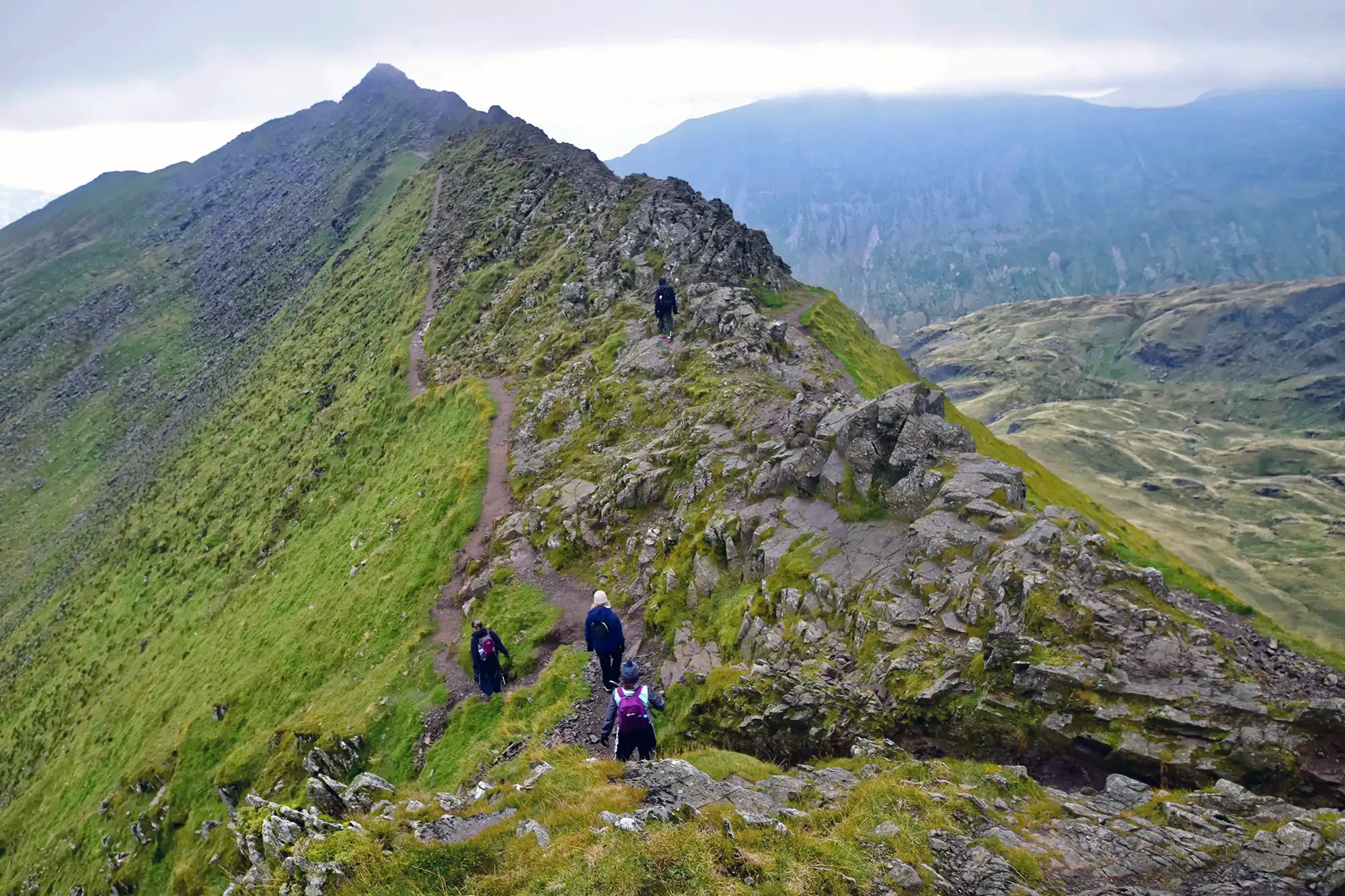
Striding Edge, an arête in the Lake District
During glaciation, ice occupied corries and valleys on either side of the ridge. Erosion caused the sides to become steeper and the ridge between them narrower, leaving the sharp landform seen today.
Swirral Edge, on the other side of Red Tarn, provides another example.
Pyramidal peaks
A pyramidal peak is a steep-sided mountain summit created when glaciers erode a mountain from several sides. As corries grow backwards towards one another, the remaining rock is left as a sharp peak.
Great Gable is a good example in the Lake District. Its distinctive steep-sided appearance is the result of glacial erosion around the mountain.
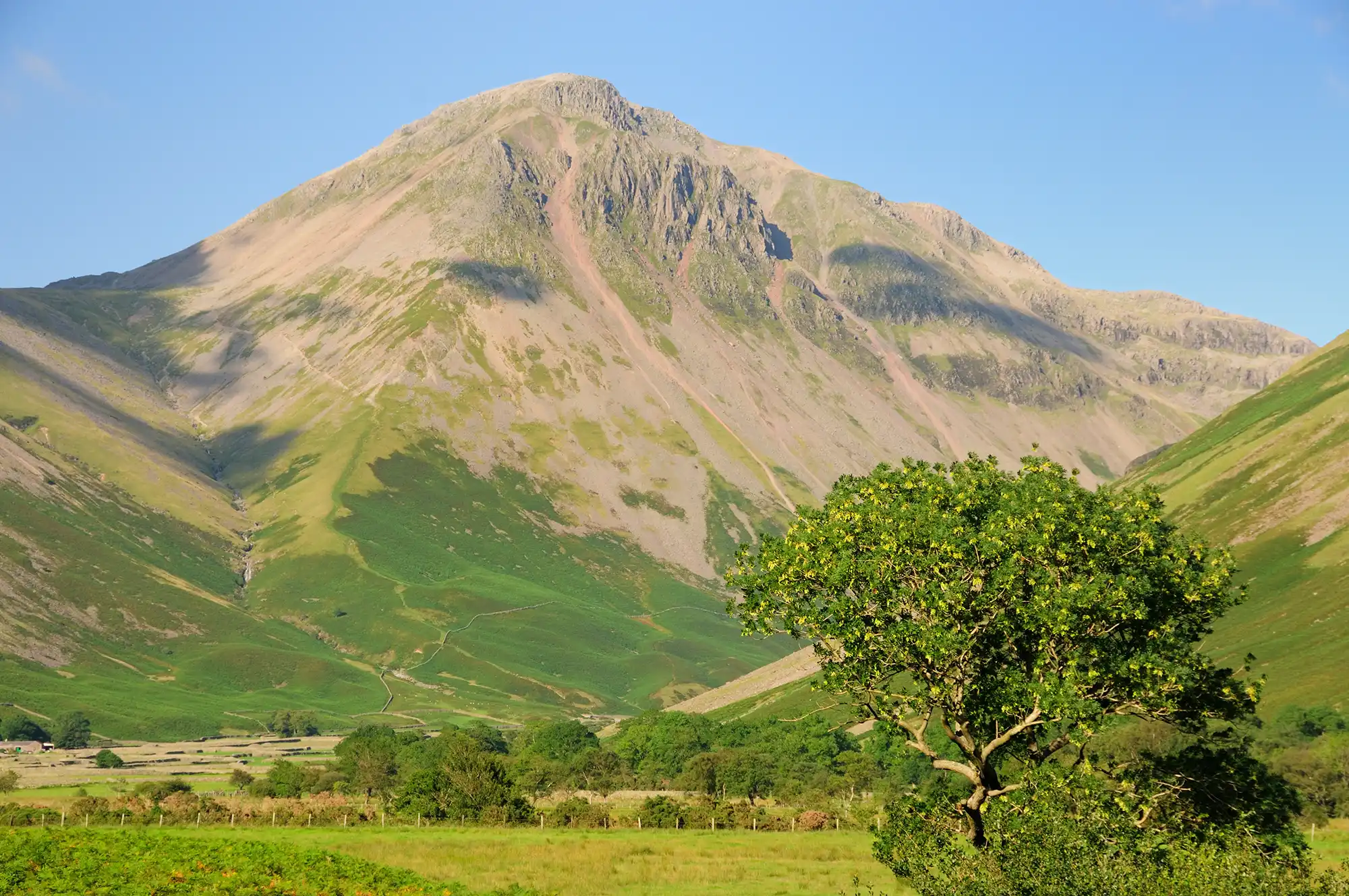
Great Gable, a pyramidal peak in the Lake District
Pyramidal peaks are closely associated with corries and arêtes, as all three landforms develop through erosion of the higher parts of a glaciated mountain landscape.
Glacial troughs
Some of the most obvious evidence of glaciation in the Lake District can be found in its valleys.
Before glaciation, rivers occupied narrower, V-shaped valleys. During the last ice age, much larger glaciers flowed through these valleys. Plucking and abrasion widened, deepened and straightened them, creating glacial troughs with steep sides and broad valley floors.
The valley containing Great Langdale is a good example of a glacial trough. Its wide floor and steep valley sides contrast with the narrower V-shaped valleys produced by rivers.
Truncated spurs
Before glaciation, rivers flowed around interlocking spurs of land. Glaciers were much larger and filled the valleys they occupied. Rather than winding around the spurs, the ice eroded through their ends.
This left steep-sided truncated spurs along the sides of glacial troughs.
Truncated spurs can be seen in several of the Lake District’s major glacial valleys, including Great Langdale.
Hanging valleys
During the last ice age, smaller tributary glaciers joined larger glaciers occupying the main valleys. The larger glaciers contained more ice and were able to erode their valleys more deeply.
When the ice disappeared, the smaller tributary valleys were left above the floors of the main glacial troughs. These are known as hanging valleys.
Hanging valleys can be seen around Great Langdale, where smaller valleys meet the main glacial trough at a higher level. Streams descending from hanging valleys may form waterfalls where there is a sudden drop into the main valley.
Ribbon lakes
The Lake District is particularly well known for its long, narrow lakes. Many occupy sections of glacial valleys that were over-deepened by erosion.
Windermere is England’s largest natural lake and occupies a long glacial trough. Glacial erosion deepened sections of the valley floor, and after the ice melted, water collected in the hollow.
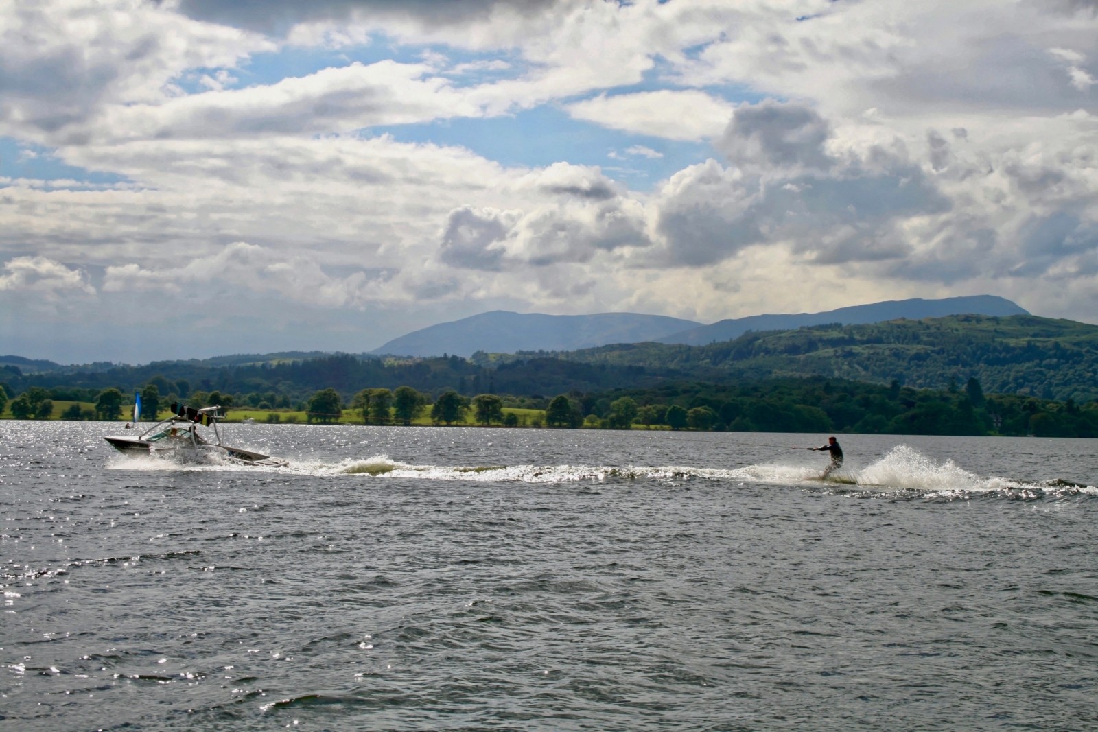
Lake Windermere
Other examples of lakes occupying glacially eroded valleys include Ullswater and Coniston Water.
Their long, narrow shape reflects the glacial valleys in which they formed.
Glacial deposition in the Lake District
Glaciers also left behind large quantities of material as they melted. This material included clay, sand, gravel and boulders that had been transported by the ice.
Depositional landforms in the Lake District include moraines, drumlins and erratics.
Moraines
A moraine is an accumulation of rock and sediment transported and deposited by a glacier.
Moraines can be found in many of the Lake District’s glacial valleys. Lateral moraines developed from material carried along the sides of glaciers, while terminal and recessional moraines were deposited at the snout of the ice.
Moraines are useful evidence of the former position and movement of glaciers. Ridges of moraine can mark places where the glacier’s snout remained in a similar position for a period of time as the ice retreated.
Drumlins
Drumlins are smooth, elongated hills, commonly made from glacial till. They are shaped beneath moving ice and are often found together in groups called drumlin swarms.
An extensive drumlin field can be found around Kendal, on the south-eastern edge of the Lake District. The drumlins have a streamlined shape and are aligned with the former direction of ice movement.
Drumlins can also be found on the valley floor in Great Langdale, providing further evidence of the movement and deposition of material by glaciers in the Lake District.
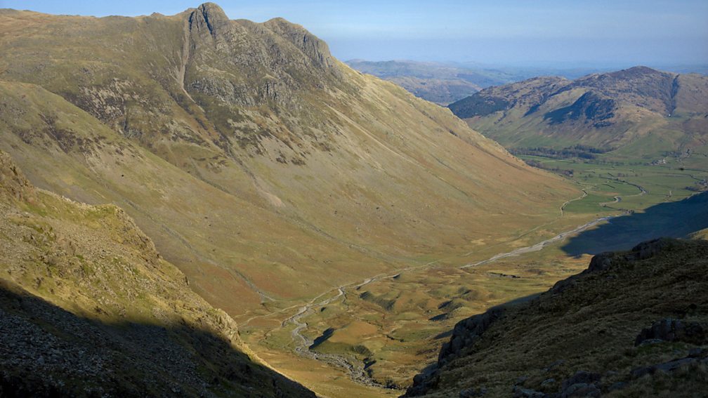
Drumlins at Langdale
Their orientation provides evidence of how ice flowed out of the Lake District during the last ice age.
Erratics
Erratics are rocks that have been transported by a glacier and deposited away from their original source.
Shap granite erratics can be found around Shap in Cumbria. During the last ice age, glaciers transported these distinctive pink granite boulders away from the Shap area. Some were carried many kilometres before being deposited as the ice melted.
Because the granite can be matched to its original source, the location of Shap granite erratics provides evidence of the direction in which the ice once moved.
Evidence of glaciation in the Lake District
The Lake District contains a wide range of erosional and depositional landforms within a relatively small area.
On and around Helvellyn, features such as Red Tarn, Striding Edge and Swirral Edge show how glaciers eroded the higher mountains. In valleys such as Great Langdale, glacial troughs, truncated spurs and hanging valleys show the impact of much larger valley glaciers.
Lakes such as Windermere occupy valleys deepened by glacial erosion, while moraines, drumlins and erratics provide evidence of the transportation and deposition of material by the ice.
Together, these landforms provide clear evidence that the Lake District was extensively glaciated during the last ice age.


