
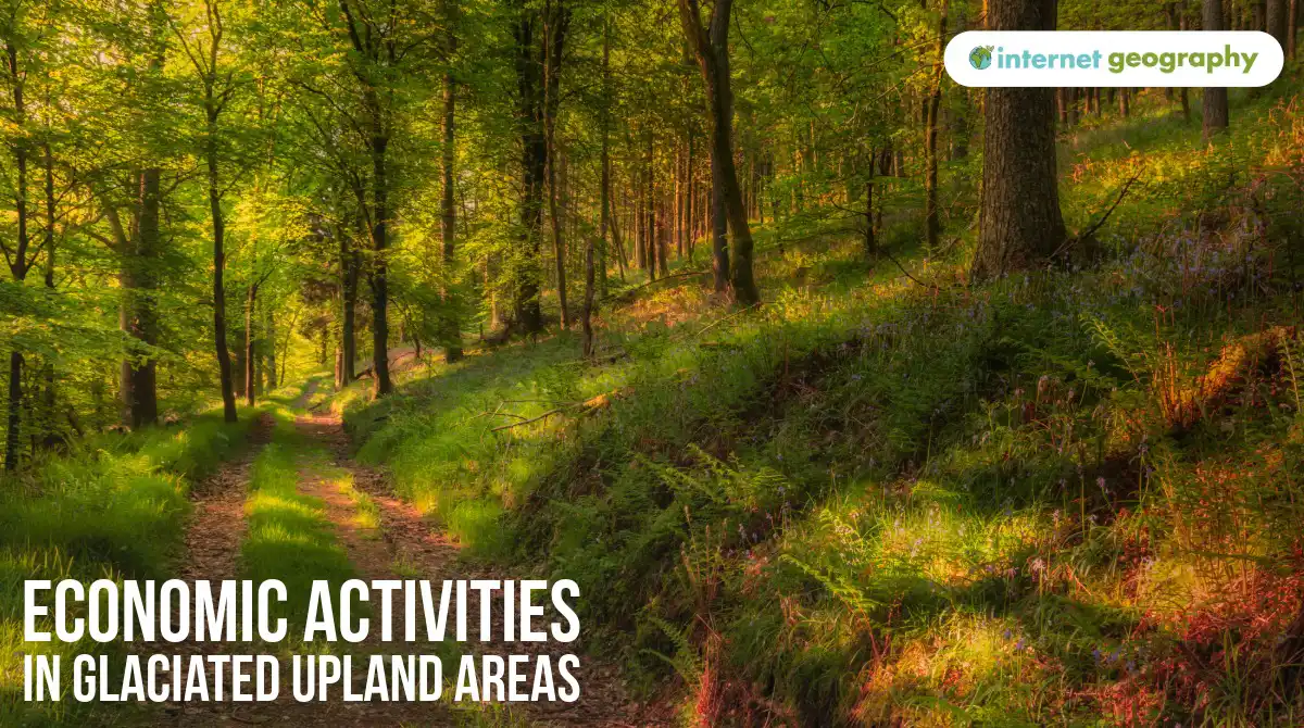
Economic activities in glaciated upland areas
Glaciated upland areas are important for a range of economic activities. Farming, forestry, tourism and quarrying all make use of the landscape and its natural resources.
However, these can be challenging places in which to work. Steep slopes, high rainfall, low temperatures and thin soils limit some activities, particularly crop farming. At the same time, the spectacular scenery created by glaciation attracts millions of visitors, while upland geology provides valuable rock that can be quarried.
Why does farming take place in glaciated upland areas?
Farming has shaped the UK’s upland landscapes for hundreds of years. However, the physical environment limits the types of farming that can take place.
Glaciated upland areas tend to have steep slopes, making it difficult to use large agricultural machinery. Soils on higher ground are often thin and relatively infertile, while lower temperatures result in a shorter growing season. High rainfall can also leave soils waterlogged.
These conditions make growing crops difficult. Instead, much of the land is used for extensive livestock farming, particularly sheep farming. Sheep can graze across large areas of rough grassland that would be unsuitable for growing crops.
The Lake District is a good example. Around 90% of Cumbria’s designated Less Favoured Areas are within the Lake District, reflecting the difficult conditions farmers face. Sheep and beef farming are particularly important.
Sheep farming in the Lake District
Sheep are well suited to the steep slopes and exposed conditions of the Lake District. Herdwick sheep are particularly associated with the area and are able to cope with cold, wet conditions on the high fells.
Many sheep graze on open fell land during the summer. More than 60% of the Lake District’s fell is common land, where farmers have traditional rights to graze their animals.
Farming varies with altitude. The rough grazing of the higher fells is mainly used for sheep, while the flatter and more fertile land on valley floors can support cattle and provide grass for hay and silage.
The climate helps explain this pattern. The growing season is relatively short, while some parts of the Lake District receive very high rainfall. Seathwaite receives around 3,552 mm of rain each year, making it one of the wettest inhabited places in England.
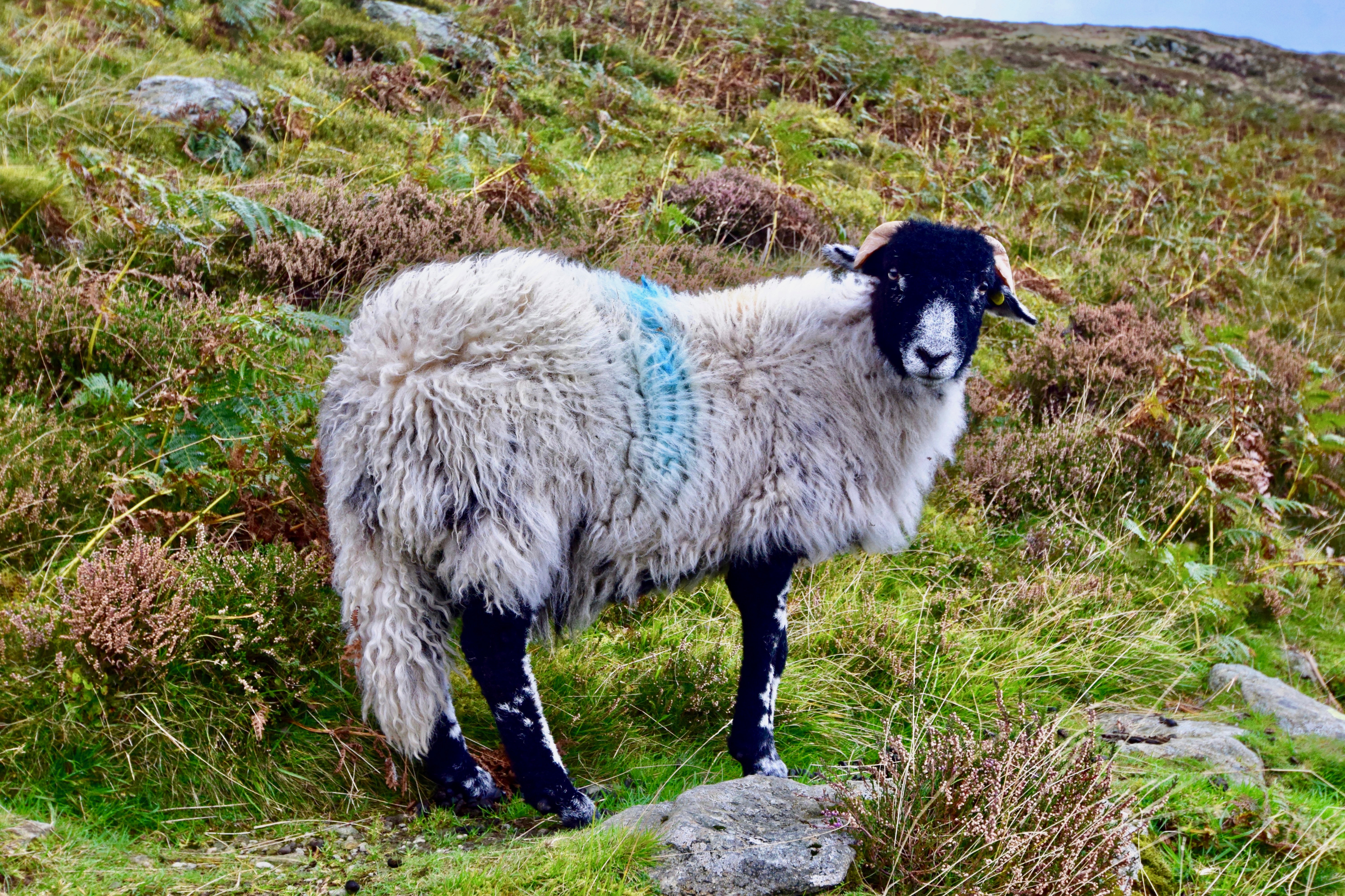
Sheep farming in The Lake District
Why does forestry take place in glaciated upland areas?
Forestry is another important use of upland land.
Trees can grow on steep slopes and on land that may be unsuitable for crop farming. Upland areas also tend to have high rainfall, providing a good supply of water for tree growth.
Commercial forestry has traditionally involved planting coniferous trees. Conifers grow relatively quickly and can tolerate the cool, wet conditions found in many upland areas. Their timber can be used for construction, fencing, furniture, paper and other wood products.
Across the UK, there were around 3.29 million hectares of woodland in 2025, covering approximately 13.5% of the country’s land area.
Forestry is not only concerned with producing timber. Woodlands can provide habitats for wildlife, store carbon, reduce surface runoff and provide places for recreation.
Around 13% of the Lake District is woodland. There are plans to expand and connect areas of woodland while protecting important habitats such as Atlantic rainforest and wood pasture.
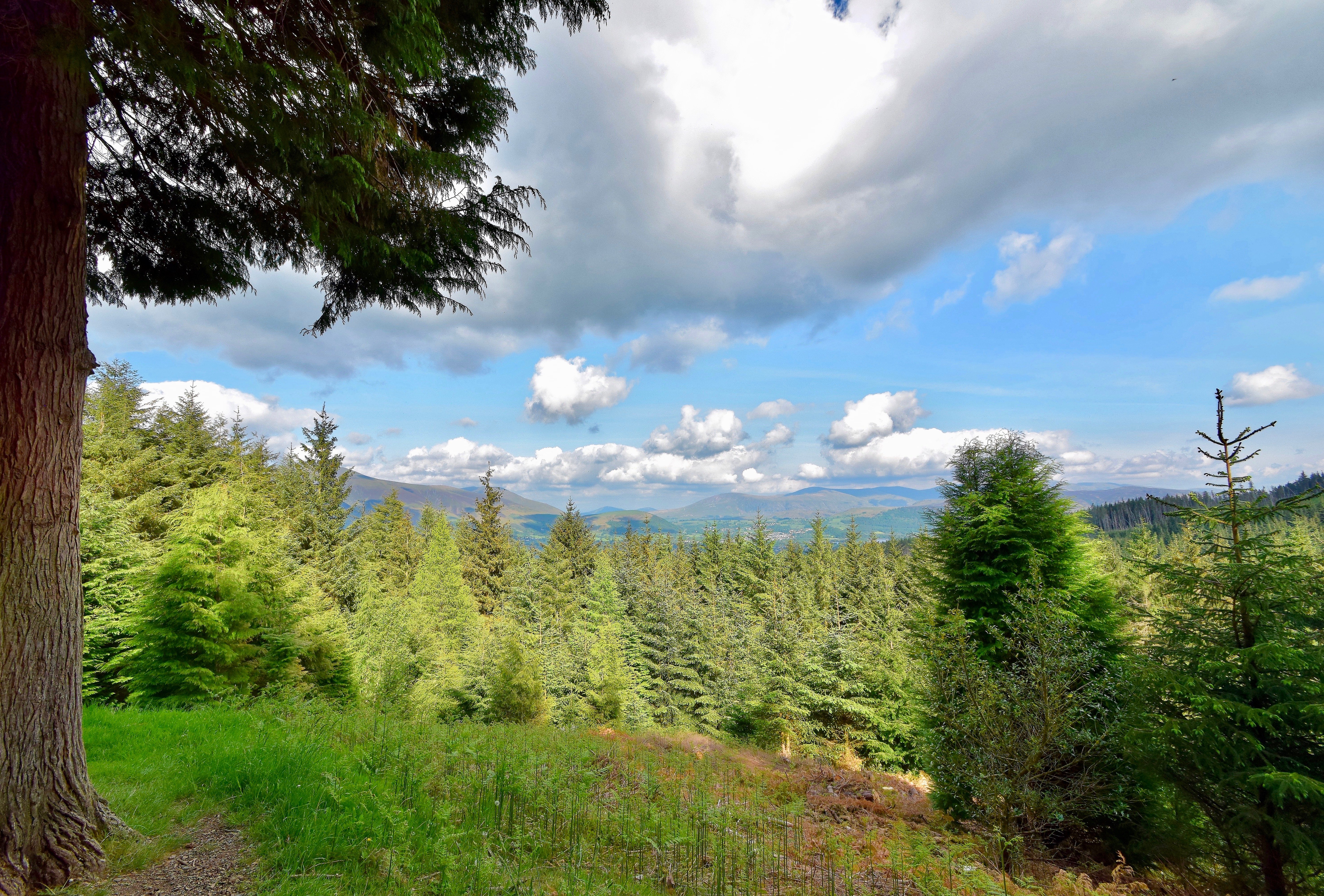
A coniferous forest in The Lake District
Why are glaciated upland areas important for tourism?
The same landscape that makes farming difficult makes upland areas attractive to tourists.
Glacial erosion has created dramatic scenery, including mountains, corries, arêtes, glacial troughs and ribbon lakes. These landscapes provide opportunities for walking, climbing, cycling, sightseeing and water-based activities.
Tourism can therefore become one of the most important economic activities in a glaciated upland area.
The Lake District demonstrates the scale of this activity. In 2024, it received approximately 17.73 million tourists, who spent around 26.85 million tourist days in the area. Tourism generated approximately £2.37 billion for the Lake District economy.
Visitors spend money on accommodation, restaurants, cafés, shops, attractions and outdoor activities. This creates employment and supports other businesses that supply the tourism industry.
The Lake District is particularly attractive because it combines glacial scenery with relatively easy access from major population centres. Visitors can walk across arêtes such as Striding Edge, climb mountains such as Helvellyn, or visit lakes including Windermere.
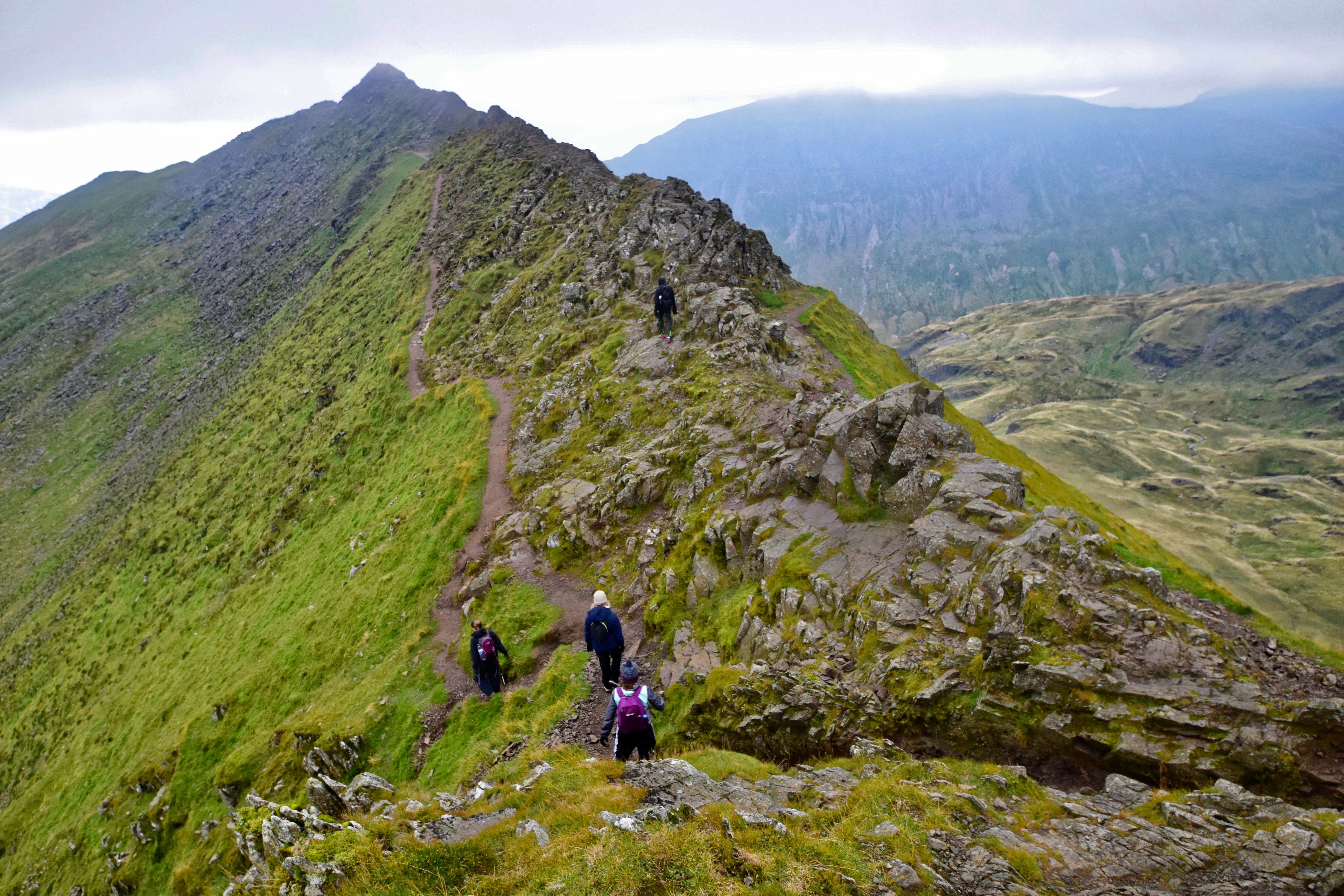
Walkers on Striding Edge, an arete in the Lake District.
You can find out more about the glacial features of the Lake District here.
Why does quarrying take place in some glaciated upland areas?
Many upland areas contain valuable rocks that can be extracted through quarrying.
The geology varies from one upland area to another, so different rocks are quarried in different locations. These can include slate, limestone and igneous rocks, which have a range of uses in construction and industry.
Quarrying has taken place in the Lake District for centuries. Slate has traditionally been used for roofing and building, helping to give settlements in the area their distinctive appearance.
Quarrying continues today, although it is more limited than in the past. There are nine active building-stone quarries within the Lake District National Park, as well as three active hard-rock quarries producing limestone, igneous rock and sandstone.
Some of the rock has importance beyond the local area. Shap Beck Quarry produces high-purity limestone that is used in industrial processes, including steel production.
Quarries can provide jobs and valuable raw materials, but they can also change the appearance of the landscape. Blasting and machinery create noise and dust, while heavy lorries increase traffic on local roads. These impacts can cause conflict, particularly where quarrying takes place in landscapes valued for tourism and conservation.
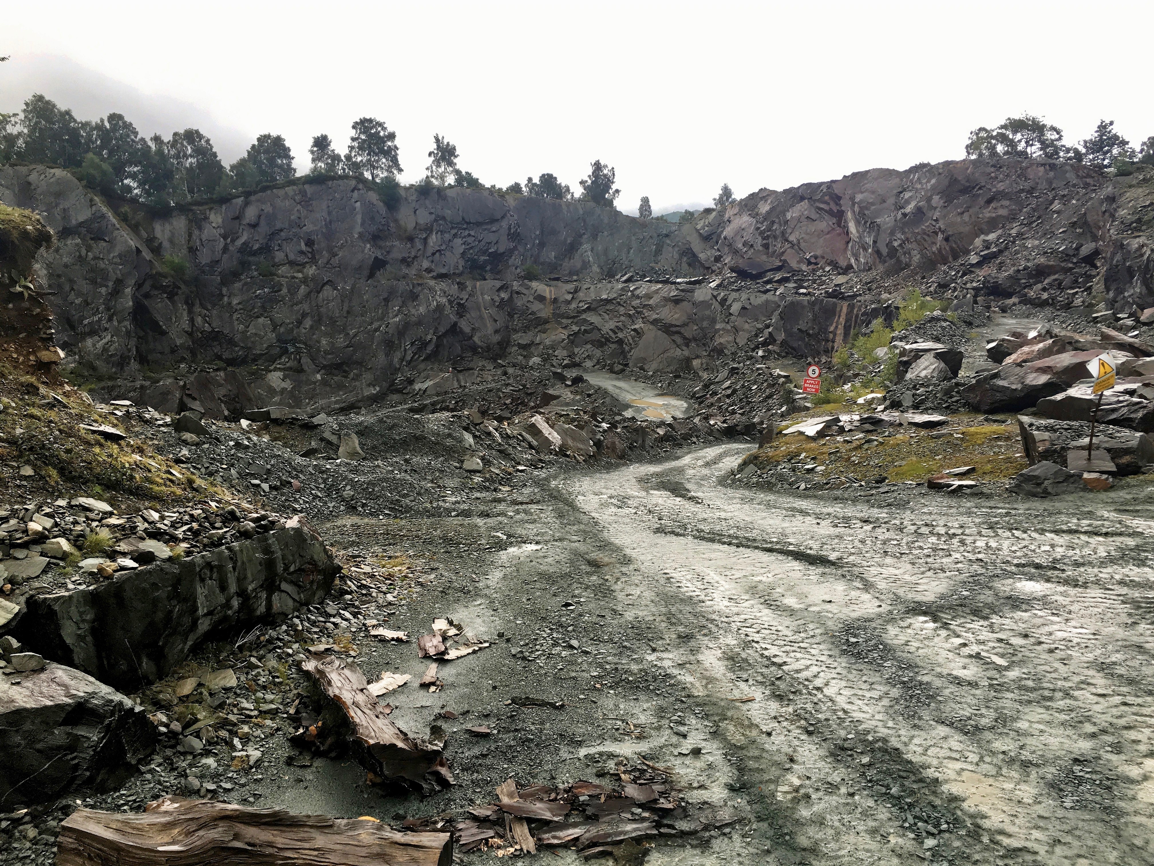
A quarry in the Lake District
How does the glaciated landscape influence economic activity?
The physical characteristics of glaciated upland areas create both opportunities and challenges.
Steep slopes, thin soils, high rainfall and lower temperatures make intensive crop farming difficult, so extensive sheep and cattle farming is more common. Some of the same land can support forestry, particularly where slopes are unsuitable for agriculture.
The underlying geology provides rocks that can be extracted through quarrying, while the spectacular landscape created by glaciation provides the basis for a large tourism industry.
These activities often take place in the same landscape. As a result, decisions about how upland areas are used can lead to conflicts between the needs of farmers, forestry companies, quarry operators, tourists, local communities and those who want to conserve the landscape.


