Landforms in the lower course of a river

The volume of water in a river is greatest in the lower course, due to the contribution of water from tributaries. The river channel is deep and wide, and the land around the river is flat. Energy in the river is at its lowest, and deposition occurs.
Floodplains are associated with rivers in their middle and lower course. They are extensive, flat areas of land covered mainly by grass.
Floodplains are formed during flood conditions. During a flood, water containing large quantities of alluvium (river silt) pours over the flat valley floor.
The water slowly recedes, leaving behind the deposited sediment.
Over hundreds of years, repeated flooding has formed a thick alluvial deposit that is fertile and often used for farming.
Floodplains become wider due to the lateral erosion of meanders caused by abrasion and hydraulic action. When the outside bend of a meander meets the edge of the river valley, erosion cuts into it, thereby widening the valley and removing interlocking spurs.
As meanders slowly migrate downstream, the entire length of the valley will eventually be widened.
When a river floods, more substantial material and most deposition occur next to the river channel due to increased friction (with the flood plain). The river’s velocity slows and rapidly reduces its ability to transport material. This leaves a ridge of higher material next to the river channel on both river banks, known as a levée.
What are the stages in the formation of a levée?
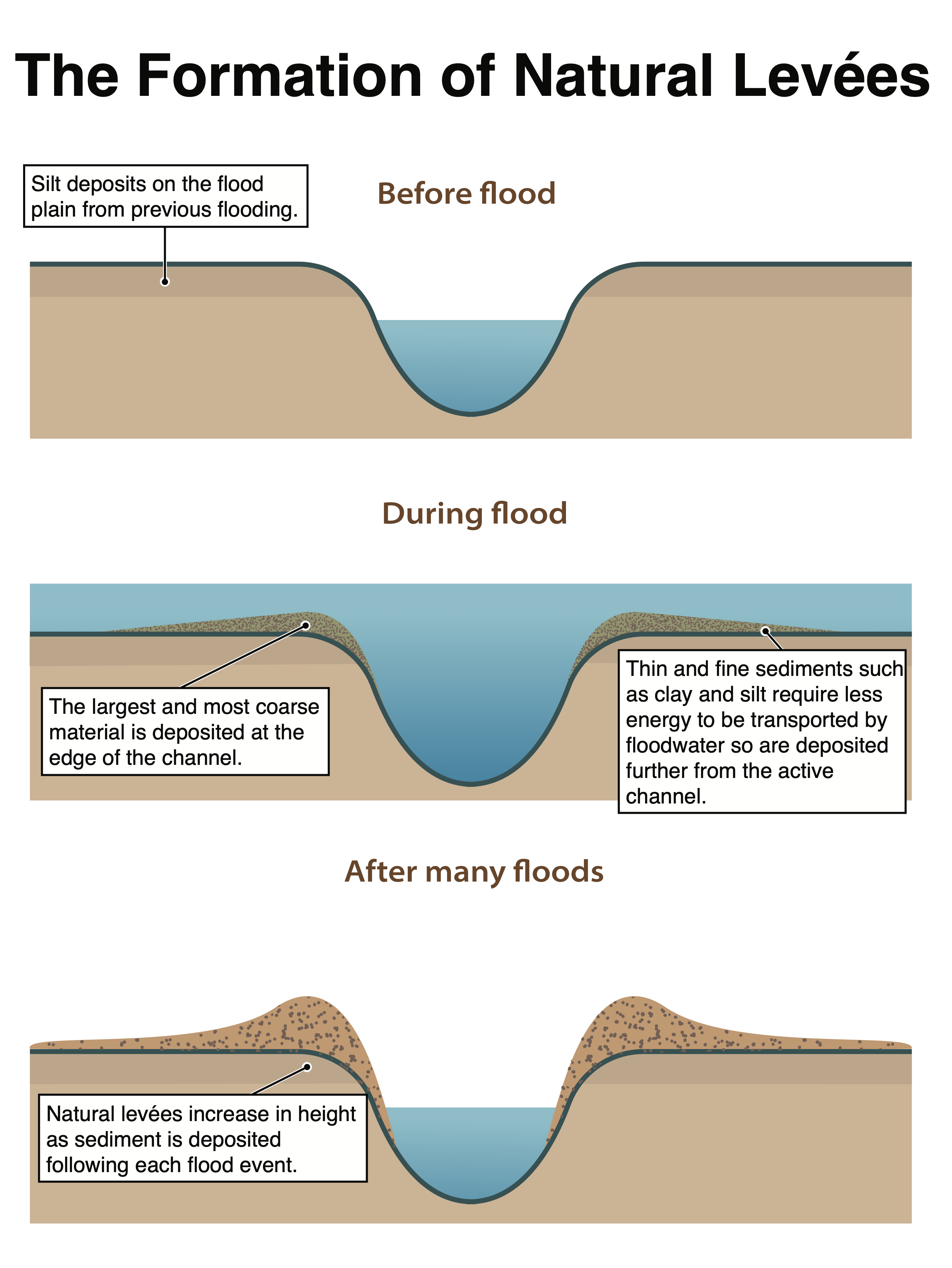
The stages in the formation of a natural levee
An estuary is a wide, sheltered body of water found at a river’s mouth, where it broadens into the sea. It combines salt water from the sea and freshwater from a river. As the river meets the sea at high tide, it slows the flow of water, leading to deposition. Mudflats and salt marsh form in these areas. The mudflats can be seen at low tide but are covered by water at high tide. Over time, the mud flats can become colonised with vegetation forming salt marshes.
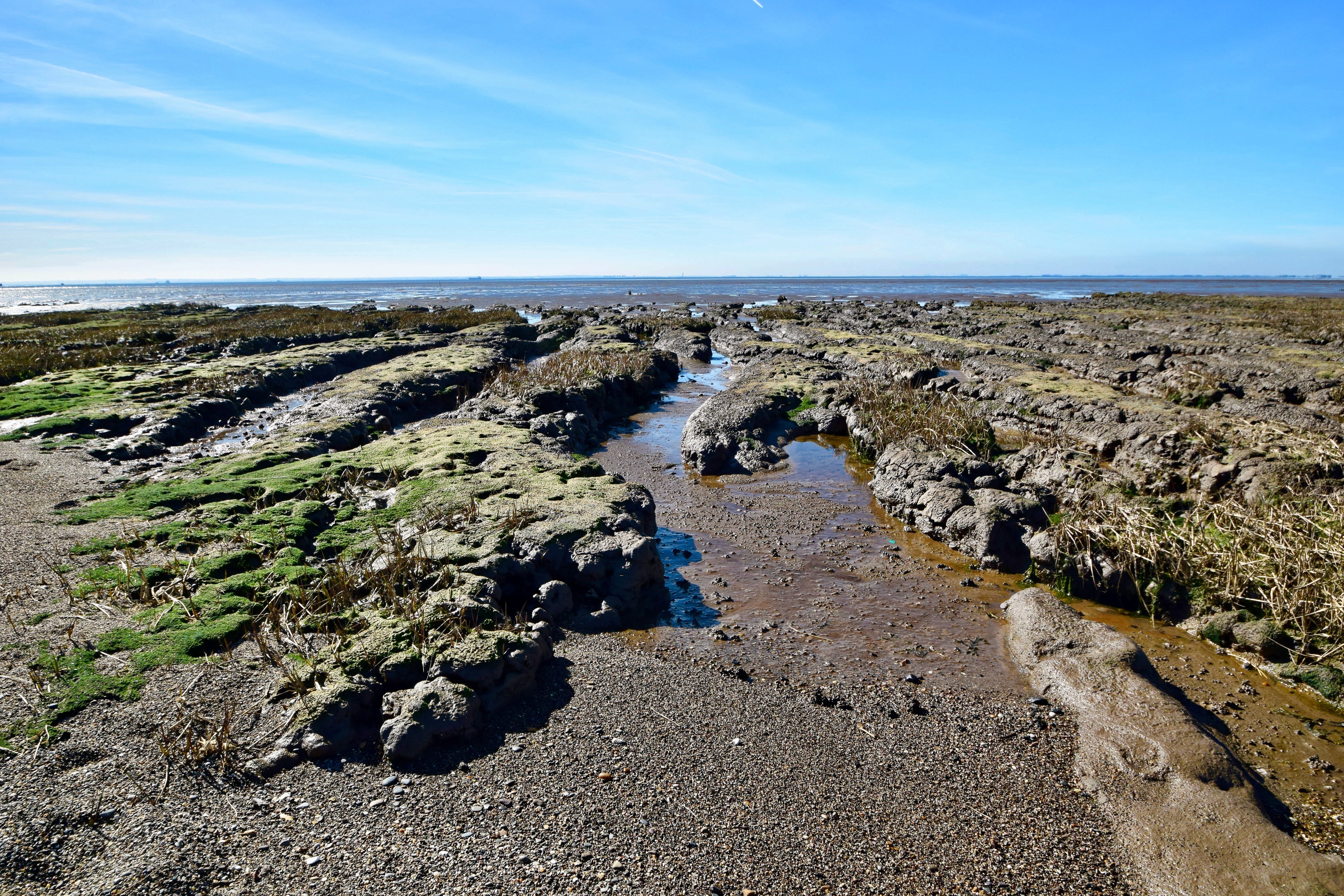
Mudflats along the Humber Estuary.
Deltas are often found at the mouth of large rivers. An example is the Nile Delta. Deltas are formed when a river deposits material faster than the sea can erode it.

The Nile Delta
The Nile Delta – source




Use the images below to explore related GeoTopics.


