
Interpreting OS Maps > Coastal Environments and OS Maps Quiz
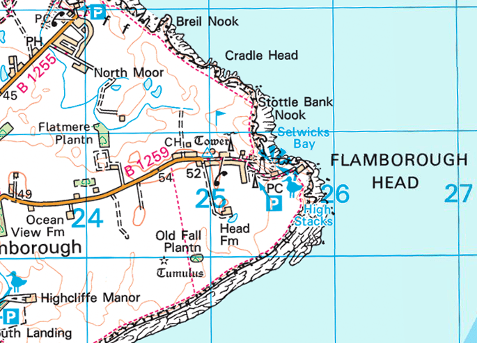
Identify the landforms of coastal erosion shown on the map.
 Ordnance Survey
Correct!
Wrong!
Arches and caves can't be seen from above because of the rock above them.
Identify the landforms of coastal erosion are shown on the map.
 Ordnance Survey
Please select 3 correct answers
Correct!
Wrong!
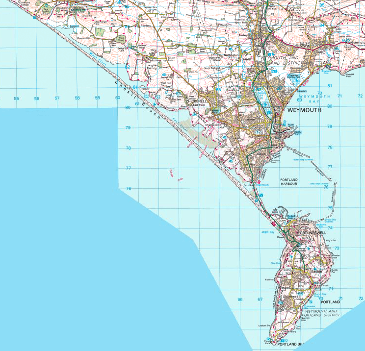
The map shows Chesil Beach. What type of landform of coastal deposition is Chesil Beach?
 Ordnance Survey
Correct!
Wrong!
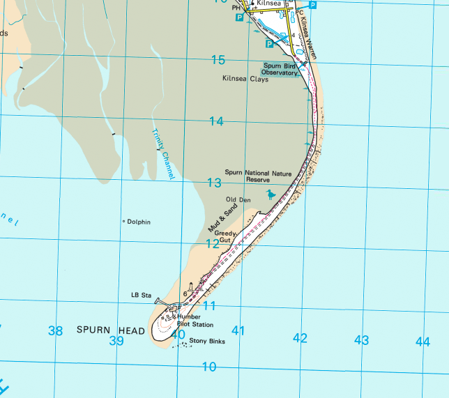
The map above show Spurn Head. What type of landform of coastal deposition is Spurn Head?
 Ordnance Survey
Correct!
Wrong!
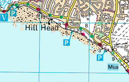
Identify the type of beach at Hill Head
 Ordnance Survey
Correct!
Wrong!
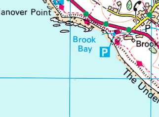
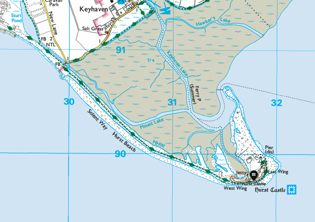
The map below shows Hurst Castle spit. What has formed behind the spit?
 Ordnance Survey
Correct!
Wrong!
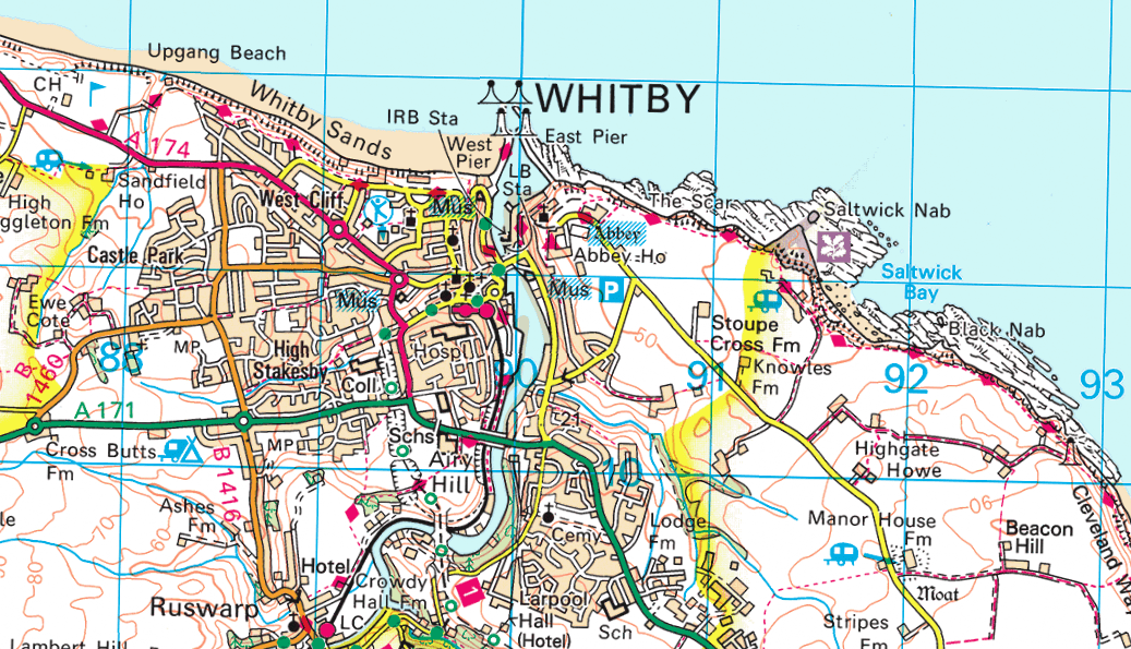
Which of the following is not a tourist attraction in the area shown on the map below?
 Ordnance Survey
Correct!
Wrong!
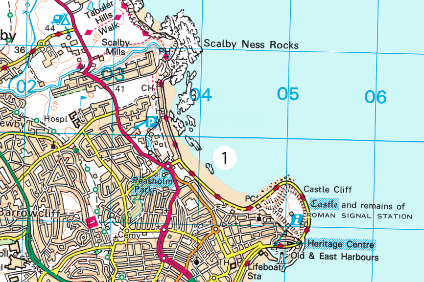
Identify the landform of coastal erosion labelled 1 on the map below.
 Ordnance Survey
Correct!
Wrong!
Coastal environments and OS Maps
You are a master of maps!

Hmmmmmmmm, legend you are.
Not bad, some work to do though!

Jabba says "not bad, could do better though".
You use a sat nav don't you!?

Jar Jar Binks thinks your map skill stinks. You need to do some work on this!
Share your Results: