
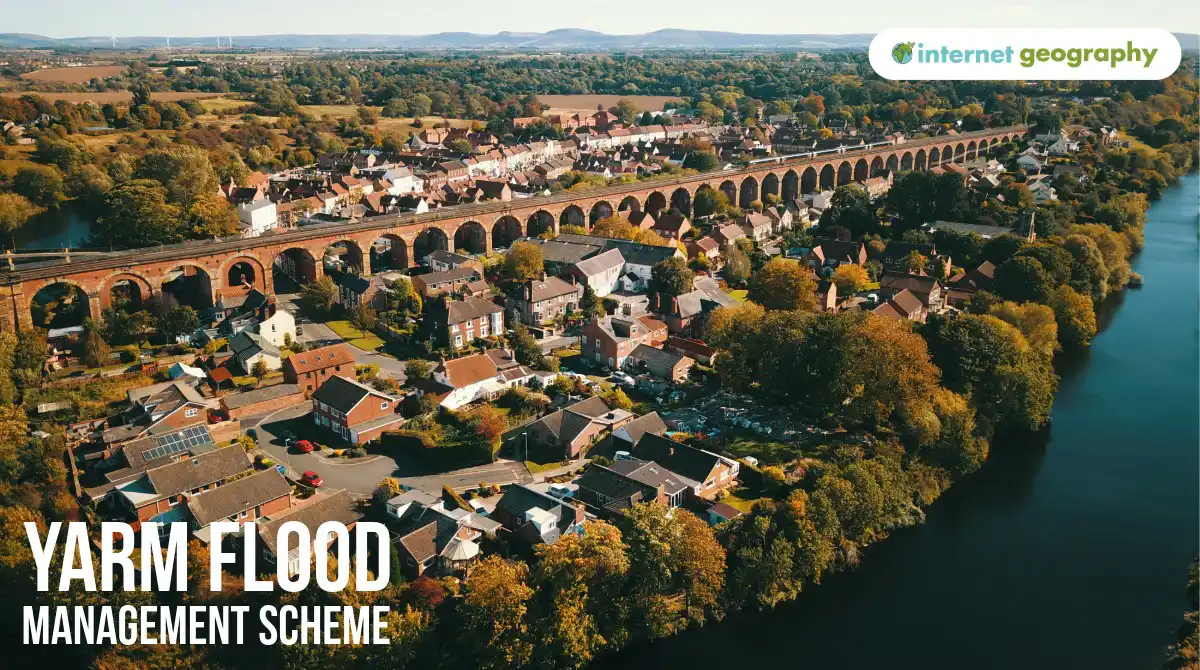
Yarm Flood Management Scheme
Important case-study clarification
Flood management at Yarm is not based on one structure. It is an integrated scheme combining:
- flood walls;
- movable floodgates;
- Environment Agency monitoring and warnings;
- restrictions on inappropriate development;
- maintenance and replacement of ageing defences.
The Tees Barrage controls tidal fluctuations downstream, but Yarm’s walls and gates provide the town’s main local protection from high river discharge.
Location and key facts
- Yarm is a historic market town on the River Tees, approximately 12 kilometres upstream from Stockton-on-Tees.
- Much of the town occupies low-lying land enclosed by a large meander.
- The Environment Agency maintains approximately 1.3 kilometres of flood wall.
- The defences reduce flood risk to more than 500 homes and businesses.
- The current system contains around 32 public and residential floodgates.
- Areas covered by the Environment Agency’s Yarm flood-warning service include the High Street, adjoining streets, Yarm School and Goose Pastures.
Why was the scheme required?
Yarm is built on a floodplain
Yarm developed beside the River Tees because the river provided transport, trade and a crossing point. However, the town occupies low-lying land within a large meander. During periods of high discharge, the river can overflow onto the surrounding floodplain, placing the historic centre at risk.
Rapid runoff from the upper catchment
The headwaters of the River Tees drain the North Pennines. The steep valleys, heavy rainfall and frequently saturated upland soils can produce rapid runoff. This water moves downstream towards settlements including Yarm, where the wider and flatter floodplain is more easily inundated. Natural England: Tees Lowlands
A long history of flooding
Yarm has experienced flooding for centuries. Flood markers displayed on Yarm Town Hall record several historical events.
The most severe recorded event occurred in November 1771, when:
- intense rainfall and a sudden thaw in the Pennines caused the River Tees to rise rapidly;
- the river burst its banks at several locations;
- Yarm High Street was flooded to a depth of more than two metres;
- homes, businesses and other buildings were inundated.
The highest flood marker on Yarm Town Hall is approximately seven feet above ground level.
Valuable property was at risk
Flooding threatened:
- homes beside the River Tees;
- businesses along Yarm High Street;
- Yarm School;
- historic buildings within Yarm Conservation Area;
- roads, riverside paths and other infrastructure.
A flood could therefore cause considerable repair costs, business disruption and damage to Yarm’s historic environment.
What was the management strategy?
The Yarm scheme is mainly a hard-engineering strategy, supported by monitoring, warnings and planning.
Flood walls
Approximately 1.3 kilometres of raised flood wall separate vulnerable parts of Yarm from the River Tees.
When the river rises, the walls increase the capacity of the channel and prevent water spreading into the town. The walls protect more than 500 homes and businesses.
Construction of a major flood-wall scheme began in 1991. The original contract was valued at approximately £2.5 million. Since then, the system has been repaired and upgraded several times.
Movable floodgates
A completely continuous wall would cut off gardens, footpaths and public spaces from the river. Openings were therefore included at:
- public riverside paths;
- car parks;
- residential gardens;
- access points leading towards the river.
The gates normally remain open to maintain access. When high river levels are forecast, Environment Agency staff close them to complete the flood-defence line.
In 2021, the system included:
- 21 residential gates;
- 11 public-access gates.
The combination of permanent walls and movable gates provides flood protection while preserving everyday access to the riverside.
Gate replacement and improvement
A 2021 Environment Agency review found that some gates were deteriorating and becoming more difficult to operate. The review considered replacing all the openings with a continuous wall, but this would have removed access from homes and public areas.
The agreed strategy included:
- replacing 16 residential gates on a similar basis;
- discussing smaller and more efficient openings with some homeowners;
- replacing nine public-access gates with improved designs;
- retaining two public gates that remained serviceable;
- replacing selected openings with permanent wall where agreed;
- introducing sliding gates at some locations to make them safer and easier to operate.
The replacement programme began on site in 2024. Some of the previous gates were considered difficult or potentially dangerous to operate in strong winds or on uneven ground.
Flood forecasting and warnings
The physical defences are supported by Environment Agency monitoring and flood warnings.
When high water is forecast:
- river levels and weather forecasts are monitored;
- warnings are issued to residents and businesses;
- Environment Agency teams close the floodgates;
- low-lying riverside paths are closed;
- the walls and gates are monitored until water levels fall;
- the gates are reopened after the flood risk has passed.
The gates were closed when the River Tees rose during Storm Babet in October 2023.
Land-use planning and preparedness
The flood-warning area remains in place because no defence can remove all risk. Residents are encouraged to:
- register for Environment Agency flood warnings;
- prepare a household or business flood plan;
- move valuable items before water levels rise;
- avoid low-lying riverside paths during flood alerts.
Planning controls can also discourage highly vulnerable development on undefended parts of the floodplain.
Social issues
Benefits
- More than 500 homes and businesses receive improved protection from the River Tees.
- The defences reduce the risk of people being displaced from flooded homes.
- Protecting Yarm School reduces disruption to students and families.
- Movable gates preserve access to public paths and residential gardens during normal river conditions.
- Flood warnings provide time for people to protect property and move to safety.
- Residents were consulted about whether their individual gates should be replaced, reduced in size or converted into a permanent wall.
- The replacement gates are safer and easier for Environment Agency staff to operate.
Problems
- The scheme does not remove flood risk completely. Extreme water levels could overtop the walls or enter through a gate that fails to close correctly.
- The system depends on the Environment Agency receiving sufficient warning and closing numerous gates before the river reaches a dangerous level.
- Closing the gates restricts access to riverside paths, gardens and public spaces.
- Residents with gates on their property must allow access for inspection, maintenance and operation.
- Flood walls can obstruct views of the river and separate the community from the waterfront.
- Construction and gate replacement temporarily disrupt paths, gardens and riverside activities.
Economic issues
Benefits
- The scheme protects homes, shops and other businesses from expensive flood damage.
- Protecting Yarm High Street helps prevent lost trade and prolonged business closures.
- Roads and other infrastructure are less likely to require flood repairs.
- The defences help protect valuable historic buildings that could be difficult and expensive to restore.
- Reducing flood risk may support property values and confidence in the town centre.
- The original investment is small compared with the cumulative cost of repeatedly repairing more than 500 flooded properties.
Problems
- The original flood-wall contract was worth approximately £2.5 million, and further money has been required for repairs and replacement gates.
- A system containing more than 30 movable gates is expensive to inspect, maintain and operate.
- Mechanical components deteriorate and eventually need replacing.
- Environment Agency teams must be available to close, inspect and reopen the gates during flood events.
- Failure of a single gate could allow water to pass through an otherwise continuous defence.
- Climate change could produce more intense rainfall and higher peak discharge, requiring the walls and gates to be raised or strengthened in the future.
Environmental issues
Benefits
- The use of gates rather than a completely continuous wall preserves connections between the town and the river.
- Public access to riverside walks is maintained when flood risk is low.
- Replacing the existing gates avoids constructing an entirely new defence through the conservation area.
- The Environment Agency has worked with the Tees Rivers Trust to include biodiversity improvements and strengthen connections with wildlife as part of the upgrade programme.
Problems
- Flood walls create an artificial boundary between the River Tees and part of its natural floodplain.
- Preventing water spreading across the defended floodplain reduces the space available for temporary floodwater storage.
- Confining high flows between artificial defences can increase water depth and velocity beside the walls.
- Hard engineering may transfer some water downstream more quickly, although there is no clear evidence that the Yarm scheme has caused increased flooding elsewhere.
- Walls and gates can affect the appearance of the river corridor, particularly because Yarm is a conservation area.
- Construction and maintenance can temporarily disturb riverbank vegetation and wildlife.
Overall assessment
The Yarm flood-management scheme has significantly reduced flood risk to more than 500 homes and businesses. Its combination of 1.3 kilometres of flood wall, approximately 32 movable gates, flood forecasting and public warnings provides strong protection while maintaining access to the river during normal conditions.
The gates are an effective compromise between protection and accessibility, but they also create the system’s greatest weakness. They require regular maintenance and must be closed correctly before the river rises.
Yarm’s flood-management scheme is effective because it combines permanent flood walls with movable gates and advance warnings. However, it is expensive to maintain, depends on successful gate operation and cannot remove the risk from an extreme flood.
Summary
Flashcards
Coming soon
Quiz
Coming soon


