
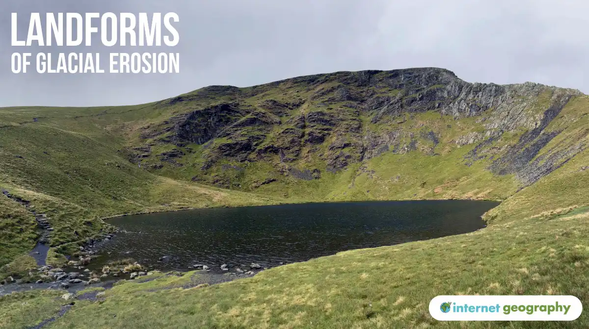
What landforms are created by glacial erosion?
Upland areas are home to some of the UK’s most distinctive landscapes and glacial landforms. During the last ice age, glaciers eroded the landscape through plucking and abrasion, creating features such as corries, arêtes and glacial troughs. When the ice eventually melted, these landforms were left behind.
The image below shows some of the main landforms created by glacial erosion.
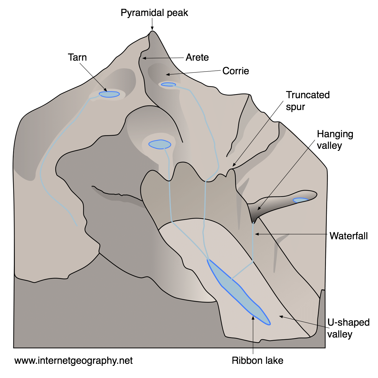
Upland glacial landforms
Corries
A corrie, also known as a cwm or cirque, is a deep, armchair-shaped hollow found high on the side of a mountain. Corries have a steep back wall, a deep hollow and a raised rock lip at the front.
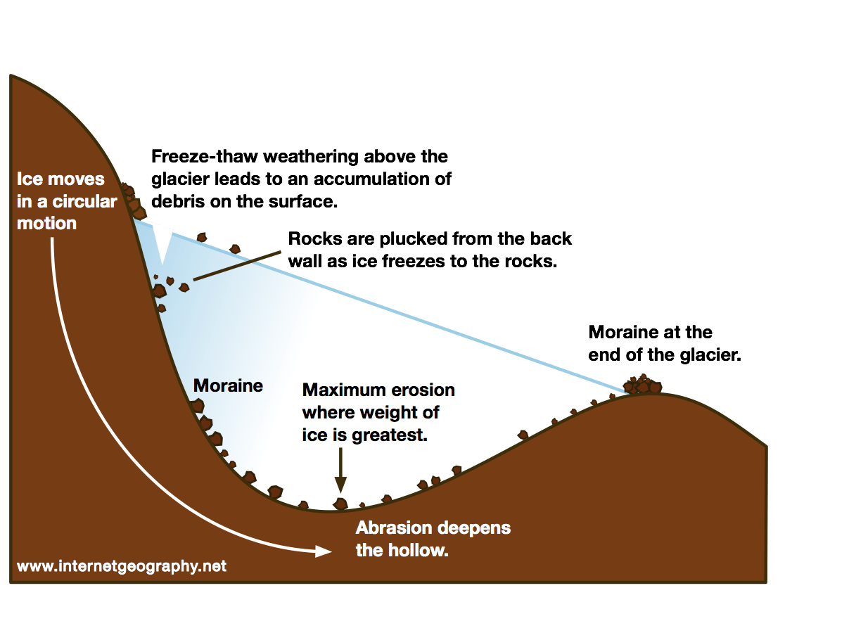
The formation of a corrie
Corries begin to form where snow collects in a hollow on a mountainside. If some of the snow remains through the summer, further snowfall adds to it the following winter. Over many years, the accumulated snow is compressed into glacial ice.
As the ice becomes thick enough to move, plucking removes rock from the floor and back wall of the hollow. The pieces of rock carried by the glacier scrape against the bedrock, causing abrasion. This makes the hollow deeper and wider.
At the back of the corrie, freeze-thaw weathering weakens exposed rock above the ice. Rock fragments fall onto the glacier and are carried away, helping the back wall to become steeper and retreat further into the mountainside.
Ice within the corrie moves in a curved motion known as rotational movement, which helps to deepen the hollow. Erosion is less effective at the front of the corrie, leaving a raised area called a rock lip.
After the glacier melts, water may collect in the hollow behind the rock lip. This forms a small lake known as a tarn or corrie lake. Red Tarn on Helvellyn in the Lake District is an example.
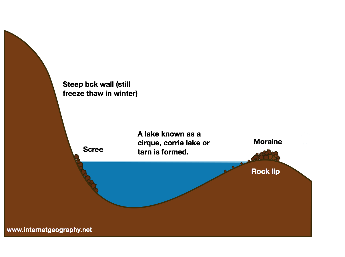
A tarn, corrie lake or cirque
The image below shows Cwm Idwal in Eryri (Snowdonia).
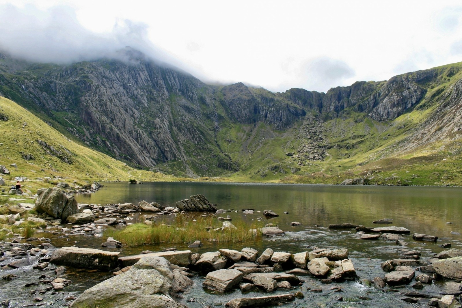
Cwm Idwal, a cwm (corrie) in Snowdonia, Wales.
The video below shows Helvellyn and the corrie containing Red Tarn.
Arêtes
When two corries form next to each other or back-to-back, continued erosion causes the rock between them to become increasingly narrow.
As the back walls of the corries retreat, a steep, narrow ridge is left between them. This is called an arête. Arêtes often have a sharp, knife-edge appearance with steep slopes on either side.
Striding Edge on Helvellyn in the Lake District is an example of an arête.
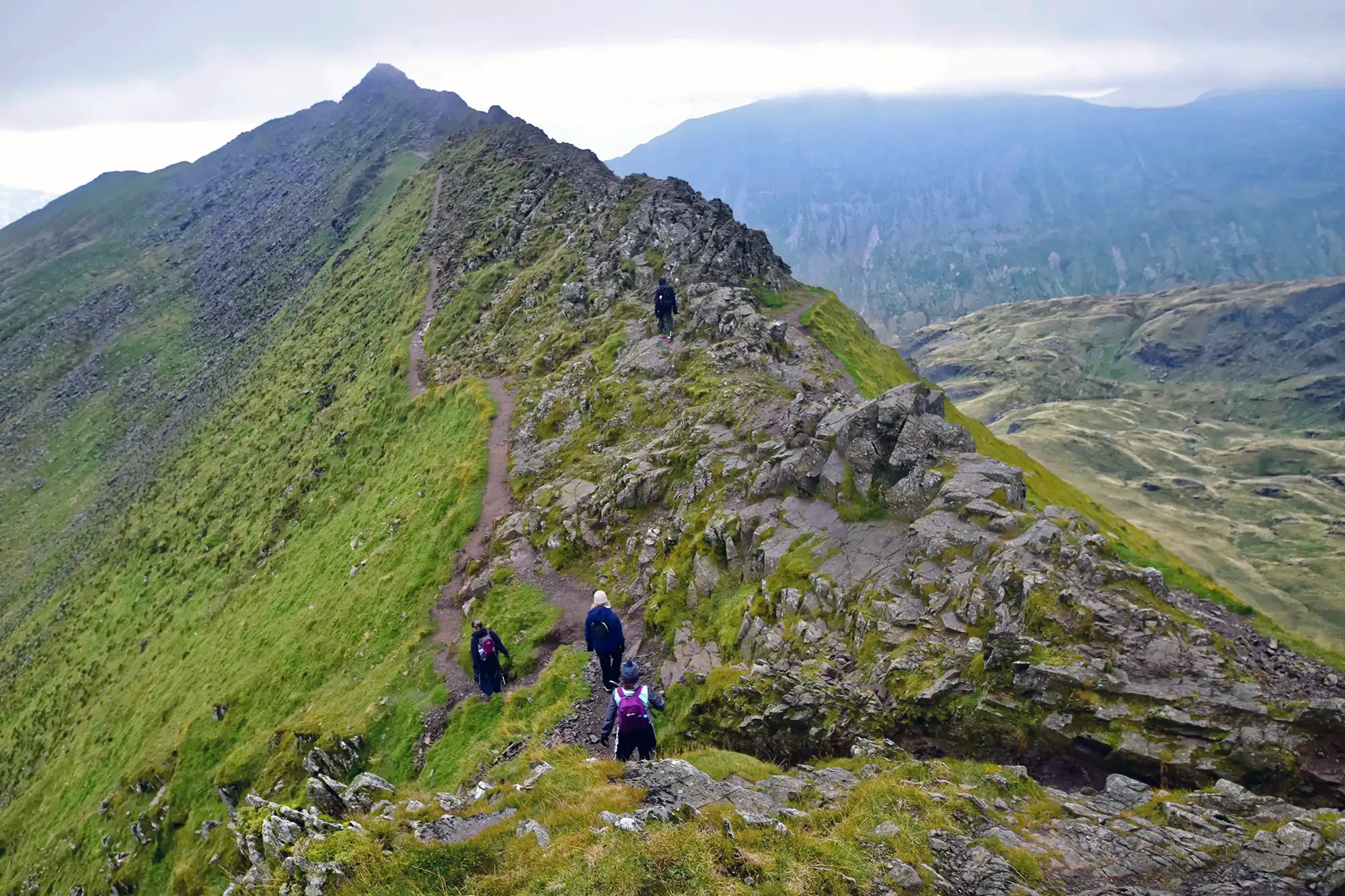
Striding Edge, an arête in the Lake District
Pyramidal peaks
When three or more corries develop around the sides of the same mountain, erosion can create a pyramidal peak.
As the corries become larger, their back walls retreat towards one another. This leaves arêtes between the corries and an increasingly narrow section of rock at the summit. Weathering and erosion continue to shape the remaining rock, eventually leaving a steep-sided mountain with a sharp, pointed summit.
The Matterhorn in the Swiss Alps is a well-known example of a pyramidal peak.
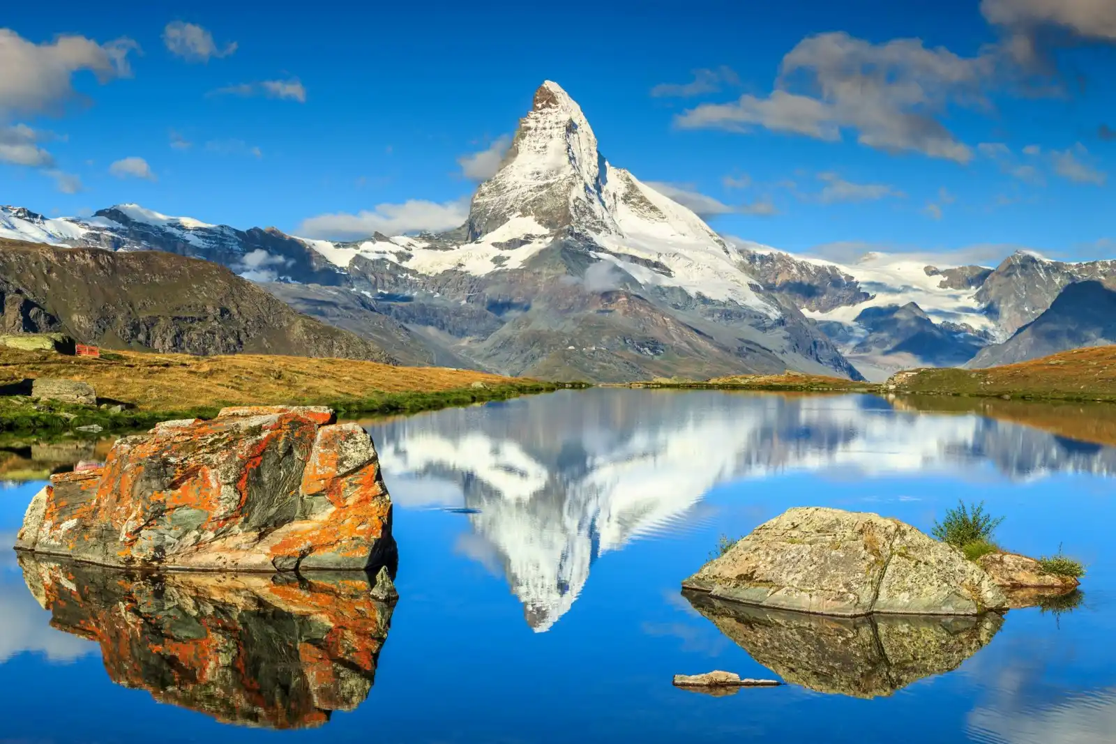
The Matterhorn, a pyramidal peak in the Swiss Alps
Great Gable is an example of a pyramidal peak in the Lake District.
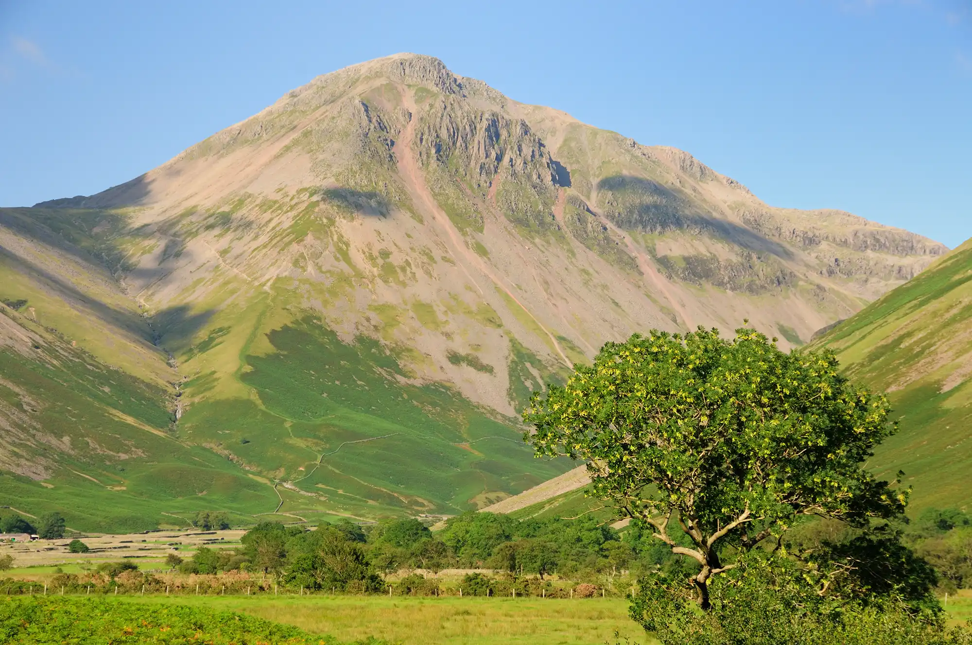
Great Gable, a pyramidal peak in the Lake District
How do glaciers affect upland river valleys?
Before the last ice age, many upland areas contained river valleys with a typical V-shaped cross profile. Rivers followed winding courses between interlocking spurs of higher land.
During the last ice age, glaciers flowed from upland areas into these existing river valleys. Unlike a river, a valley glacier filled much of the valley. As the ice moved, plucking and abrasion eroded both the valley floor and its sides.
Over time, the valleys became wider, deeper and straighter. The original V-shaped river valleys were transformed into glacial troughs, also known as U-shaped valleys.
Glacial troughs
A glacial trough is a wide, deep valley with steep sides and a broad, relatively flat floor. In cross-section, it has a distinctive U-shape.
Plucking removed blocks of rock from the valley floor and sides, while debris carried by the glacier caused abrasion. Thousands of years of erosion widened and deepened the original river valley.
Nant Ffrancon in Eryri is a good example of a glacial trough.
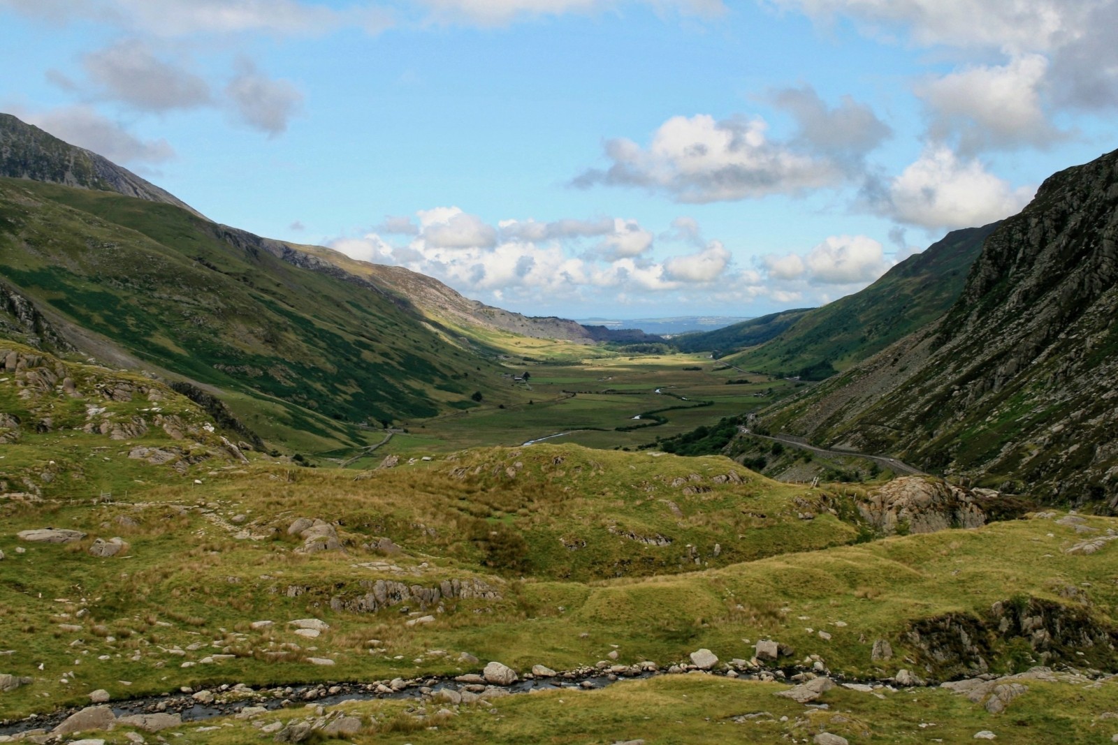
Nant Ffrancon, a U-shaped valley in Snowdonia.
Several other erosional landforms are commonly found within and around glacial troughs.
Truncated spurs
Before glaciation, rivers wound around interlocking spurs as they flowed through upland valleys.
A glacier filled much more of the valley and could not follow the river’s winding course. As the ice moved down the valley, it eroded the ends of the interlocking spurs through plucking and abrasion.
The remains of these spurs form steep, often triangular sections of rock along the sides of the glacial trough. They are known as truncated spurs.
Hanging valleys
Smaller glaciers often flowed down tributary valleys and joined a much larger glacier in the main valley.
The larger glacier contained more ice and eroded its valley more deeply than the smaller tributary glaciers. When the ice melted, the floors of the tributary valleys were left high above the floor of the main glacial trough.
These smaller valleys are known as hanging valleys. Streams flowing from them may fall steeply into the main valley below, forming waterfalls.
Ribbon lakes
Glaciers did not erode the entire valley floor evenly. In some places, plucking and abrasion caused greater erosion, creating deep hollows in the valley floor. This could happen where the ice was thicker or where the glacier moved across less resistant or more heavily jointed rock.
After the glacier melted, water collected in these over-deepened sections of the glacial trough to form long, narrow ribbon lakes.
Ribbon lakes have a distinctive elongated shape because they occupy the floor of the valley. Windermere in the Lake District is an example.
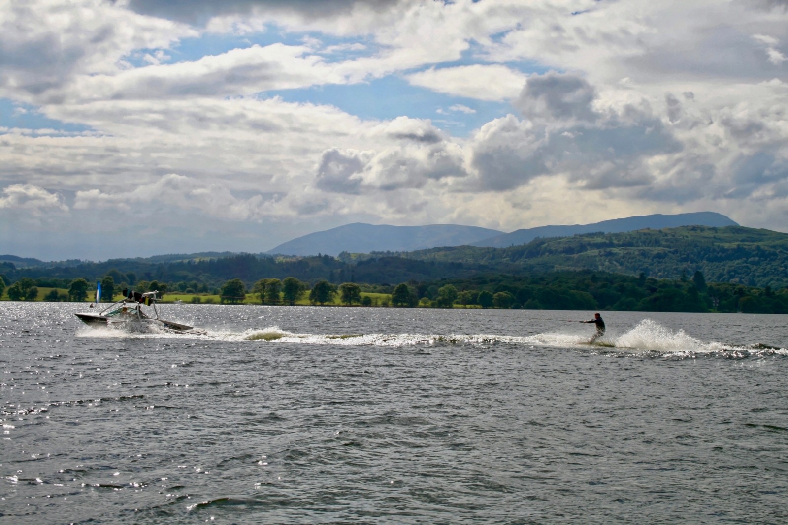
Lake Windermere
Glacial landscapes in the UK
Corries, arêtes, pyramidal peaks, truncated spurs, glacial troughs, hanging valleys and ribbon lakes can all be found in upland areas that were covered by glaciers during the last ice age.
The Lake District and Eryri (Snowdonia) contain particularly good examples. Together, these landforms provide clear evidence of the powerful effect that glacial erosion has had on the UK’s upland landscape.


