
Oracy in Geography
&amp;lt;/a>&lt;/p&gt;</p></a><a></p></p> [/av_two _t hird]
Helping Students Tackle the 2025 AQA GCSE Geography Pre-Release: Strategies for a Challenging Text
Practical strategies for helping students overcome literacy challenges to tackle the 2025 AQA GCSE Geography Pre-Release.
Improve Geographical Skills with Skills Plus
Feedback from the recent AQA GCSE Geography examiner’s report suggests that geographical skills are an area for development. Given that geographical skills are worth 10% of the GCSE, across three papers, we’ve been thinking about how Internet Geography Plus can support you in improving students’ geographical skills. Considering so many skills are covered in the AQA GCSE specification, we felt a quick fix wouldn’t be enough. Therefore, this year, we are developing several sets of resources to support you, including:
- Skills Plus
- Skills Plus Baseline Assessments
What is Skills Plus?
Skills Plus is a collection of activities that focus on applying geographical skills in the context of the units covered by the specification. Each Skills Plus sheet focuses on one or two skills, and questions are based on a particular unit. They are short, focused activities that can be used as starter or plenary activities. They can also be issued to individual students if there is a particular area for development identified from assessments or intervention sessions etc. Each Skills Plus resource is editable and includes a mark scheme to reduce your workload.
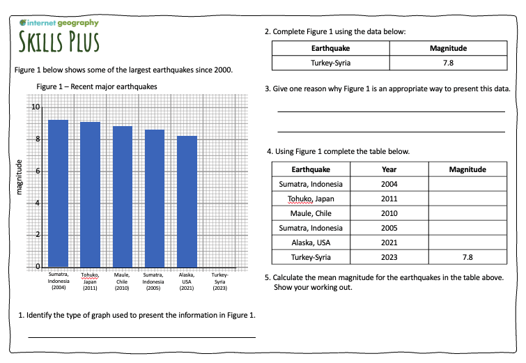
An example of a Skills Plus resource
Subscribers can access the first of these resources in the new Skills Plus area of Internet Geography Plus. We’ll be adding new Skills Plus resources regularly over the coming year. If you have a specific request, please get in touch. Not got access to Internet Geography Plus? Please purchase a low-cost annual subscription to access these and over a thousand other resources.
Skills Plus Baseline Assessments
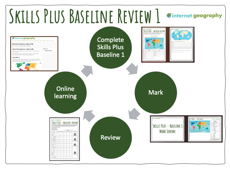
As well as Skills Plus, we are developing a comprehensive, planned approach to developing geographical skills through our new Skills Plus Baseline Assessments. The approach involves:
- Students complete a baseline assessment covering various geographical skills.
- Students assess their performance (a mark scheme is provided, including a PowerPoint that can be used to take the students through the answers).
- Students complete a review sheet to RAG rate their performance across the different skills (a PowerPoint is also available for you to deliver this)
- Students use QR codes/web links to access resources on Internet Geography to support improving their identified areas for development.
- The assessment can be repeated later to review progress.
We’ll be adding a number of Skills Plus Baseline assessments to Internet Geography Plus over the coming year, which review the range of geographical skills identified in the specification (and a few relevant extras). As there are so many skills to cover, we have decided to divide the skills and produce a series of baseline assessments this academic year.
The first Skills Plus Baseline Assessment (see image below) is now available to Internet Geography Plus subscribers.
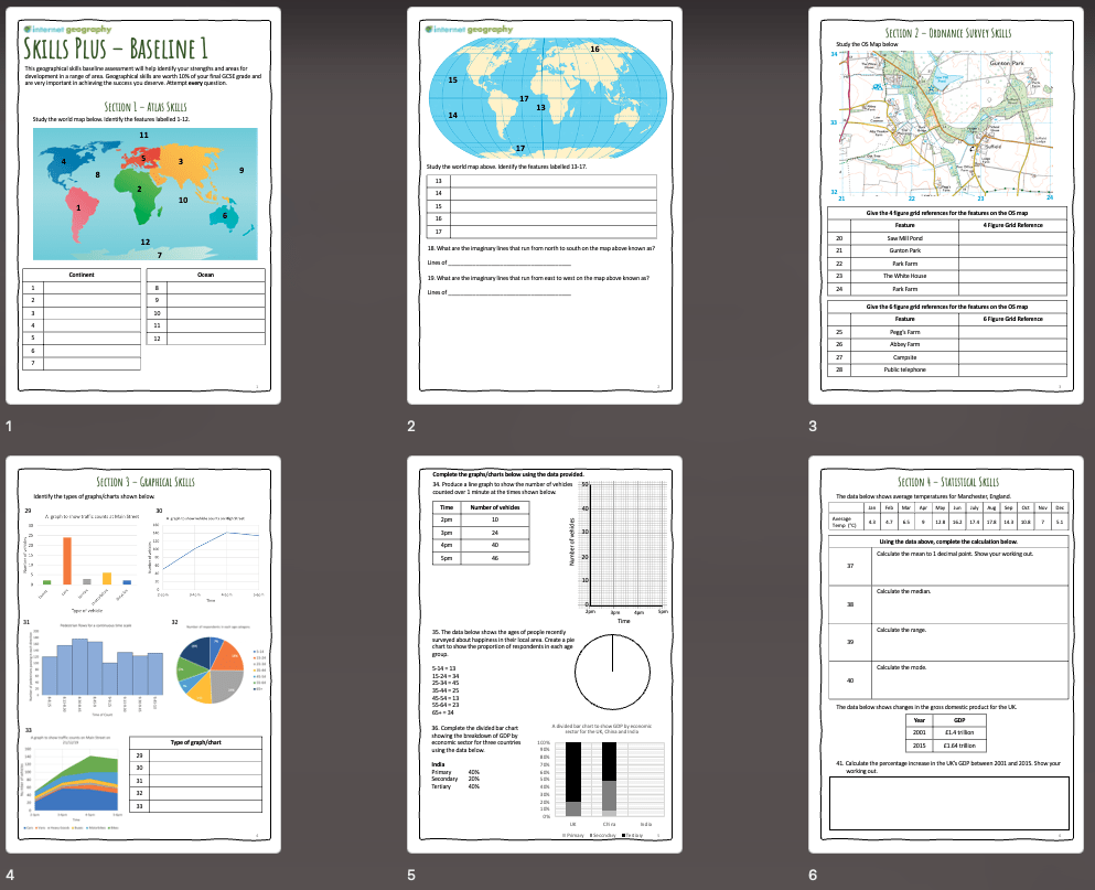
Skills Plus Baseline Assessment 1
The first Skills Plus Assessment addresses relatively basic geographical skills students should know. However, we have included a couple of more challenging elements so that most students will have areas for development!
Each Skills Plus Baseline will cover a range of atlas, OS maps, graphical, and statistical skills.
An introduction PowerPoint is available to download to support you in launching the Skills Plus Baseline.
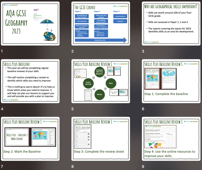
Skills Plus Baseline teacher presentation
Once the students have completed the Skills Plus Assessment, they will self-assess using the provided mark scheme, which includes a PowerPoint presentation that you can use to take the students through the processes.
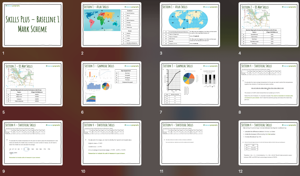
Skills Plus Baseline 1 Mark Scheme PowerPoint
Students then review their performance using the Skills Plus Baseline Review (see below). There is a PowerPoint to guide students through this process on Internet Geography Plus.
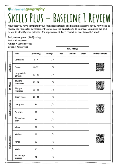
Skills Plus Baseline Review
The completed review sheet will help students identify their priorities for skills development. The review sheets include a QR code/link to free-to-access online resources on Internet Geography that students will use to improve their geographical skills. These pages are now available to access.
We’re working on a spreadsheet to identify which geographical skills are covered in this and future assessments. Hopefully, it will be a helpful tracking tool that provides a clear overview of the skills that have been/will be covered. It can also be shared with those delightful OFSTED people, if you are lucky enough to have a visit, to illustrate how you are taking a systematic approach to skills development.
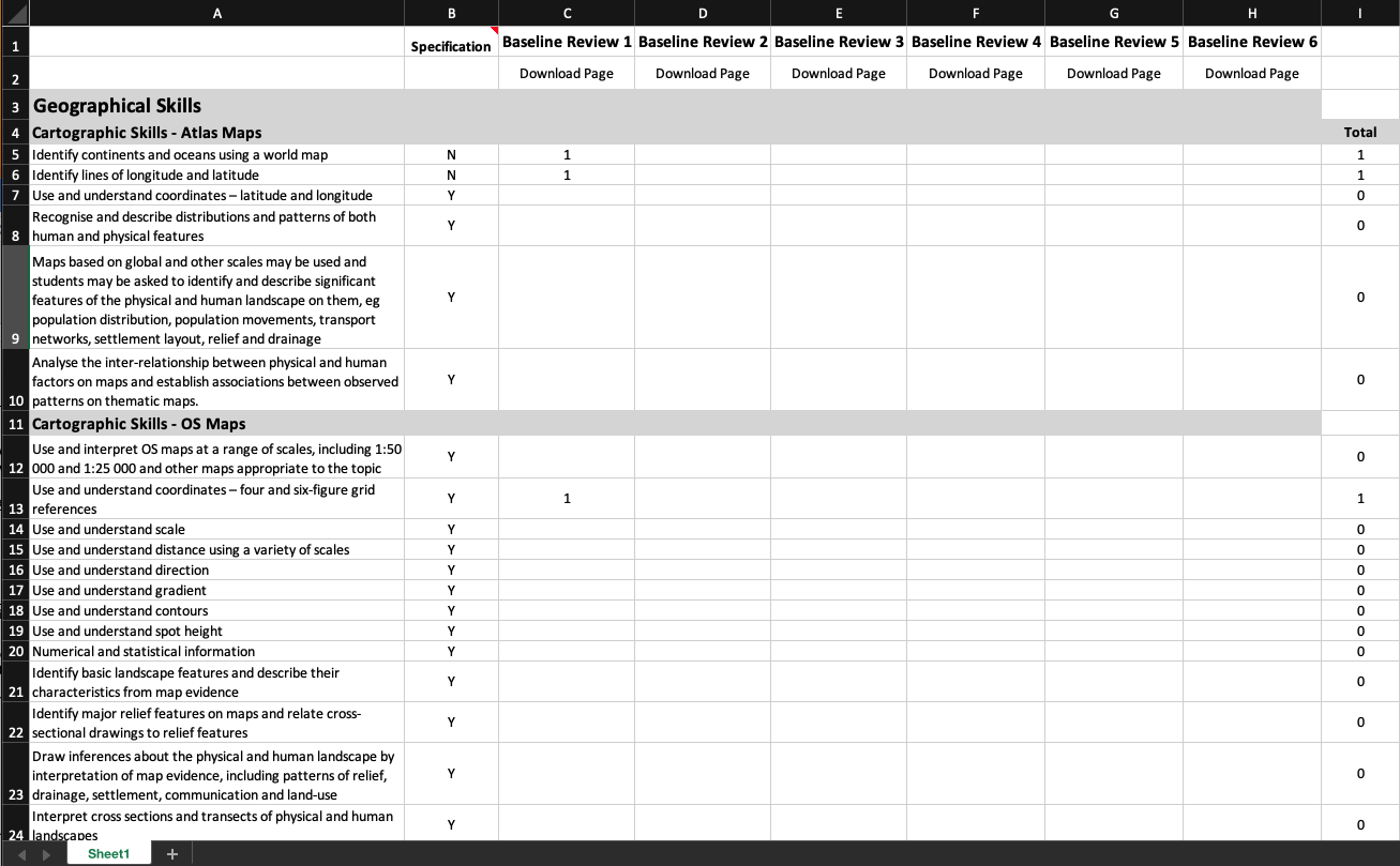
Skills Plus Tracking Sheet
Subscribers can now access the new Skills Plus Baseline and Baseline Review in the new Skills Plus area of Internet Geography Plus. Mark schemes and presentations will be added later today.
We’ll be adding further baseline assessments over the coming year. If you have a specific request, please get in touch. Not got access to Internet Geography Plus? Please purchase a low-cost annual subscription to access these and over a thousand other resources.
Sketch Notes in Geography
Geography is a fascinating subject that helps us understand our world. There is much to learn from studying natural resources, climate patterns, and human geography. However, it can also be challenging, with much information to remember (most GCSE specifications have too much content!). In all honesty, I have often struggled to retain key facts and figures about geography (and other aspects of life!). My children often joke that I have a terrible memory. Having seen several posts on social media about the power of sketch notes, I decided to investigate further. Sketch notes are a visual way of taking notes that involve drawing and writing to represent information clearly and concisely. Instead of just writing down words or phrases, sketch notes use images and symbols to represent ideas, making remembering and recalling them easier.
Below is my first attempt at a sketch note covering urbanisation. I still have a few tweaks (the data for megacities needs some work to make it more ‘sticky’), so let’s call it a first draft. Please, don’t judge my dodgy drawing skills and left-handed scrawl!
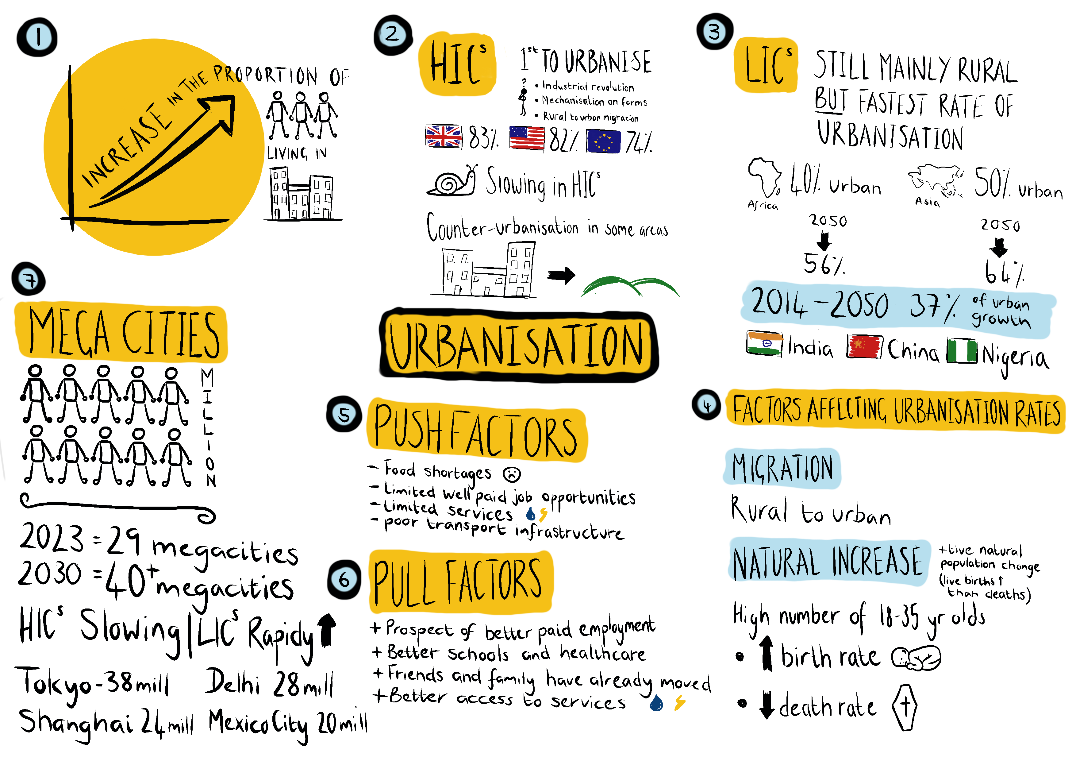
The sketch note above was created using Procreate on an iPad. However, sketch notes can just as easily be created using other apps or with paper and felt tips or the holy grail of geography, pencil crayons.
The sketch note below was also created using Procreate on an iPad. However, it could easily be produced using paper and pens.
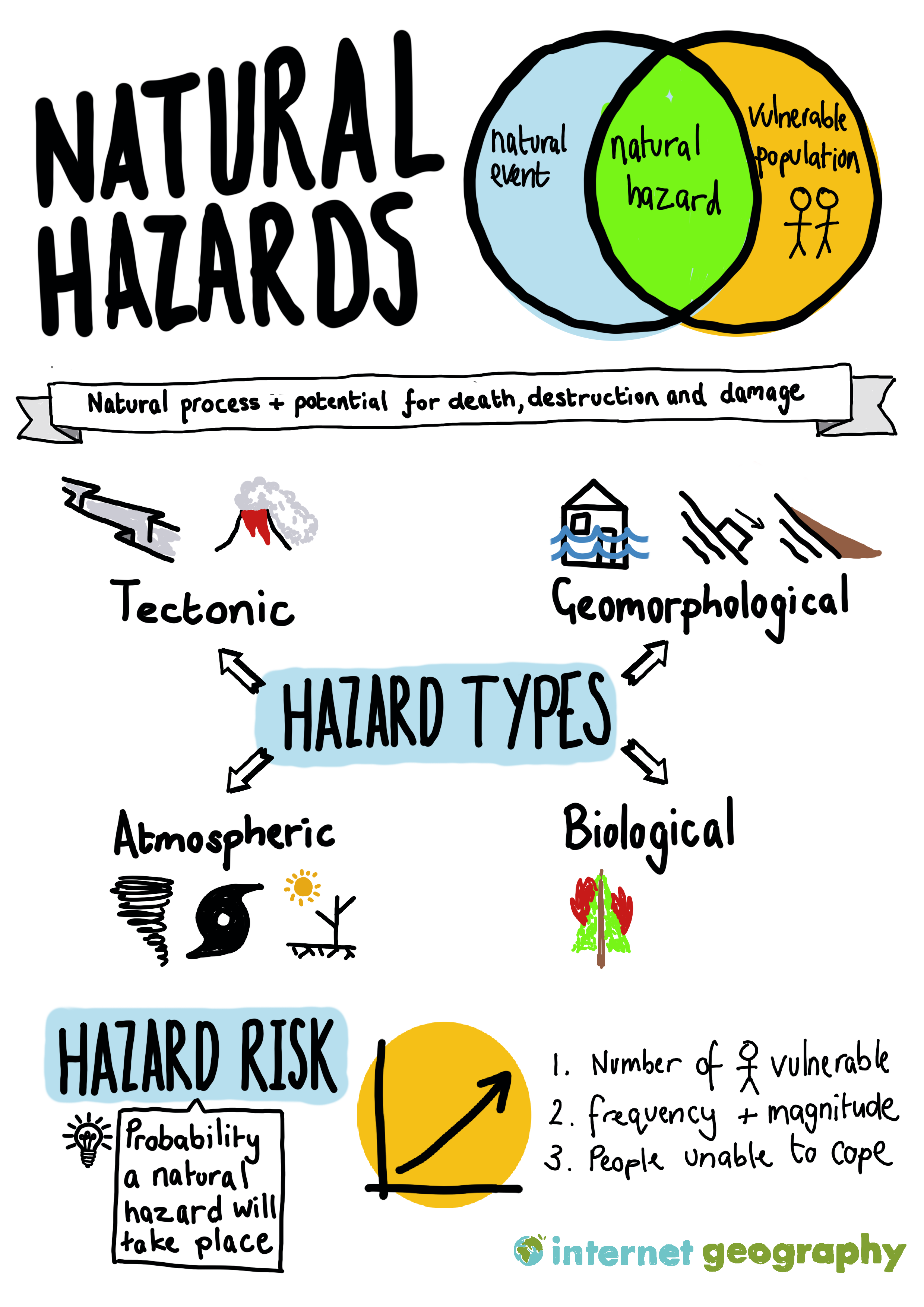
I’ve found several advantages and disadvantages to using sketch notes. Let’s focus on the positives first. The first benefit I found was that I could recall the information on the sketch note. Several days after creating the sketch note, I could recall all the key statistics, and for someone with the short-term memory of a sieve, I was pretty blown away by this. Secondly, creating the sketch note made me carefully consider the information I would include and plan the sketch note. This process made me evaluate the information I had at hand (for the experiment, I used a GCSE Geography revision book) and carefully consider the most important information I should include. At the moment, I’m thinking batch-making sketch notes and giving them to students will remove some of their power. Lastly, I was proud of my first attempt and felt engaged and motivated to explore this technique further (and write this blog post about it!). I’ve come across lots of educational snake oil in my time, and this is not an example. I’ve concluded that this is a powerful tool for improving recall. I’d be interested in exploring its wider application (any geography departments interested in exploring this, do let me know!).
On to the disadvantages. The sketch note took me quite some time to create. I redrafted several areas and didn’t quite get the layout right the first time. Perhaps this is part of the learning experience, and I will get it right next time now I have a bit of experience. Also, my drawing skills are not the best so I had to get some inspiration from the Internet. I’ve started creating a cheat sheet with images and icons I can use next time to overcome this. The perfectionists out there might find this challenging. Because I created this on an iPad, I spent too much time redrafting sections of the sketch note. Perhaps committing it to paper might make me less fussy about it looking ‘perfect’.
Using sketch notes for revision in geography could be an effective way to help students retain key information. With the vast amount of data and concepts to remember in geography, it can be difficult to keep everything straight in one’s head. Sketchnotes can help to organise this information into a visual format, making it easier to understand and remember.
For example, when studying urbanisation, there are many key facts and figures to remember, such as the percentage of the world’s population that lives in urban areas and the rate of urbanisation in different regions. Using sketch notes, students can create diagrams, charts, and maps to represent this data visually. They can also use symbols and images to represent key concepts, such as the impact of urbanization on the environment and society.
In addition to helping with memory, sketch notes can be a fun and engaging way to revise geography. Students can use different colours and styles to create visually appealing notes that they are more likely to enjoy reviewing. This can help to make revision less stressful and more enjoyable.
To start with sketch notes, students can create a basic layout for their notes. This might include a central theme or topic, with different branches representing key concepts or subtopics. They can then use images and symbols to represent these ideas, with arrows and lines connecting them to show the relationships between concepts.
When revising geography, it is important to focus on understanding key concepts and their relationships rather than just memorising facts and figures. Sketchnotes can help students to do this by breaking down complex ideas into simpler components and representing them visually. This can help to create a deeper understanding of the subject matter, which is essential for success in geography.
I would be tempted not to launch using sketch notes with students close to final exams. They will likely struggle to get through the content. Instead, I’d be tempted to teach them how to use sketch notes early on in the course and then set it as regular homework or, if you have time, have review lessons where the students can summarise learning using the technique.
I’d be interested in hearing your thoughts on using sketch notes. If it is something you’d like to try, please drop me an email. If there’s enough interest, I’d happily put together some guides and cheat sheets to support your students using the technique.
Update – 14th March 2023: I’ve started assembling a guide to creating sketchnotes for revision on Internet Geography. In addition, Internet Geography Plus subscribers can now download an editable guide to creating sketchnotes (you need to be logged in to download) that can be shared with students to guide them through the process.
Anthony
Strategies for teaching geographical vocabulary
Developing knowledge organisers for AQA GCSE geography units provided a stark reminder of the sheer number of geographical terms students need to understand to succeed in the subject. As a result, I have included seventy-four key terms for the documents covering River Landscapes in the UK alone.
AQA has produced a document containing key terms and definitions for each GCSE geography unit. However, it falls short of including all the terms students need to know. Adding vocabulary to the knowledge organisers reminded me of the significant number of tier-three literacy terms students need to be able to use. It also made me reflect on my time in the classroom and realise that, in all honesty, I didn’t do enough to explicitly teach these critical terms to my students. I think I probably got into a comfort zone where I assumed students would know and be able to use these terms.
The Geographical Association provide a reminder of the importance of literacy in geography.
“The use of language is an integral part of learning geography, and literacy skills are essential for geographical understanding. It is through language that students develop their ideas about geography and communicate them. “
Rather than treating literacy as a discrete element, it should be a foundation of geographical education, including the explicit instruction of tier-three vocabulary.
“Literacy in secondary school must not simply be seen as a basket of general skills. Instead, it must be grounded in the specifics of each subject. Crucially, by attending to the literacy demands of their subjects, teachers increase their students’ chance of success in their subjects. Secondary school teachers should ask not what they can do for literacy, but what literacy can do for them.”
Education Endowment Foundation – Improving literacy in secondary schools
Many learners may struggle with tier 3 (subject-specific) vocabulary as it is often unfamiliar. A Year 8 student, for example, will rarely see ‘gross national product’ or ‘tributary’ in their wider reading.
Learners who can’t understand subject-specific terminology can’t access the taught content. Fortunately, content and vocabulary don’t have to be separate entities.
Approaches to the development of subject-specific language
-
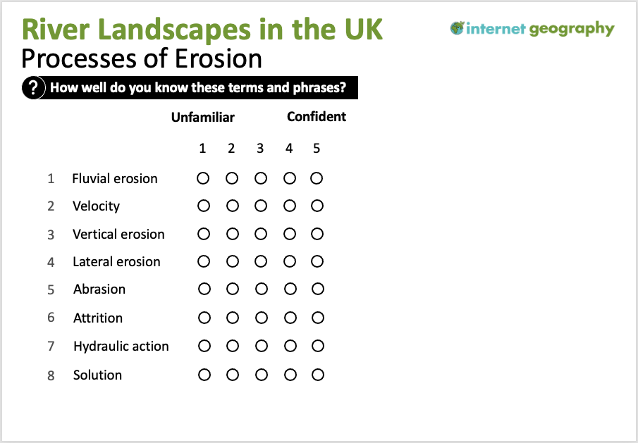
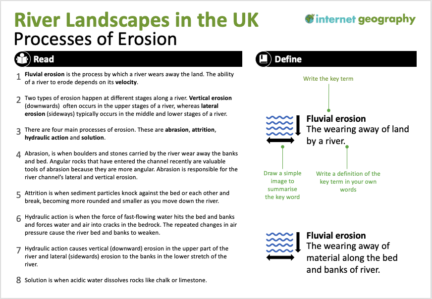
- Identify key terms – Before teaching a lesson or sequence of lessons, identify the geographical terms students need to be able to use fluently. Find out the words students already know and which you will focus on. To do this, you could provide them with a continuum, as shown below.

Identify key terms – Available in PPT format to Internet Geography Plus subscribers.
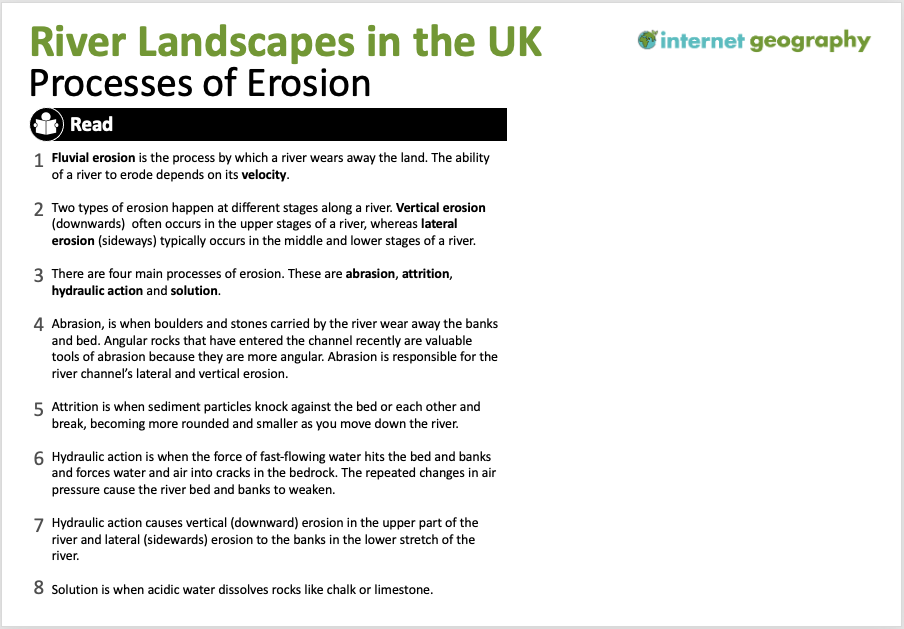
- Present the terms in context – Give the class a passage of text containing the keywords used in context. Once they see the big picture, you can start exploring their meanings.

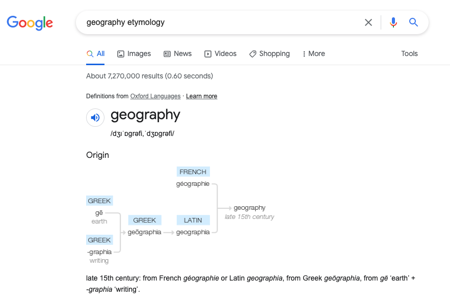
- Word morphology – Breaking words into prefixes, suffixes, and roots is an effective way to help students link with familiar language. So many terms that seem intimidating initially contain parts that students already know. For example, a biome is a large-scale ecosystem. Breaking this down and looking at the prefix ‘bio’ – life – will help them define the new word ‘biome’. Online tools such as Etymonline Online are useful for investigating etymology. Additionally, a Google search of a keyword followed by etymology provides a very useful overview through a branch diagram, as shown below.

Geography etymology branch diagram
- Images and definitions – Ask the students to draw a simple image to summarise the word. They should then write a definition for each word. As they do this, check for understanding as you circulate. Address misconceptions with individuals and provide whole-class feedback.

Images and definitions – A downloadable PPT of this is available to Internet Geography Plus subscribers.
- Video – Videos are often shown in geography lessons to introduce new information. A problem with this is that students may be unfamiliar with the technical terms used in the video. Perhaps we should rethink how we use videos in the classroom by showing them after students have engaged with geographical terms (through the exercises above) so that they can process the information more effectively.
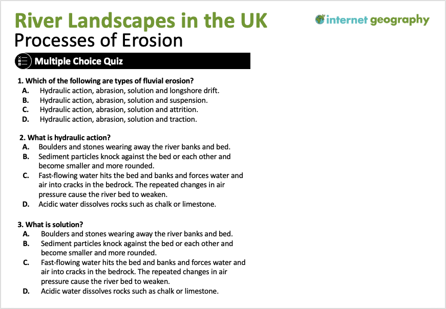
- Low-stakes quiz – Regular quizzes are a great way to revisit the course content and beat the forgetting curve. Multiple-choice and short-answer questions are ideal for this.

Low-stakes quizzes – Internet Geography subscribers can access this slide in PPT format.
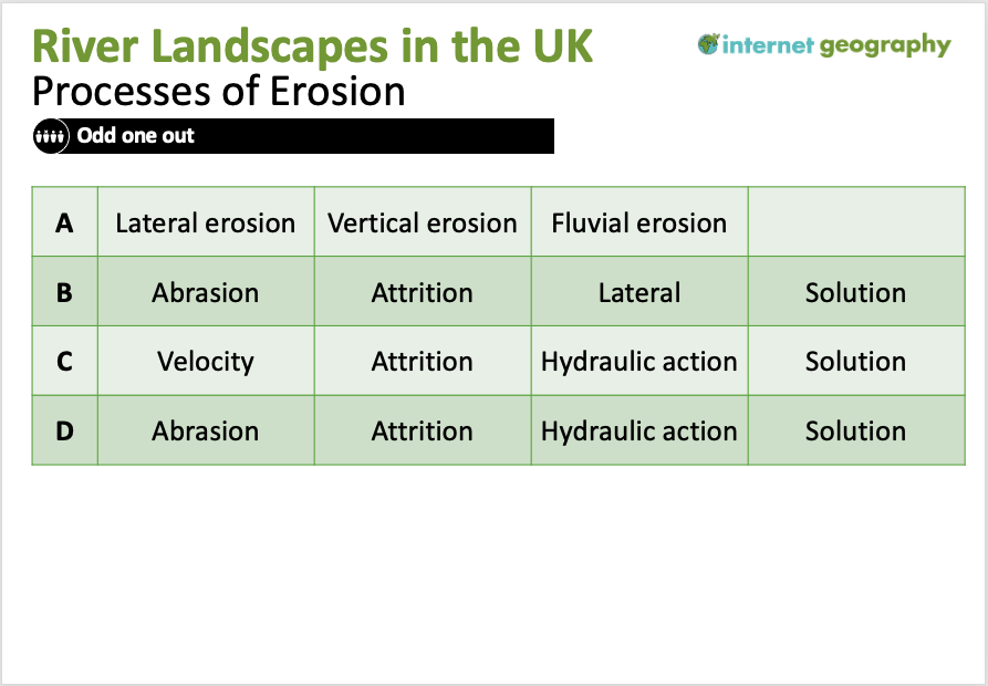
Internet Geography Plus subscribers can access a significant bank of multiple-choice booklets and Google/Microsoft forms multiple-choice quizzes. - Odd-one-out – Odd one out activities encourage the retrieval of prior knowledge, promote critical thinking and provide opportunities to practice geographical vocabulary. Provide students with a collection of words (3-4) where the majority are connected. Students then identify the word that is the odd one out and explain why. Odd one-out activities encourage students to think about characteristics and processes. To complete the task successfully, students must know the meanings of the vocabulary, enabling them to identify similarities and differences. These skills have a positive impact on the geographical communication not only of individual students but of the class as a whole.

Odd one out
Internet Geography Plus subscribers have access to a collection of odd one-out activities.
- Keyword dominoes – There are various ways students can use dominoes to build an understanding of key terms. The keywords could be added to dominoes that students match up at the most basic level. The next level would be to add a definition to one side of the domino with a key term on the other. Finally, students could match key terms that link, so long as they can explain the connection, e.g. vertical erosion will match abrasion as abrasion leads to vertical erosion in the upper stages of a river.
- Identify key terms – Before teaching a lesson or sequence of lessons, identify the geographical terms students need to be able to use fluently. Find out the words students already know and which you will focus on. To do this, you could provide them with a continuum, as shown below.
-
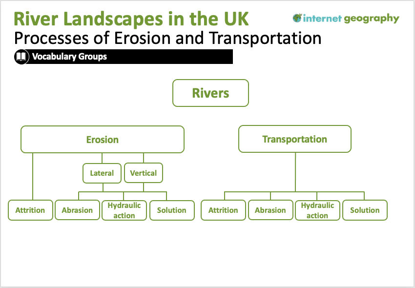
- Vocabulary groups – Grouping geographical terms can help students build reference points in their new vocabulary. In the case below, three processes of erosion that lead to lateral and vertical erosion are grouped together. A blank version of the diagram below could be given to students to populate with key terms until they become confident in using vocabulary groups. Students could develop their own vocabulary groups when they become more familiar with the studied terms.

Vocabulary groups
- Flashcards – Flashcards are a common revision tool used by students and are one of the most effective ways for motivated learners to study and retain information. Students should be encouraged to create keyword flashcards throughout the course. Why not share our guide to creating flashcards? Alternatively, we’re building a bank of revision flashcards that can be accessed in our interactive revision area.
- Vocabulary groups – Grouping geographical terms can help students build reference points in their new vocabulary. In the case below, three processes of erosion that lead to lateral and vertical erosion are grouped together. A blank version of the diagram below could be given to students to populate with key terms until they become confident in using vocabulary groups. Students could develop their own vocabulary groups when they become more familiar with the studied terms.
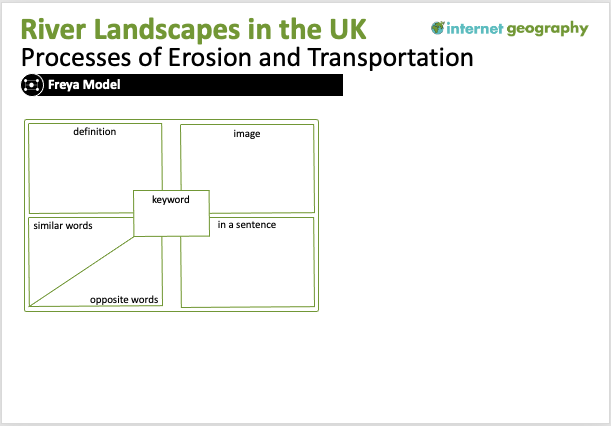
- Fraya Model – The Fraya model is a graphic organiser that provides a simple but effective framework to help students organise their understanding of a new geographical term.

The Fraya Model in geography.
A template for the Fraya Model is available to Internet Geography Plus subscribers in an editable PPT format.You can learn more about the Freya model on Alex Quigley’s blog.
Students must regularly revisit these key terms to commit them to long-term memory. Therefore, retrieval practice activities will be essential over the long term.
If you’ve successfully used a strategy to support teaching geographical vocabulary, please join the discussion and let us know below!
Ice Core Lesson by Ewan Vernon
Ewan Vernon (@Ewan_1999) recently Tweeted about a really successful lesson based on the use of ice cores.
Second day of studying ice cores with year 8! I hope they don’t melt today… the pupils or the ice cores! #geographyteacher pic.twitter.com/NXpPoNsg06
— Ewan 🌎 (@Ewan_1999) July 18, 2022
Ewan has generously agreed to share his resources for the lesson, which can be downloaded below!
Resources
Initial lesson inspiration – Ohio State University online: https://byrd.osu.edu/create-classroom-ice-cores
Additional inspiration and help from:
- https://sciencelessonsthatrock.com/teaching-climate-change-with-ice-cores-html/
- https://www.smithsonianmag.com/smart-news/in-a-first-microplastics-are-found-in-fresh-antarctic-snow-180980264/#:~:text=Scientists%20have%20found%20microplastics%E2%80%94small,their%20findings%20in%20The%20Cryosphere
- https://www.bbc.co.uk/news/science-environment-61739159
Main information and picture source: https://climate.nasa.gov/news/2616/core-questions-an-introduction-to-ice-cores


