Strategies for embedding geographical enquiry into the GCSE curriculum
Geographical enquiry is a fundamental element of geography and is now firmly established in the geography curriculum, at least on paper, across Key Stages 2-5. There is little or no doubt that students who are involved in geographical enquiry will develop essential skills for learning. However, perhaps more importantly to us, geographical enquiry helps students in constructing geographical knowledge. There is general agreement that this implies an active approach to learning geography which encourages pupils to ask questions about real issues, to search for answers using a wide range of skills and information and to think critically about issues rather than accept the conclusions, research and opinion of others passively. (Davidson, 2006; Naish et al., 2002).
The new GCSE specifications all have an element of geographical enquiry. Take the AQA specification as an example, which assesses the enquiry process in the following ways:
- Questions based on the use of fieldwork materials from an unfamiliar context.
- Questions based on students’ individual enquiry work. For these questions, students will have to identify the titles of their individual enquiries.
In practice, however, opportunities for geographical enquiry are often missed as we plough through the copious content of the new GCSE specifications.
Like many geography teachers across the country, I have been guilty of focussing on the individual enquiry’s students need to complete while paying limited lip service to addressing fieldwork from an unfamiliar context. Having asked geography teachers on Twitter how they prepared students for unfamiliar fieldwork enquiry questions, the results did not surprise me.
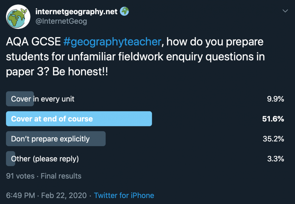
It is probably fair to say, even based on this limited sample, geography departments across the country tend to focus on the two compulsory fieldwork investigations but spend little or no time on other aspects of geographical enquiry. Having re-read the AQA GCSE geography examiner’s report for paper three, it is clear that enquiry skills, particularly in the unseen context, is an area for development. Misunderstandings such as the difference between data collection technique and data presentation technique are also highlighted.
In all honesty, and after considerable reflection, I think we are doing both our students and our discipline a disservice if we are not including geographical enquiry throughout the curriculum. However, we face significant challenges in addressing this. Many are finding the increase in the content covered in the new GCSE curriculum a problem to get through. Additionally, an increasing number of schools are reverting to a two-year key stage 4.
Despite these challenges and without ripping up the curriculum and starting again, simple tweaks can be made to the curriculum, our practice and delivery that will allow us to better address geographical enquiry. We should do this not just for the sake of meeting the needs the expectations of the specification but more importantly, to make our students better geographers.
Let’s get tweaking…
In the AQA specification students will be questioned on fieldwork from an unfamiliar context including, but not limited to:
- identifying geographical questions/hypothesis
- identifying risk and strategies for managing this
- identifying appropriate investigation techniques
- identifying appropriate presentation techniques
- completing unfinished data presentation
- describing/explaining data
- completing data analysis (mean, median, mode etc.)
- forming conclusions
There are many opportunities to embed unfamiliar fieldwork throughout the AQA GCSE Geography course, providing students with multiple opportunities to hone their enquiry skills. Students exposed to unfamiliar fieldwork, little and often, are more likely to develop the skills, knowledge and understanding to complete effective fieldwork investigations and improve their enquiry skills.
Most units in the AQA GCSE Geography specification provide opportunities for addressing unfamiliar fieldwork. At an appropriate point within a unit, when students have acquired a strong foundation of subject knowledge, geographical enquiry can be introduced.
So, how might this look in practice?
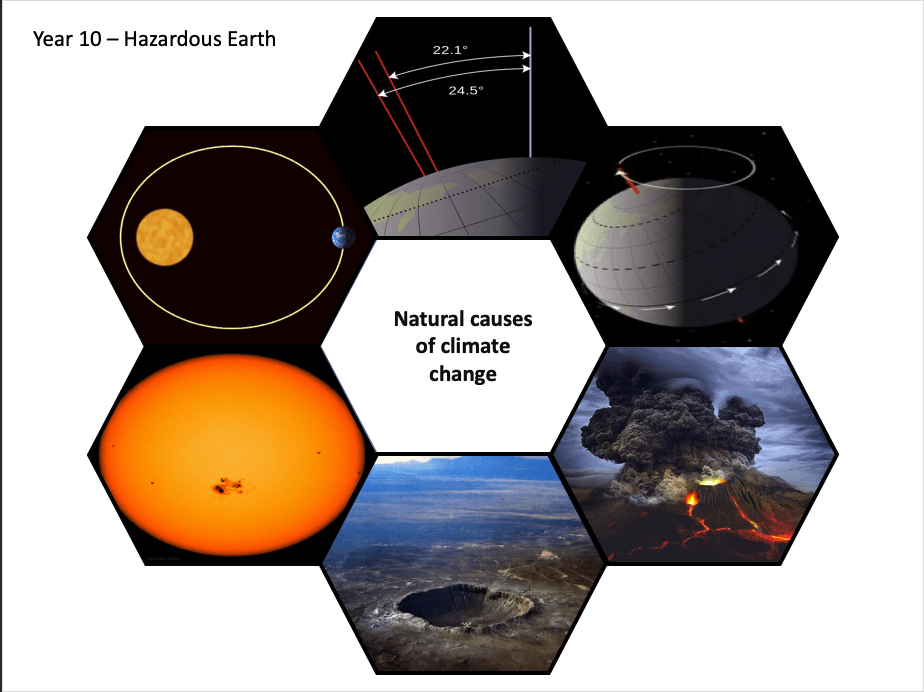
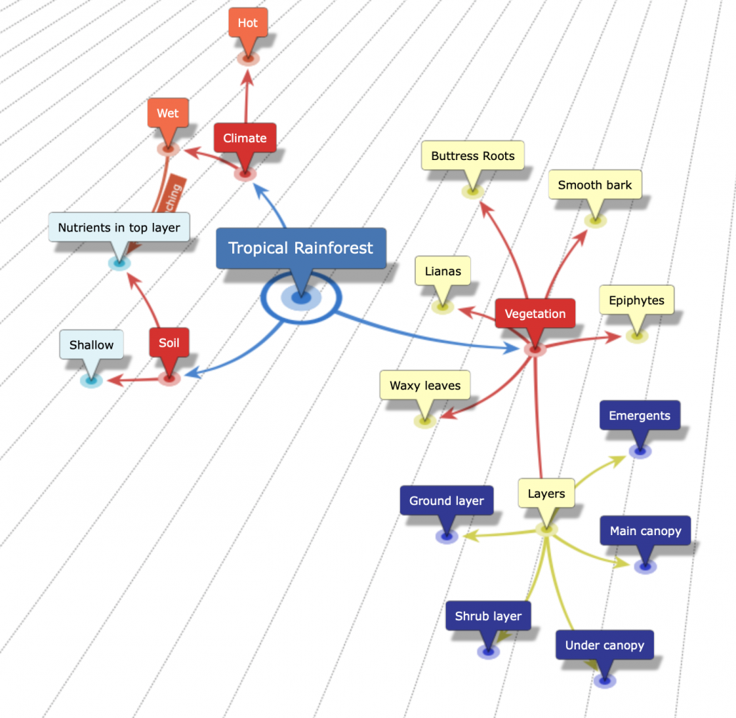
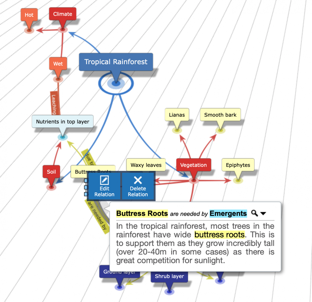
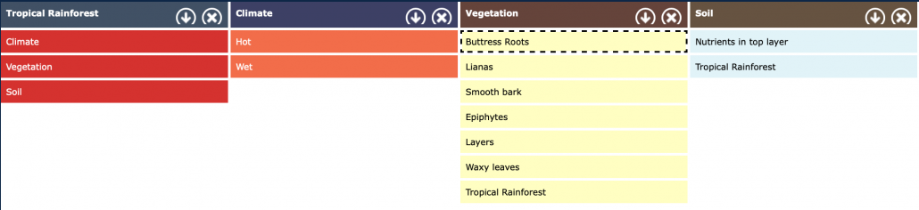
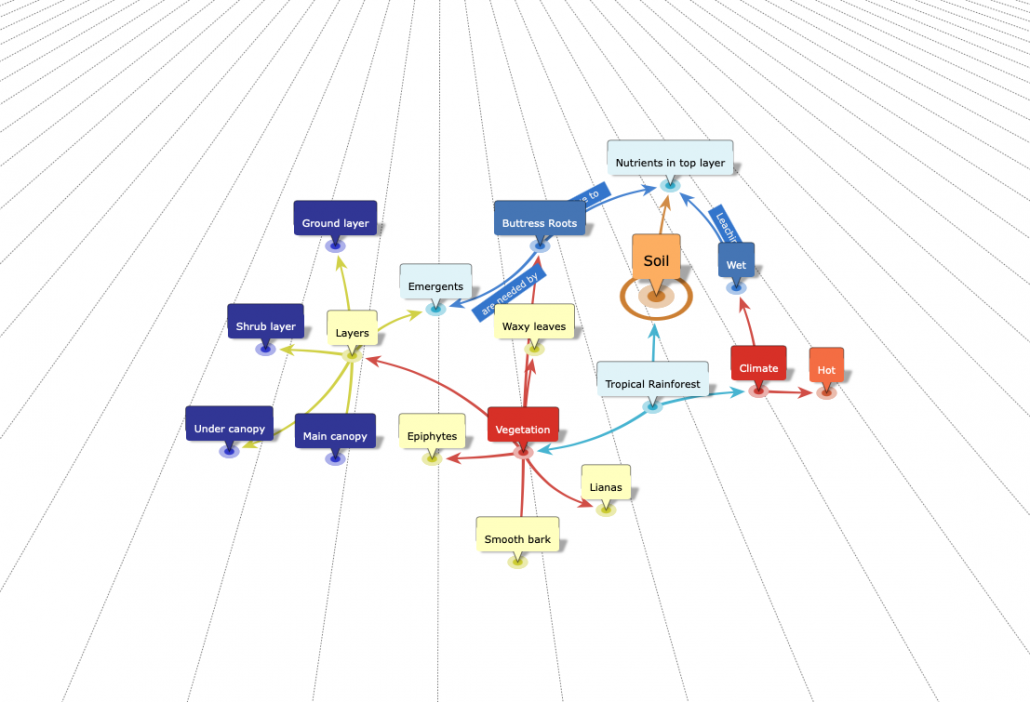
If the first GCSE unit covered is ecosystems, introduce an unfamiliar fieldwork enquiry by showing your students an image of a deciduous forest ecosystem (once they have studied this aspect of the course). Next, model several examples of geographical questions/hypothesis for this environment, then ask them to develop more. Paired or group work might be appropriate at this stage. You could also address the risks associated with completing fieldwork in this environment and examine risk management along with some basic data presentation and interpretation.
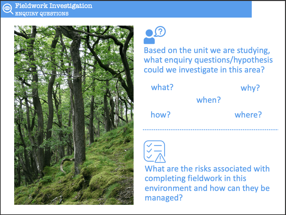
Identify enquiry questions and risks associated with the deciduous forest
In the next unit, present the students with another image and ask them to formulate questions independently, identify risks along with strategies for managing the risk and complete data presentation and interpretation. Next, spend time examining the fieldwork techniques that will support investigating the geographical question(s)/hypothesis. The students can then select appropriate data collection techniques for their enquiry questions/hypothesis (perhaps from a list of methods suitable for the environment) and justify their choice.
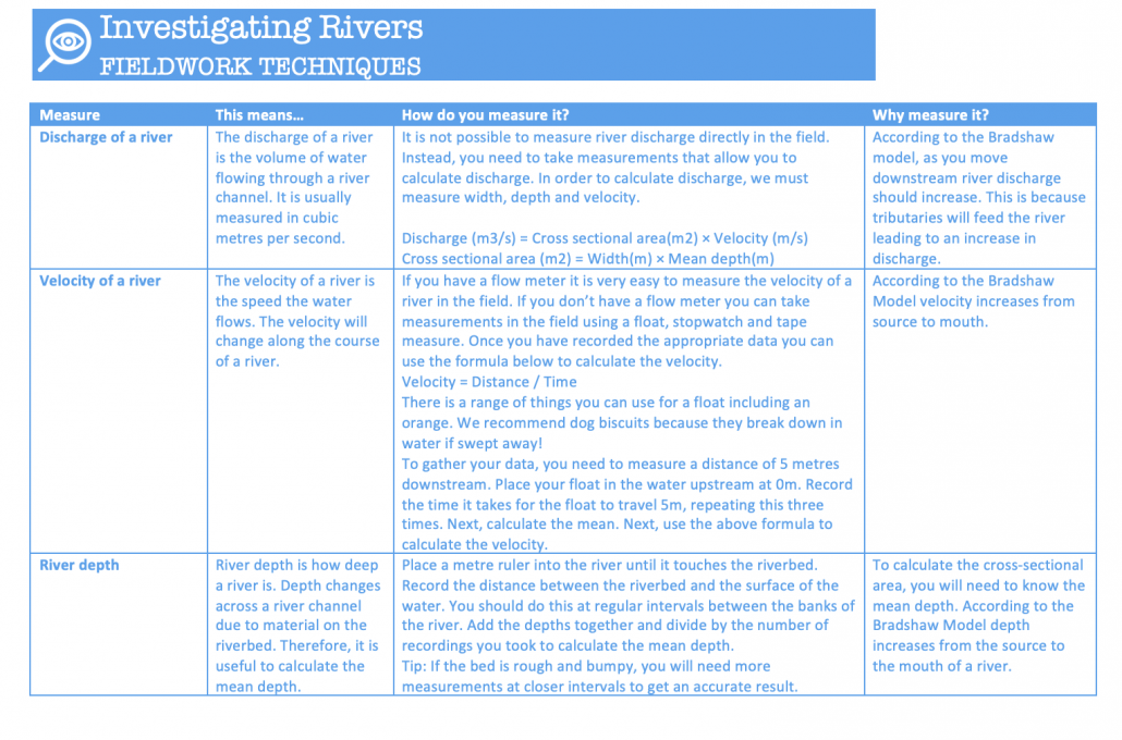
River fieldwork techniques
For homework, they can re-visit their ecosystems enquiry and identify suitable data collection techniques (again, from a list of possible approaches), explaining their choice.
As you move through units, expose your students to further aspects of the enquiry processes, including:
- data presentation
- data processing
- describing, analysing and explaining data
- forming conclusions
- evaluation
In addition to addressing unfamiliar fieldwork in class, assessments should include unfamiliar enquiry questions from the beginning of the course. Start small and build throughout the course.
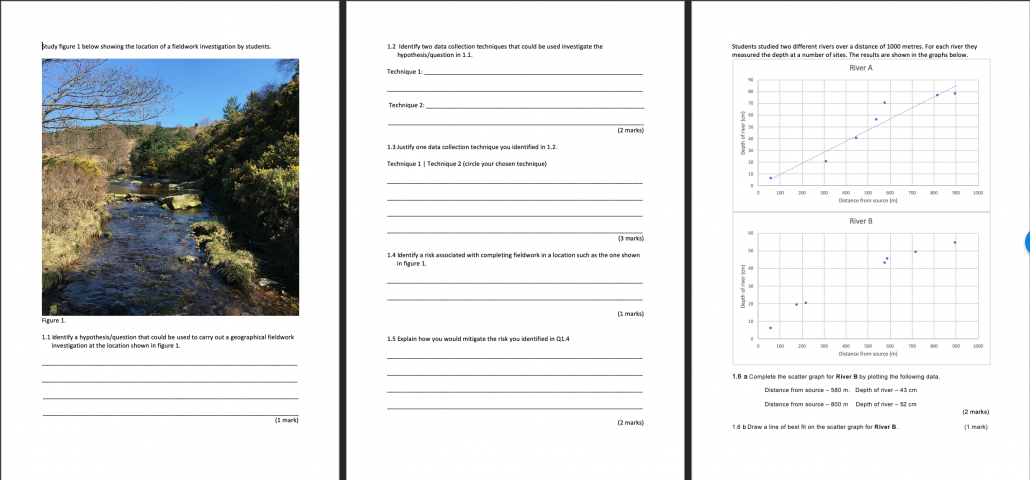
Unfamiliar fieldwork questions – rivers
Below is an outline of resources available to Internet Geography Plus subscribers to support with the enquiry process.
I will be sharing further thoughts on how to embed enquiry in the geography curriculum in future posts.
Comments are welcome below!
Anthony
Internet Geography Plus resources to support with enquiry
To support the above approach, we are developing a range of resources for AQA units that cover fieldwork in unfamiliar contexts. These will include:
• exam questions and mark schemes covering unfamiliar fieldwork contexts
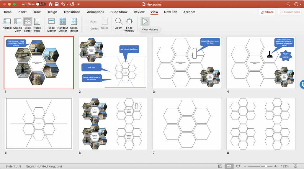
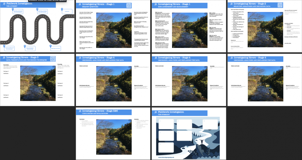
• a PowerPoint resource to support the process of tackling unfamiliar fieldwork contexts in a range of units
• examples of techniques used in a variety of fieldwork investigations
• example fieldwork enquiries
Our first set of resources, available to Internet Geography Plus subscribers include:
- exam questions and mark scheme based on a river enquiry in an unfamiliar context
- a PowerPoint presentation containing images for a range of units that encourage students to consider geographical questions/hypothesis and risk assessments in a variety of environments
- a rivers fieldwork techniques cheat sheet
Did you know? Our Geography Curriculum Tracking Tool allows you to plan for progression in developing enquiry skills. The tracking tool is useful, not just for planning for progression, but is handy if you suffer a ‘deep dive’.
If you have any resources to share in this area, please send them over to [email protected].
Questions based on students’ individual enquiry work
We are currently developing resources to support students in the enquiry process. These guides will take the students through the enquiry sequence and will provide examples of what they need to consider. The A3 resources are fully editable so you can customise them to meet the needs of your students. Each resource pack also contains an overview of the enquiry process and a summary document they can complete at the end of the investigation to support revision.
Fieldwork investigation guide – rivers (available to download in the Internet Geography Plus area)
You can download our first draft of a river-based investigation guide and presentation.
These documents will be updated as we build more online guides to support data presentation techniques etc.
Look out for additional resources shortly.