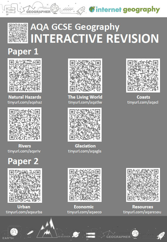
Improve Geographical Skills with Skills Plus
Feedback from the recent AQA GCSE Geography examiner’s report suggests that geographical skills are an area for development. Given that geographical skills are worth 10% of the GCSE, across three papers, we’ve been thinking about how Internet Geography Plus can support you in improving students’ geographical skills. Considering so many skills are covered in the AQA GCSE specification, we felt a quick fix wouldn’t be enough. Therefore, this year, we are developing several sets of resources to support you, including:
- Skills Plus
- Skills Plus Baseline Assessments
What is Skills Plus?
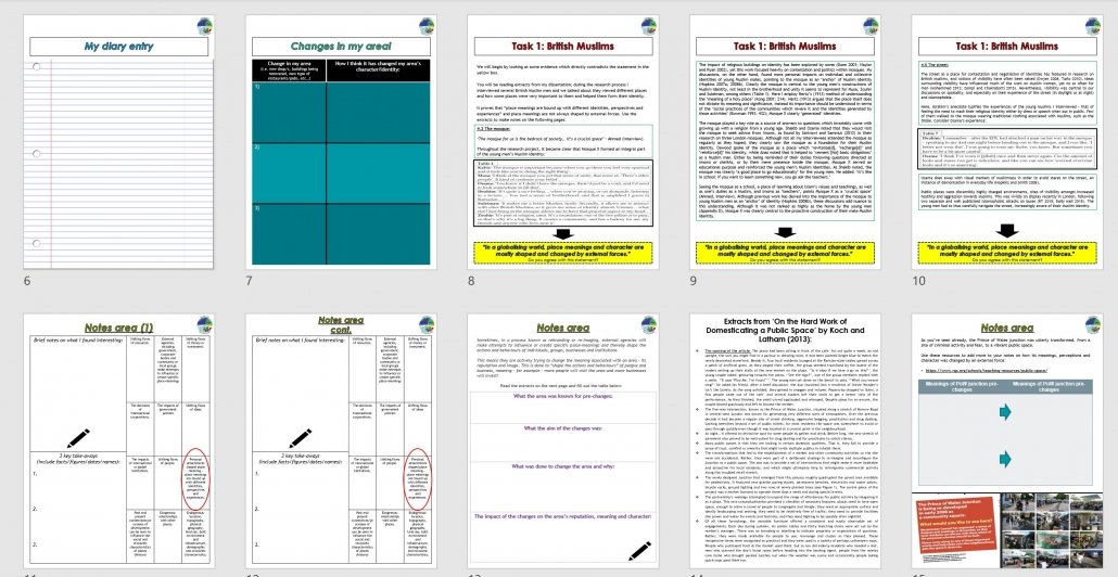
Skills Plus is a collection of activities that focus on applying geographical skills in the context of the units covered by the specification. Each Skills Plus sheet focuses on one or two skills, and questions are based on a particular unit. They are short, focused activities that can be used as starter or plenary activities. They can also be issued to individual students if there is a particular area for development identified from assessments or intervention sessions etc. Each Skills Plus resource is editable and includes a mark scheme to reduce your workload.
An example of a Skills Plus resource
Subscribers can access the first of these resources in the new Skills Plus area of Internet Geography Plus. We’ll be adding new Skills Plus resources regularly over the coming year. If you have a specific request, please get in touch. Not got access to Internet Geography Plus? Please purchase a low-cost annual subscription to access these and over a thousand other resources.
Skills Plus Baseline Assessments
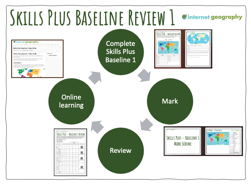
As well as Skills Plus, we are developing a comprehensive, planned approach to developing geographical skills through our new Skills Plus Baseline Assessments. The approach involves:
- Students complete a baseline assessment covering various geographical skills.
- Students assess their performance (a mark scheme is provided, including a PowerPoint that can be used to take the students through the answers).
- Students complete a review sheet to RAG rate their performance across the different skills (a PowerPoint is also available for you to deliver this)
- Students use QR codes/web links to access resources on Internet Geography to support improving their identified areas for development.
- The assessment can be repeated later to review progress.
We’ll be adding a number of Skills Plus Baseline assessments to Internet Geography Plus over the coming year, which review the range of geographical skills identified in the specification (and a few relevant extras). As there are so many skills to cover, we have decided to divide the skills and produce a series of baseline assessments this academic year.
The first Skills Plus Baseline Assessment (see image below) is now available to Internet Geography Plus subscribers.
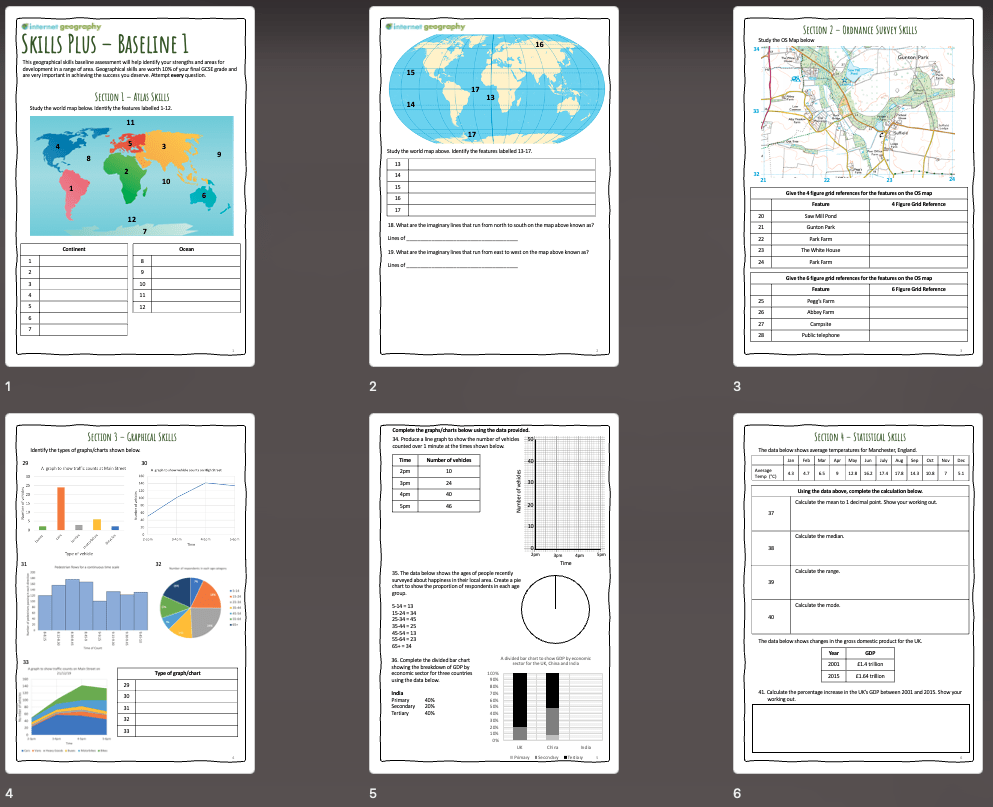
Skills Plus Baseline Assessment 1
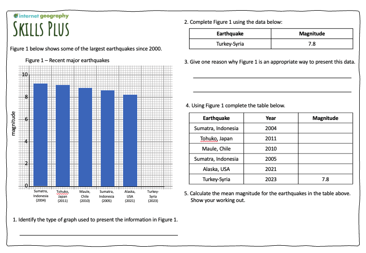
The first Skills Plus Assessment addresses relatively basic geographical skills students should know. However, we have included a couple of more challenging elements so that most students will have areas for development!
Each Skills Plus Baseline will cover a range of atlas, OS maps, graphical, and statistical skills.
An introduction PowerPoint is available to download to support you in launching the Skills Plus Baseline.
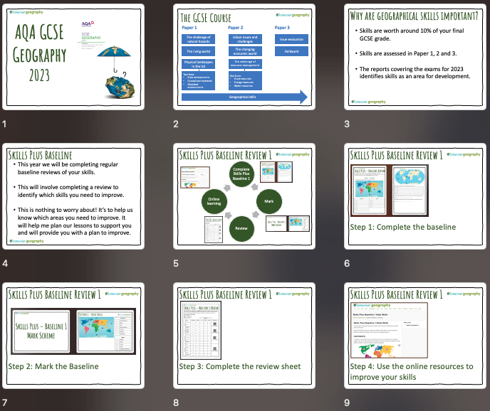
Skills Plus Baseline teacher presentation
Once the students have completed the Skills Plus Assessment, they will self-assess using the provided mark scheme, which includes a PowerPoint presentation that you can use to take the students through the processes.
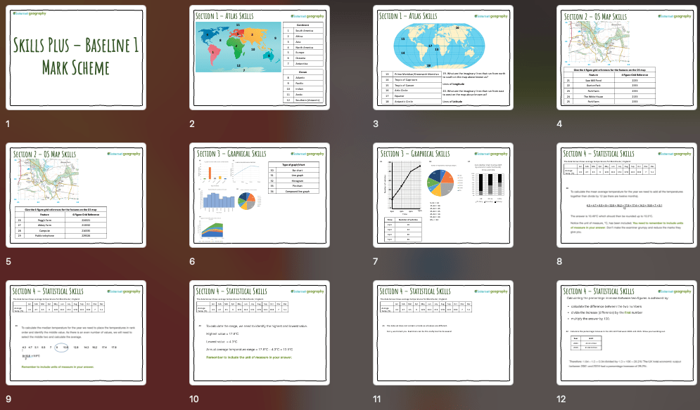
Skills Plus Baseline 1 Mark Scheme PowerPoint
Students then review their performance using the Skills Plus Baseline Review (see below). There is a PowerPoint to guide students through this process on Internet Geography Plus.
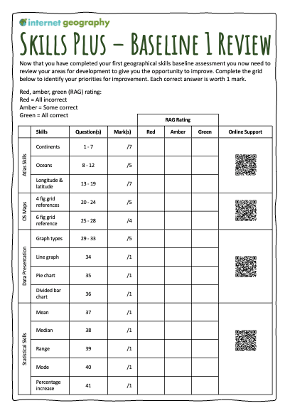
Skills Plus Baseline Review
The completed review sheet will help students identify their priorities for skills development. The review sheets include a QR code/link to free-to-access online resources on Internet Geography that students will use to improve their geographical skills. These pages are now available to access.
We’re working on a spreadsheet to identify which geographical skills are covered in this and future assessments. Hopefully, it will be a helpful tracking tool that provides a clear overview of the skills that have been/will be covered. It can also be shared with those delightful OFSTED people, if you are lucky enough to have a visit, to illustrate how you are taking a systematic approach to skills development.
Skills Plus Tracking Sheet
Subscribers can now access the new Skills Plus Baseline and Baseline Review in the new Skills Plus area of Internet Geography Plus. Mark schemes and presentations will be added later today.
We’ll be adding further baseline assessments over the coming year. If you have a specific request, please get in touch. Not got access to Internet Geography Plus? Please purchase a low-cost annual subscription to access these and over a thousand other resources.