Edexcel B GCSE Geography > The UK’s Evolving Physical Landscape > 2024 River Severn Flood Case Study – How do physical and human processes cause the River Severn to flood?
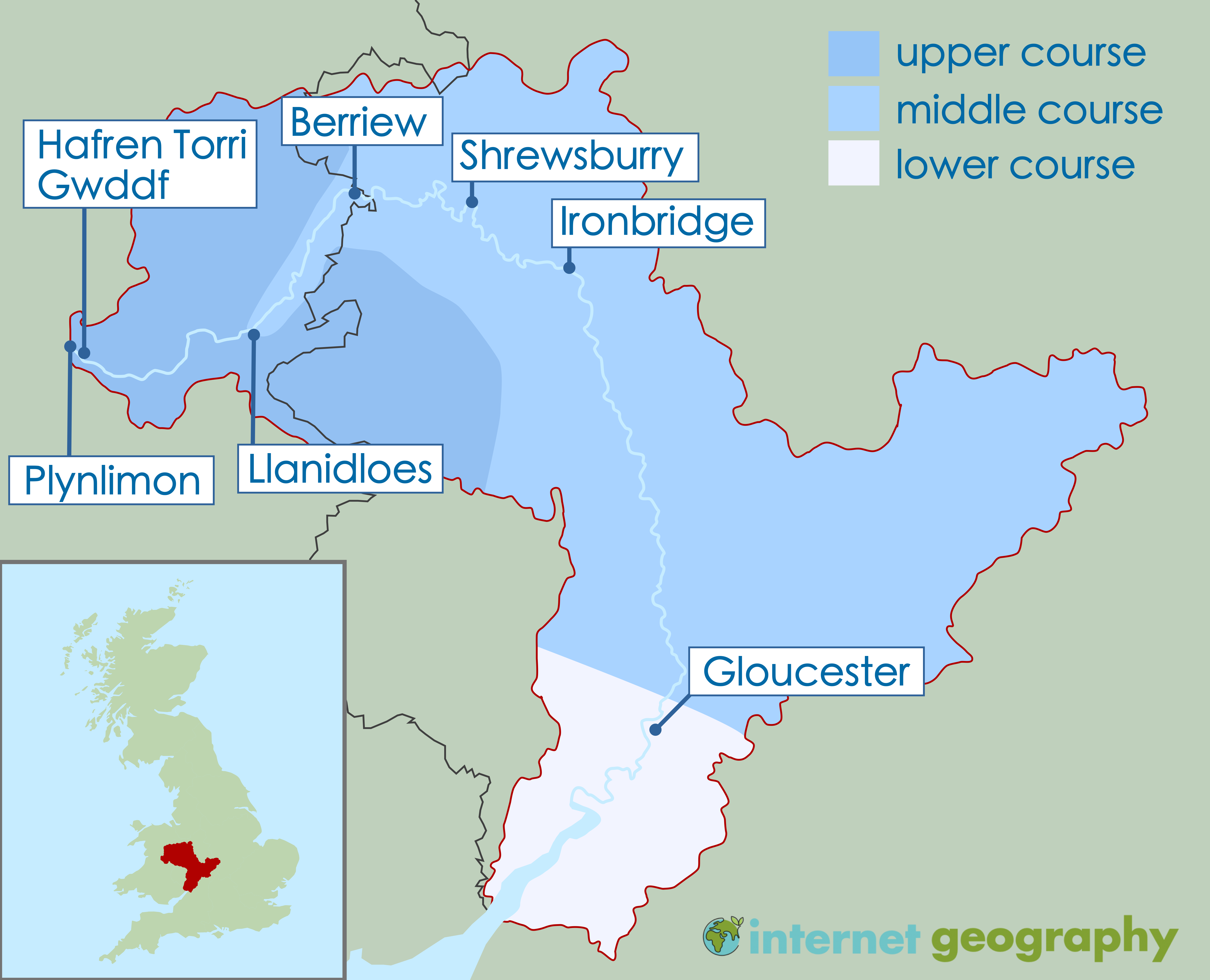
Where is the River Severn?
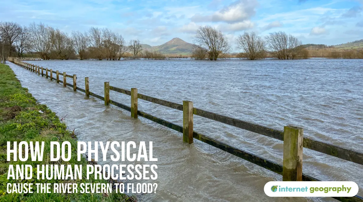
The River Severn is the longest river in the UK, stretching 354 km from the Cambrian Mountains in Wales, through the West Midlands, and into the Bristol Channel. It passes through major settlements including Shrewsbury, Worcester, and Tewkesbury. The river’s lower course has a wide floodplain and a tidal estuary, making it highly susceptible to flooding.
The upper, middle and lower courses of the River Severn
Physical causes of flooding on the River Severn
Several natural (physical) processes influence flooding on the River Severn:
Heavy rainfall and storms: In early 2024, a series of intense storms brought above-average rainfall to Wales and western England. Storm Henk in January 2024 and persistent rainfall in February led to saturated ground and increased river discharge.
Saturated soils: Weeks of rainfall left the ground unable to absorb further water, increasing surface runoff into the river.
Confluence of rivers: At Tewkesbury, the River Severn meets the River Avon. When both rivers are in spate (flood), water cannot drain quickly enough, worsening flooding.
Steep upland slopes: The upper course in Wales has steep slopes and thin soils, meaning water drains rapidly into the Severn.
Human causes of flooding on the River Severn
Human activity has made the River Severn more prone to flooding:
Urbanisation: Growing towns and cities such as Shrewsbury, Gloucester, and parts of the West Midlands have built over natural floodplains with impermeable surfaces (roads, buildings), reducing infiltration and increasing runoff into the river.
Development on floodplains: The expansion of housing and infrastructure in flood-prone areas (e.g., Tewkesbury) has placed more people and property at risk.
Land-use changes: Deforestation and agriculture in the Severn’s upper catchment reduce interception, speeding up water flow to the river.
Recent River Severn Flooding (2024)
In January and February 2024, the River Severn experienced its highest levels since 2020:
Shrewsbury and Ironbridge saw widespread flooding, with dozens of properties flooded despite temporary barriers.
Worcester was cut off in places due to water overtopping roads.
The Environment Agency issued multiple red flood warnings along the river.
Local authorities and emergency services used pumps and temporary flood defences to protect vulnerable areas.
These recent floods illustrate the ongoing interaction between extreme weather (climate change), catchment conditions, and human settlement in flood-prone areas.
Significance of the River Severn’s Location
The Severn’s large drainage basin collects water from across much of central and western England and parts of Wales.
Its tidal estuary is vulnerable to storm surges from the Bristol Channel.
Low-lying settlements, such as Tewkesbury, are built on the confluence of rivers and flat floodplain land, thereby increasing flood exposure.
The River Severn remains highly prone to flooding due to the combination of physical processes (rainfall, saturated soils, steep gradients, river confluences) and human activity (urbanisation, development, floodplain use). The flood events in 2024, particularly during Storm Henk and the weeks that followed, serve as a powerful reminder of the importance of effective flood risk management, climate resilience, and sustainable planning in UK river basins.
Summary
River Severn Location
The River Severn flows through key towns like Shrewsbury and Tewkesbury. Its wide drainage basin and confluence with the River Avon make it prone to flooding.
High Rainfall and Saturated Soils
February 2020 saw the wettest UK February on record. Previous rainfall left soils saturated, increasing surface runoff into the Severn.
Urbanisation Effects
Urban development has increased impermeable surfaces, accelerating runoff and reducing infiltration, which contributes to flashier hydrographs.
Confluence at Tewkesbury
The meeting point of the River Severn and Avon at Tewkesbury worsens flooding risks during heavy rain, as both rivers can peak simultaneously.
Impacts of the 2020 Flooding
Storm Dennis caused widespread damage—homes were flooded, infrastructure was disrupted, and emergency rescues took place.
Response and Future Planning
Flood warnings and emergency plans helped reduce harm. Authorities are now considering more sustainable long-term flood defences.