Where are the areas of water deficit and surplus in the UK?
Availability of water across the UK is uneven.
Water availability in the UK is uneven because both supply and demand vary across regions. Some areas receive large amounts of rainfall but have a small population, while others receive little rainfall but have very high water demand.
A water surplus occurs when the water supply exceeds demand. A water deficit occurs when there is not enough water available to meet the needs of people, industry and agriculture.
Population distribution in the UK is uneven. The most densely populated areas are often located in the driest parts of the country. The highest population densities are found in the south-east of England, where around one-third of the UK’s population lives.
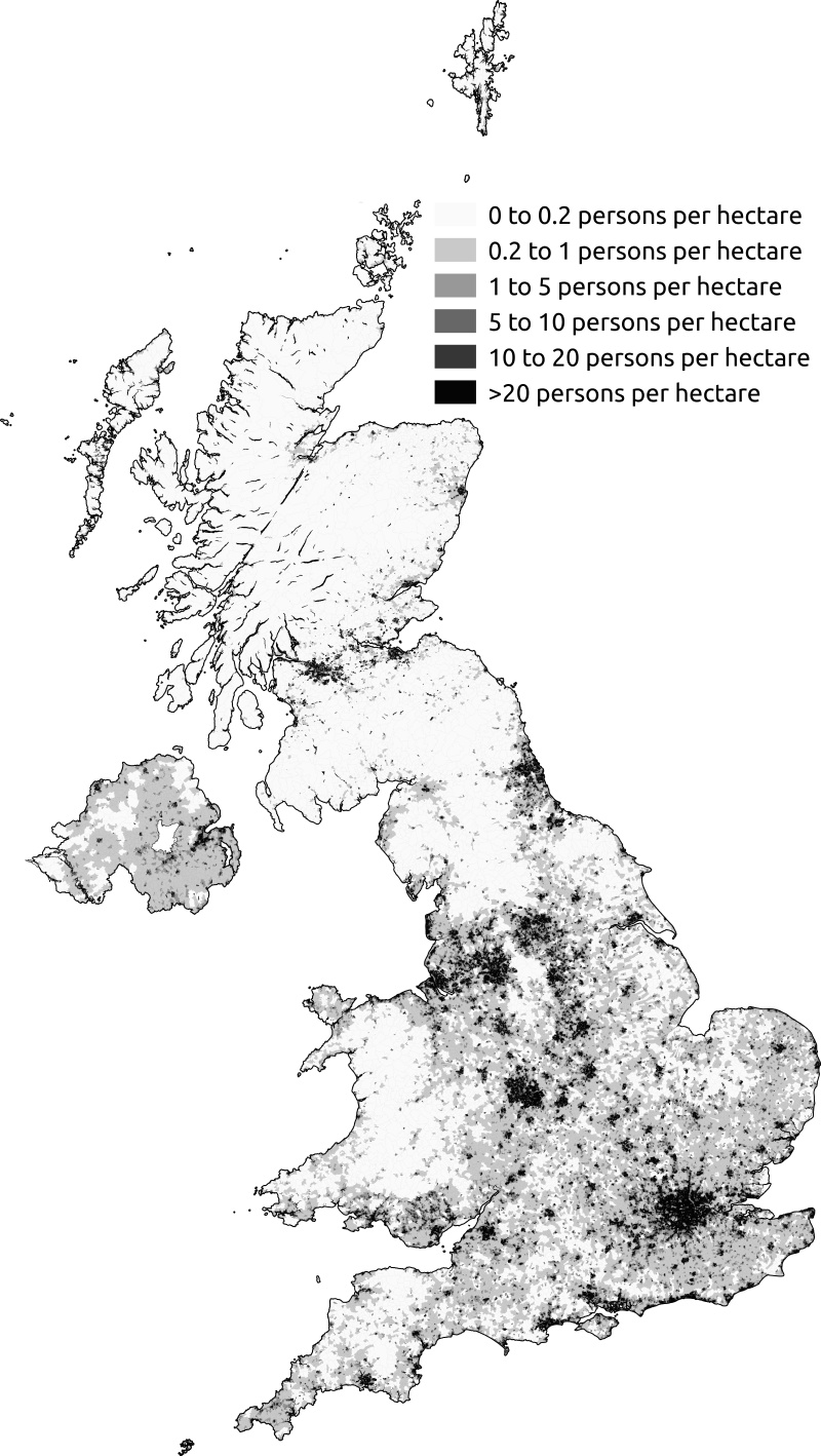
Population density in the UK based on the 2011 UK census.
The south-east of England is also one of the driest areas of the UK. In contrast, the north and west receive much higher levels of rainfall each year.
The map below shows average annual rainfall across the UK, using long-term climate data. It clearly shows a west–east divide, with wet upland areas in the north and west and much drier lowland areas in the east and south-east.
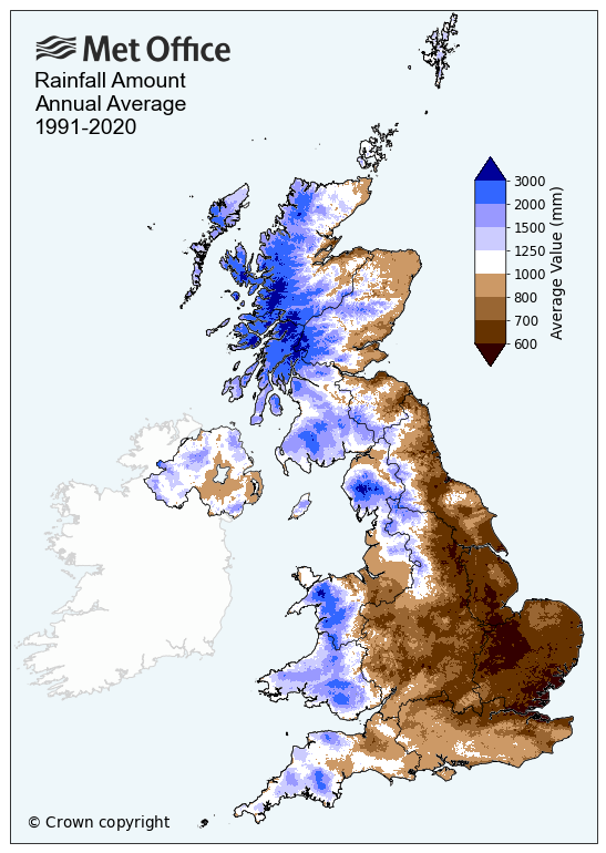
Average yearly rainfall in the UK between 1991 and 2020 – source UK Met Office
This contrast in rainfall is a key reason why some areas experience water surplus while others experience water deficit.
Some parts of the UK experience high rainfall but low population density. Examples include North Wales, the Lake District and parts of western Scotland.
In these areas, the amount of water available is greater than the demand from people and industry. This means they are described as having a water surplus. Rivers and reservoirs in water-surplus areas are often used to supply water to drier regions through water transfer schemes.
In contrast, south-east England experiences low rainfall but very high water demand. Large populations, industry, agriculture and services all require significant water supplies.
As a result, this region experiences a water deficit, with demand exceeding the naturally available supply. Areas experiencing severe or long-term water deficits are considered water-stressed.
Water stress occurs when water supplies are insufficient to meet demand, or when water quality limits the amount that can be safely used.
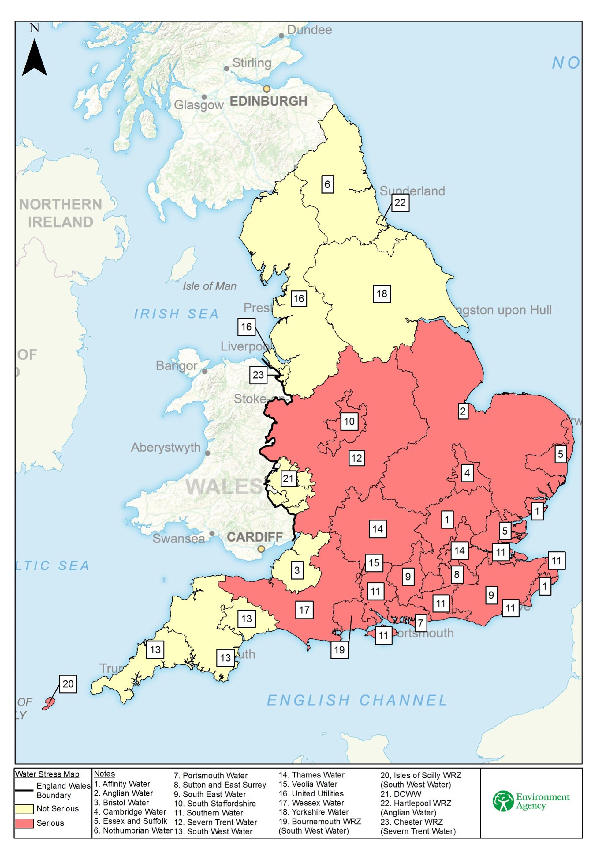
A map to show water stress in England. Source Environment Agency
The north and west of the UK are wetter because they are mainly upland areas and lie in the path of prevailing south-westerly winds from the Atlantic Ocean.
As moist air moves inland from the west, it is forced to rise over high land such as the Welsh mountains, the Pennines and the Scottish Highlands. As air rises, it cools and condenses to form clouds, which then produce rainfall. This process is known as relief rainfall.
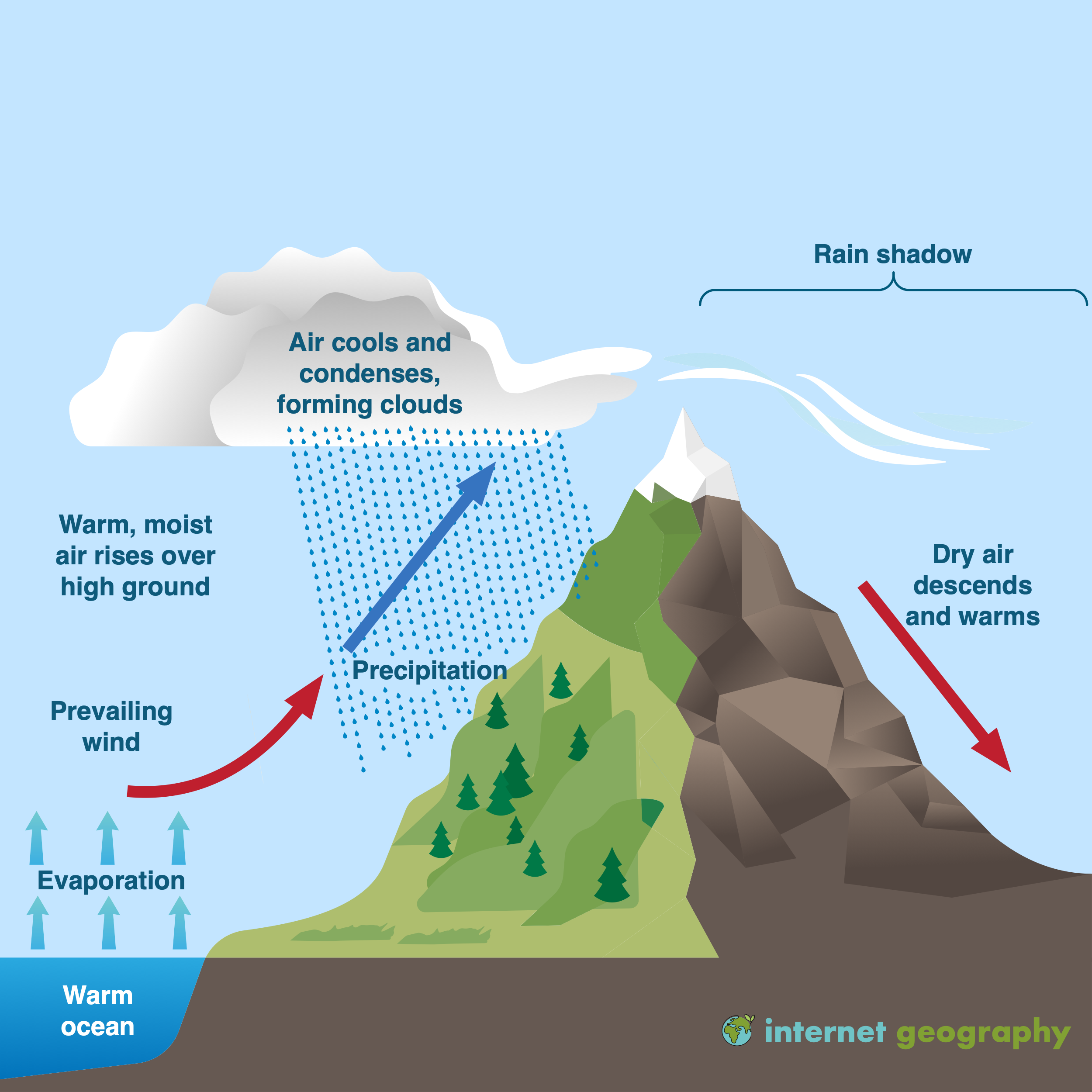
Relief Rainfall
Rainfall in the UK is unreliable and increasingly variable. In some years, rainfall is well below average, leading to water shortages and restrictions on water use. In other years, rainfall may be well above average.
Climate change, population growth and rising demand mean that matching water supply and demand is becoming more difficult, particularly in water-deficient regions of southern and eastern England.
Water transfer in the UK


Use the images below to explore related GeoTopics.