River Landforms
Rivers create a range of distinctive landforms as they erode, transport and deposit material along their course. Different landforms are associated with the upper, middle and lower courses of a river and reflect changes in energy, gradient and discharge.
Waterfalls
What is a waterfall?
A waterfall is a steep vertical drop in the river channel, where water flows over a resistant band of rock.
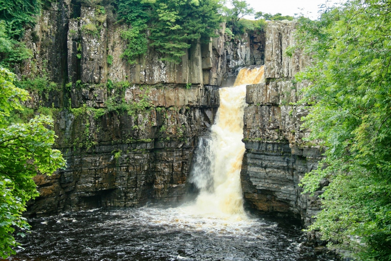
High Force waterfall on the River Tees.
Formation stages
- The river flows over hard rock followed by softer rock, creating a change in resistance.
- The softer rock is eroded more rapidly by hydraulic action and abrasion, creating a step in the river bed.
- Water plunges over the step, increasing the force of hydraulic action at the base.
- A plunge pool forms as abrasion by swirling rocks deepens the base.
- Undercutting of the softer rock creates an overhang of hard rock.
- The overhang collapses due to mass movement.
- The collapsed material is removed by abrasion, allowing the waterfall to retreat upstream.
Gorges
What is a gorge?
A gorge is a narrow, steep-sided valley often found downstream of a waterfall.
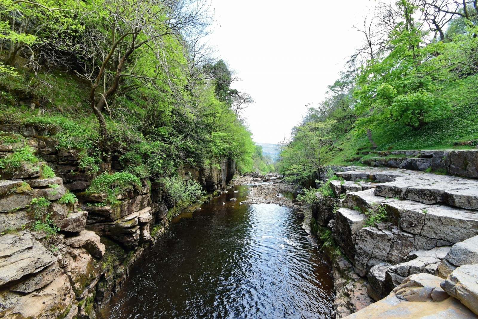
A gorge on the River Swale, Yorkshire Dales.
Formation stages
- A waterfall retreats upstream as hydraulic action and abrasion erode the softer rock at the base, forming a plunge pool and undercutting the hard rock above.
- The unsupported overhang collapses due to mass movement, and the fallen material is removed by abrasion.
- This cycle of undercutting and collapse repeats, causing continued upstream retreat of the waterfall.
- As the waterfall retreats, intense vertical erosion by hydraulic action and abrasion cuts downwards into the river bed.
- The valley sides remain very steep because ongoing erosion at the base and repeated mass movement prevent them from stabilising.
- The retreat leaves behind a long, narrow, steep-sided valley known as a gorge.
Rapids
What are rapids?
Rapids are turbulent, fast-flowing sections of river with uneven beds.
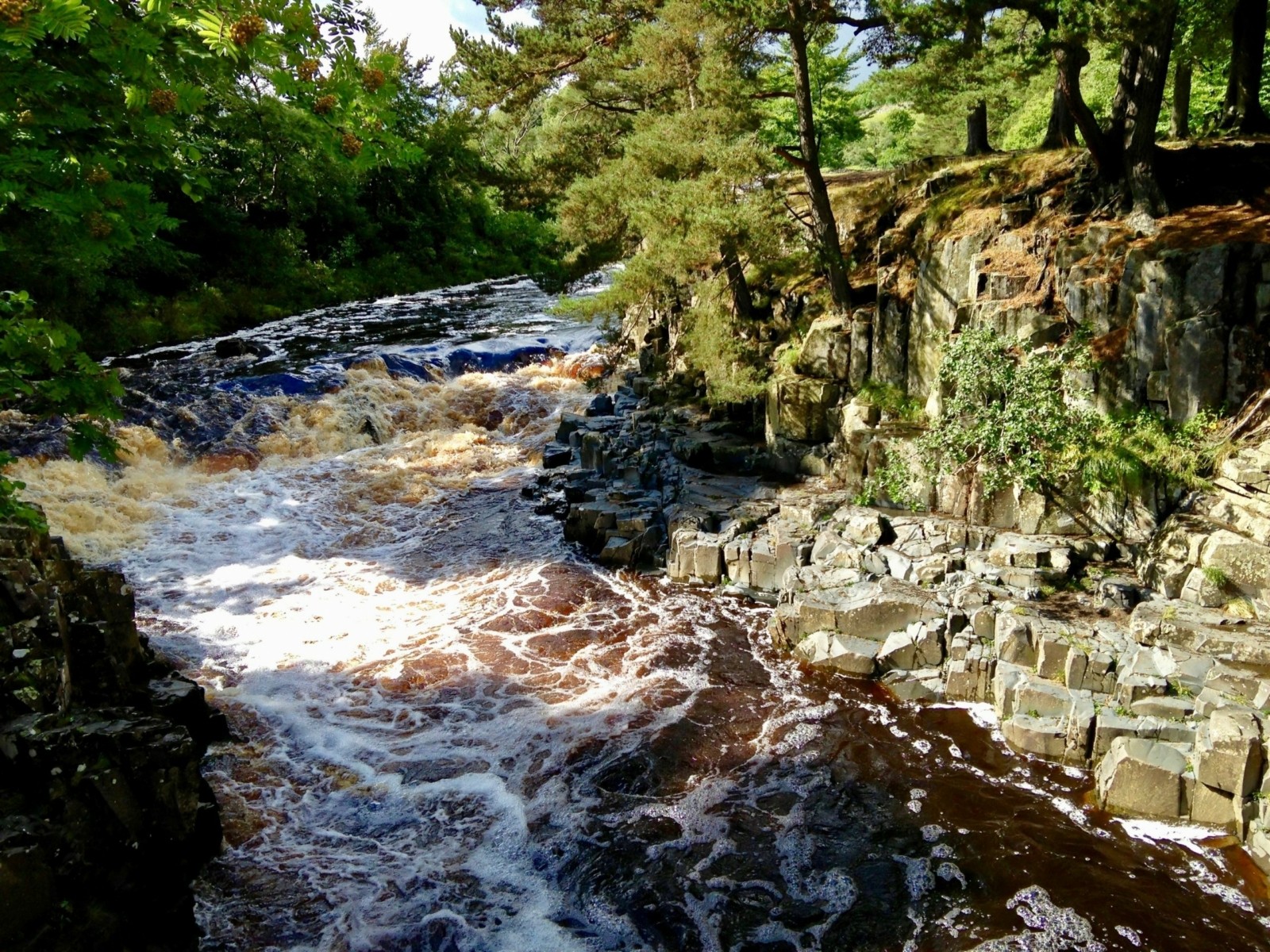
Rapids on the River Tees
Formation stages
- The river flows over alternating bands of hard and soft rock.
- Softer rock is eroded more quickly by hydraulic action and abrasion.
- Harder rock remains raised, creating an uneven river bed.
- Water accelerates over the irregular surface, increasing turbulence.
- Increased turbulence enhances erosion and maintains rapids.
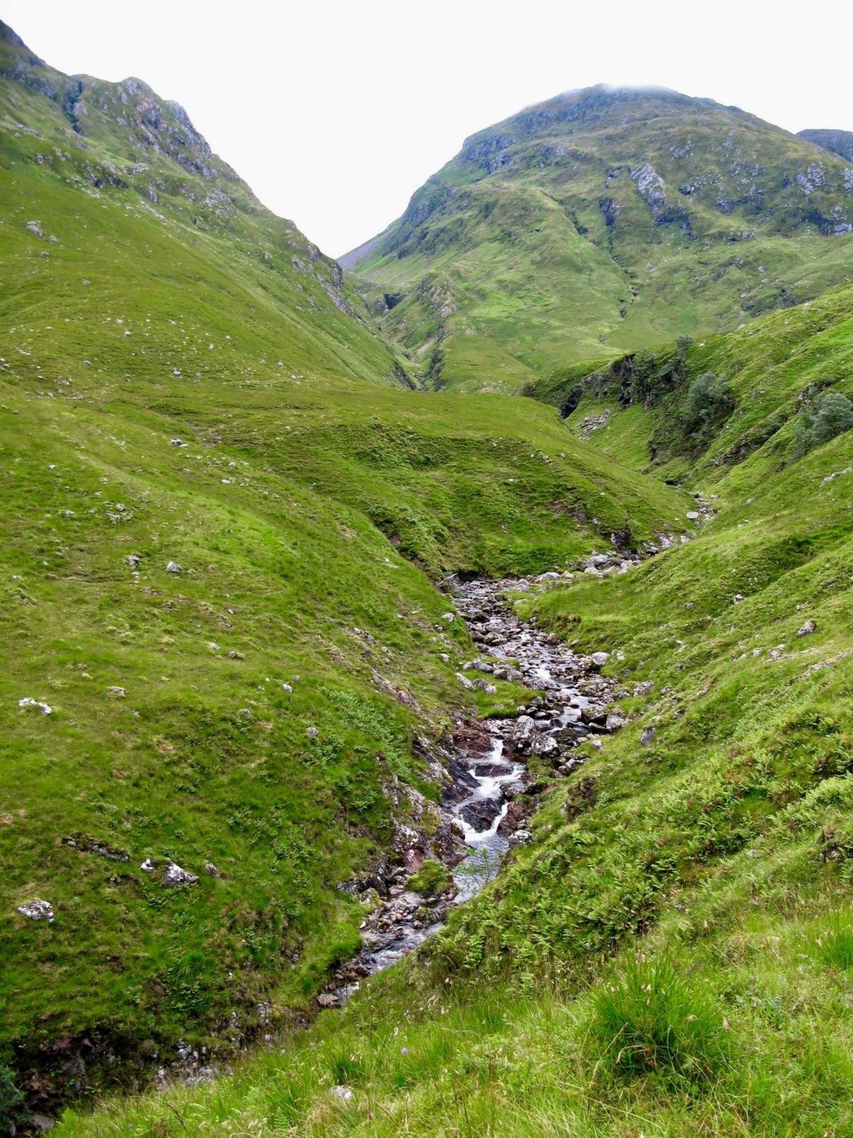
V-Shaped Valleys
What is a V-shaped valley?
A V-shaped valley is a narrow valley with steep sides, typical of the upper course of a river.
Formation stages
- The river has a steep gradient and high energy.
- Vertical erosion dominates as hydraulic action and abrasion cut downwards into the bed.
- Weathering weakens the valley sides.
- Material falls into the channel through mass movement.
- The river removes this material by transportation, maintaining steep sides.
- Continued vertical erosion creates a narrow, V-shaped valley.
Interlocking Spurs
What are interlocking spurs?
Interlocking spurs are ridges of land that alternate from one side of the valley to the other.
Interlocking spurs in the upper course of a river
Formation stages
- The river flows downhill following the path of least resistance.
- Harder rock resists erosion by hydraulic action and abrasion.
- The river winds around resistant rock rather than cutting through it.
- Vertical erosion dominates, while lateral erosion is limited.
- The valley remains narrow, creating overlapping spurs.
Pothole
What are potholes?
Potholes are circular holes drilled into the river bed, usually in the upper course.
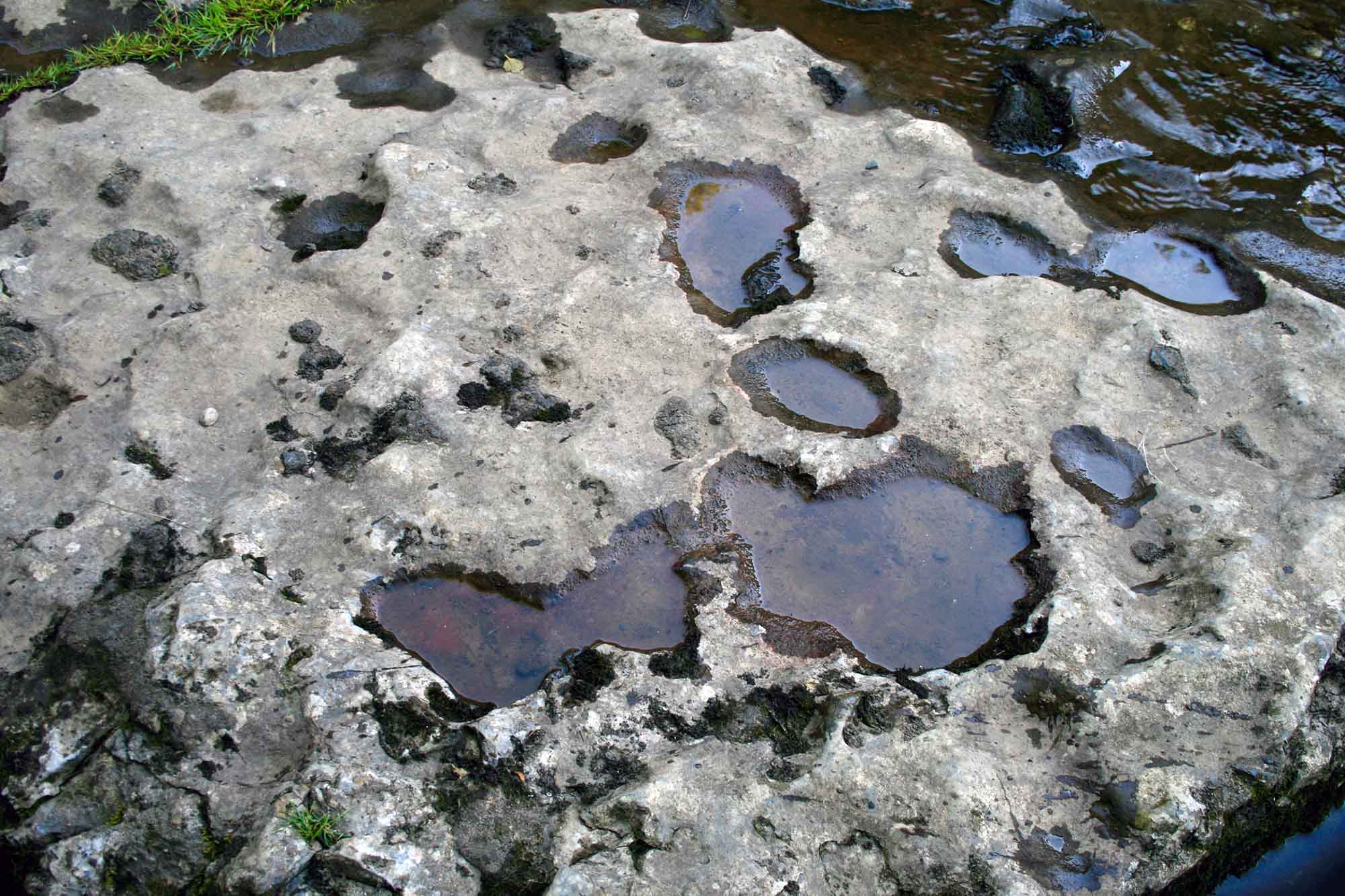
Potholes on the River Ure, close to Ayesgarth Falls in North Yorkshire
Formation stages
- Turbulent water flows over cracks or joints in the bed.
- Pebbles become trapped in these hollows.
- The force of water causes the pebbles to spin.
- Abrasion drills circular holes into the bedrock.
- Continued abrasion deepens and widens the pothole.
Meanders
What is a meander?
A meander is a bend or curve in a river channel, common in the middle and lower course.
A meander in the middle course of the river
Formation stages
- As the river moves into its middle course, variations in velocity cause small irregularities in the channel.
- Faster-flowing water is directed towards the outside of bends, where hydraulic action and abrasion erode the river bank.
- This erosion undercuts the outer bank, forming a steep river cliff.
- On the inside of the bend, water flows more slowly due to increased friction.
- The reduction in velocity causes deposition of transported sediment.
- Deposited material builds up to form a slip-off slope.
- Continued erosion on the outer bank and deposition on the inner bank exaggerate the bend.
- Over time, the meander becomes more pronounced and migrates laterally across the floodplain.
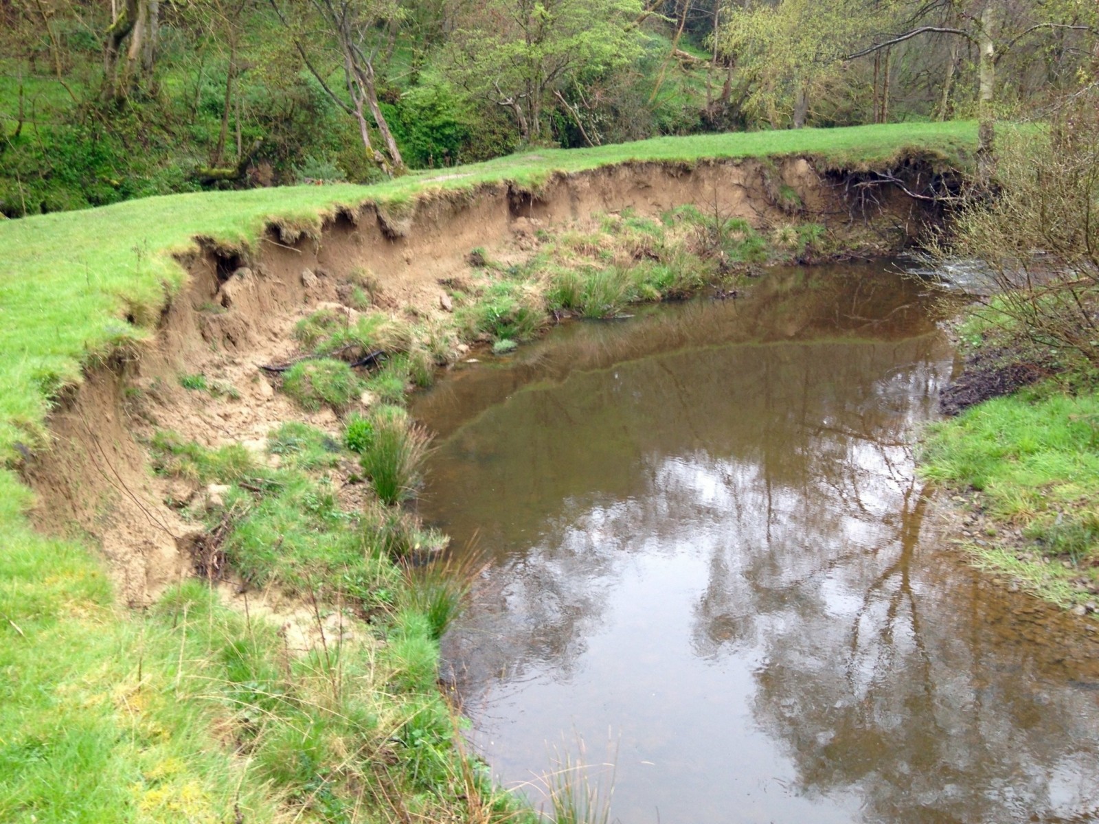
Oxbow Lakes
What is an oxbow lake?
An oxbow lake is a horseshoe-shaped lake formed when a meander is cut off.
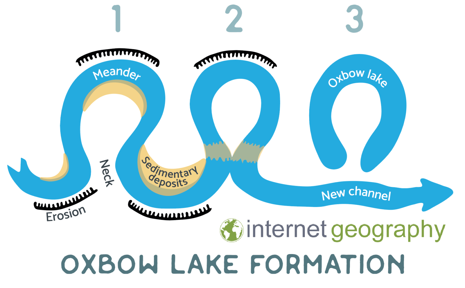
Formation of an oxbow lake
Formation stages
- Continued hydraulic action and abrasion on the outer banks of a meander increase lateral erosion, narrowing the meander neck.
- At the same time, deposition continues on the inner banks, further exaggerating the bend.
- During a period of high discharge or flooding, the river has enough energy to cut through the narrow neck.
- The river adopts the shorter, straighter route, increasing efficiency.
- Velocity decreases around the abandoned loop of the meander.
- Deposition seals off the ends of the old meander channel.
- The isolated loop becomes a still, crescent-shaped oxbow lake.
- Over time, the oxbow lake may fill with sediment and vegetation.
Floodplains
What is a floodplain?
A floodplain is a wide, flat area of land next to a river.
Formation stages
- As a river moves into its middle and lower course, its gradient becomes gentler and lateral erosion increases as hydraulic action and abrasion erode the outer banks of meanders.]
- Continued lateral erosion causes meanders to migrate sideways across the valley floor, widening the valley.
- Over time, repeated erosion of the valley sides creates a broad, gently sloping floor.
- During periods of high discharge, the river overflows its banks and spreads across the valley floor.
- As floodwater spreads out, velocity decreases rapidly.
- Deposition occurs as the river drops its load, with heavier sediment deposited first near the channel and finer sediment spread further across the valley
- When floodwater returns to the channel, a thin layer of fertile alluvium is left behind.
- Repeated flooding over long periods builds up layers of alluvium, gradually creating a wide, flat floodplain.
Levées
What are levées?
Levées are raised embankments along the sides of a river channel.
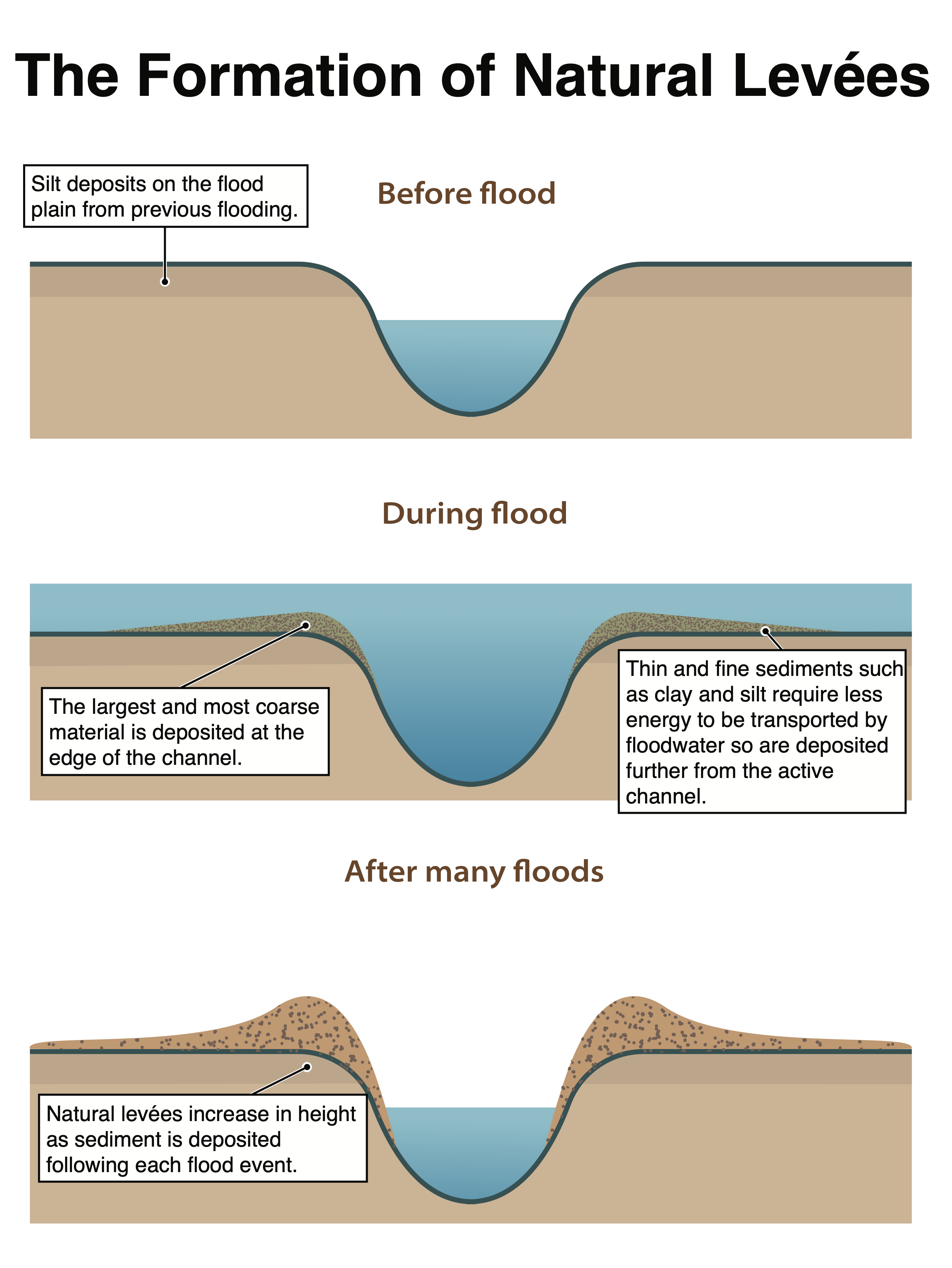
The stages in the formation of a natural levee
Formation stages
- During periods of high discharge, the river overflows its banks and floodwater spreads onto the floodplain.
- As water leaves the channel, its velocity decreases sharply because friction increases outside the channel.
- This sudden loss of energy causes deposition of the river’s load.
- Coarse, heavier sediment (such as sand and gravel) is deposited first, close to the river channel.
- Finer sediment (such as silt and clay) remains in suspension for longer and is carried further across the floodplain.
- When floodwater returns to the channel, raised ridges of coarse sediment are left along the channel margins.
- Repeated flooding and deposition over time build up these ridges.
- The raised embankments formed alongside the river channel are known as levées.
Deltas
What is a delta?
A delta is a low-lying area of deposited sediment at the mouth of a river.
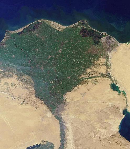
The Nile Delta
Formation stages
- As a river approaches its mouth, it is carrying a large load of sediment that has been transported downstream in suspension, saltation and traction.
- When the river enters a body of still or slower-moving water (such as the sea or a lake), its velocity decreases suddenly.
- The sharp reduction in velocity causes the river to lose energy.
- Deposition begins as the river can no longer carry its load.
- Coarser, heavier sediment is deposited first at the river mouth, forming shallow areas.
- Finer sediment (such as silt and clay) remains in suspension for longer and is carried further into the water body before being deposited.
- Continued deposition builds up sediment layers, causing the river bed at the mouth to become shallower.
- As the channel becomes blocked by deposited material, the river splits into smaller channels called distributaries.
- These distributaries continue to deposit sediment at their mouths, building land outward into the sea or lake.
- Over time, repeated deposition causes the delta to grow in size.