The River Tees flows for approximately 137 km from its source at Cross Fell in the Pennines to its mouth at Teesmouth, where it enters the North Sea. Along its course, the River Tees forms a range of erosional and depositional landforms that change from the upper to the lower course.
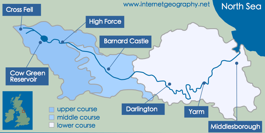
The upper, the middle and the lower courses of the River Tees
The upper course of the River Tees
The source of the River Tees is Cross Fell in the Pennines.
In the upper course, the River Tees flows over hard, impermeable rock. The river has a steep gradient, low discharge and high energy, so vertical erosion is the dominant process.
V-shaped valleys and interlocking spurs
Vertical erosion by hydraulic action and abrasion deepens the river channel. Weathering and mass movement weaken the valley sides, causing material to collapse into the river. This creates steep-sided V-shaped valleys.
The river winds around more resistant rock, forming interlocking spurs, which are clearly visible near Cauldron Snout in upper Teesdale.
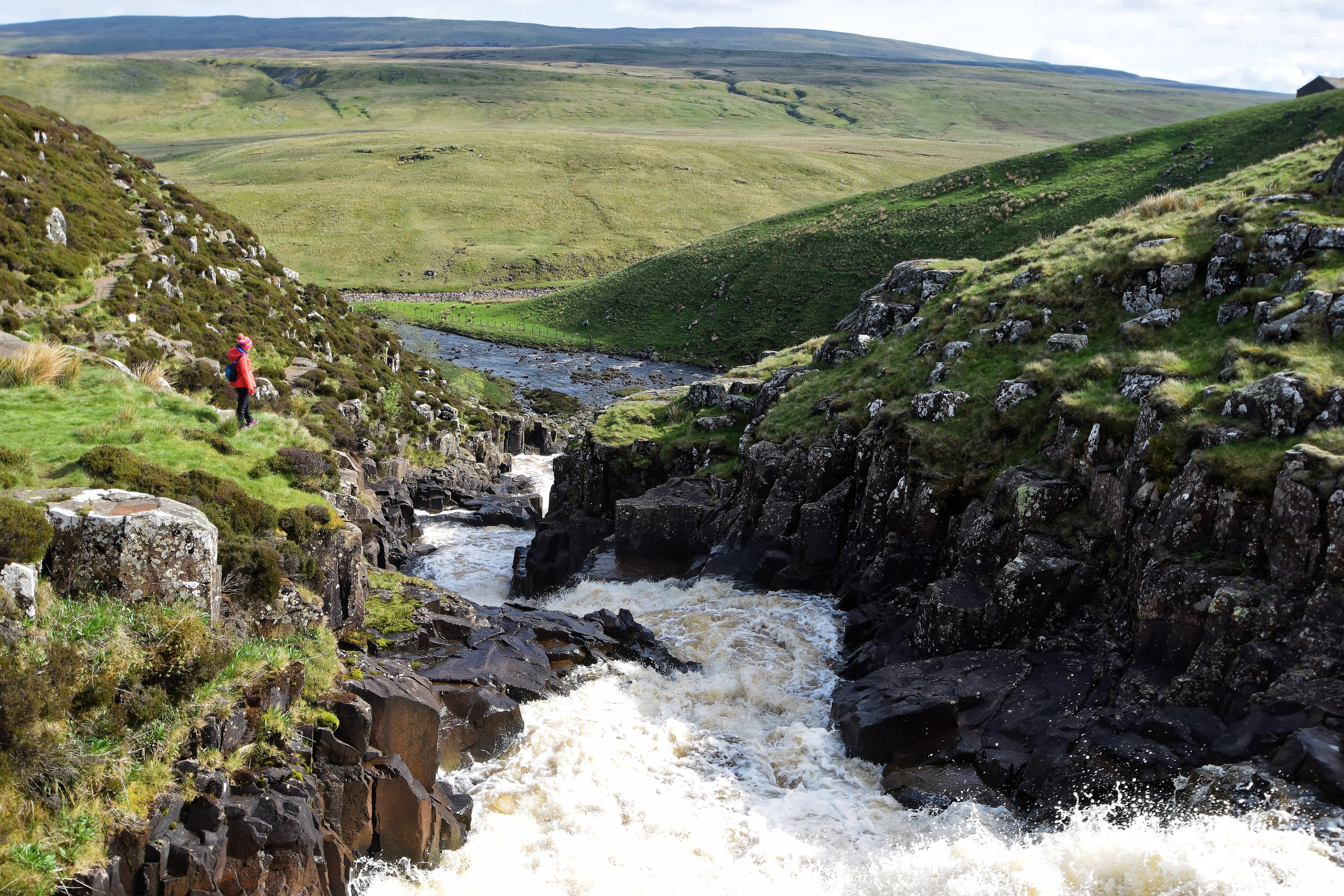
Interlocking spurs close to Cauldron Snout on the River Tees.
High Force waterfall
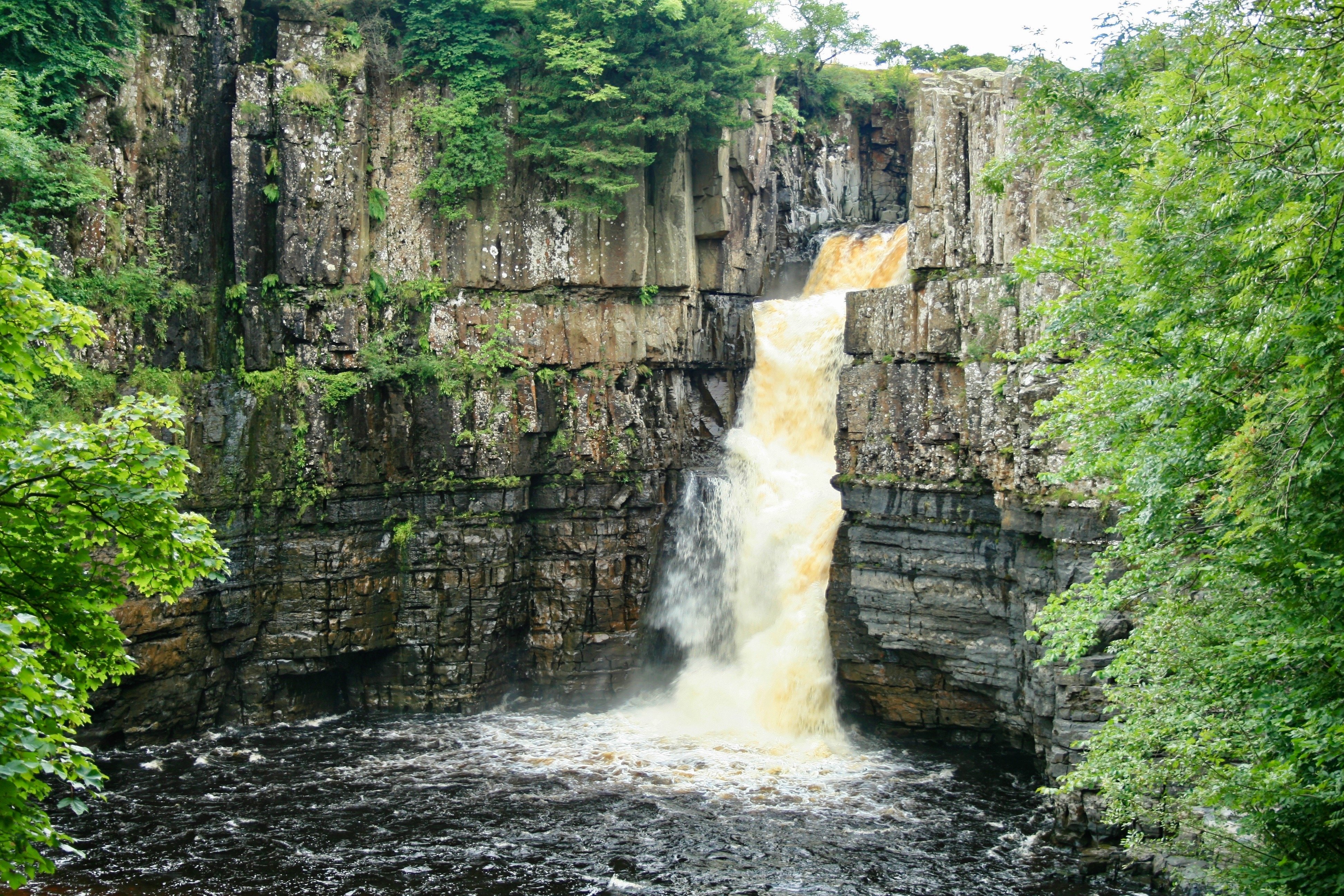
High Force waterfall on the River Tees.
The UK’s largest waterfall, High Force, is located in the upper course of the River Tees, west of Barnard Castle.
High Force has formed due to differential erosion:
- A band of hard igneous rock called the Whin Sill lies above softer sandstone and shale.
- The softer rock is eroded more rapidly by hydraulic action and abrasion.
- This undercuts the Whin Sill, creating an overhang.
- The overhang collapses, forming a plunge pool.
- Repeated collapse causes the waterfall to retreat upstream, leaving a steep-sided gorge.
The middle course of the River Tees
Downstream of High Force, the River Tees enters its middle course. The gradient becomes gentler and discharge increases, meaning lateral erosion becomes more important than vertical erosion.
Meanders
In the middle course, the river begins to develop meanders lateral erosion overtakes vertical erosion, particularly around Barnard Castle.
On the outside bend, faster-flowing water causes erosion through hydraulic action and abrasion. On the inside bend, slower water leads to deposition of sand and gravel.
Over time, these processes make the meanders more pronounced and sinuous.
Lower course of the River Tees
As the River Tees reaches its lower course, lateral erosion has formed winding meanders. Meanders in the lower course are much larger than those in the middle course. Oxbow lakes have formed in some areas. Evidence of past flooding can be seen in the naturally formed levees.
A wide floodplain has developed along the lower River Tees, especially around Yarm and downstream towards Stockton-on-Tees.
At Teesmouth, near Middlesbrough and Redcar, the River Tees forms a large estuary.
- River velocity decreases sharply as it meets the sea.
- Fine sediment is deposited, forming mudflats and sandbanks.
- Tidal action redistributes sediment, continually reshaping the estuary.
This area is a clear example of deposition in the lower course of a UK river.