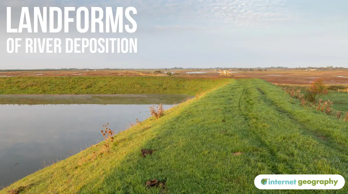
Landforms of river deposition
Rivers shape the landscape through erosion, transportation and deposition. Deposition occurs when a river loses velocity and energy and can no longer carry all of its sediment. This most commonly happens in the middle and lower courses of a river, where the gradient is gentle, and the channel is wide.
Over time, deposition, working alongside lateral erosion, creates distinctive landforms, including floodplains, levées, estuaries, and deltas.
Floodplains
What is a flood plain?
A flood plain is a wide, flat area of land found on either side of a river channel. Flood plains develop mainly in the middle and lower courses of a river and are formed through a combination of lateral erosion by meanders and deposition during flooding.
How do floodplains form?
As a river enters its middle course, it begins to form meanders. On the outside bend of a meander, water flows fastest and has the most energy. This causes lateral erosion, mainly through hydraulic action and abrasion. When the outer bend of a meander reaches the edge of the river valley, erosion cuts into the valley sides, widening the valley and removing interlocking spurs.
As meanders migrate sideways and downstream over time, the valley floor gradually widens, creating space for a flood plain to develop.
At the same time, during periods of high discharge, the river may overflow its banks. When floodwater spreads out across the valley floor, increased friction causes the river to lose energy. As velocity decreases, the river deposits sediment.
The coarsest material is deposited first near the channel, while finer sediment, such as silt and clay, is carried further across the flood plain. When floodwater retreats, it leaves behind layers of fertile sediment known as alluvium. Repeated flooding over long periods builds up thick layers of alluvium, forming a wide, flat floodplain.
Levées
What is a levée?
A levée is a raised embankment that runs alongside a river channel. Levées form naturally through deposition during flooding, though they may also be artificially strengthened by humans.
How do levées form?
When a river floods, water spills out of the channel onto the flood plain. As the water leaves the channel, its velocity decreases suddenly. This causes the coarsest sediment, such as sand and gravel, to be deposited closest to the river banks.
Finer material, including silt and clay, remains in suspension for longer and is carried further across the flood plain before being deposited. Repeated flood events gradually build up layers of coarse sediment along the channel margins, forming raised banks known as levées.
Levées can help to contain small floods, but if water levels rise above them, flooding may be more severe.
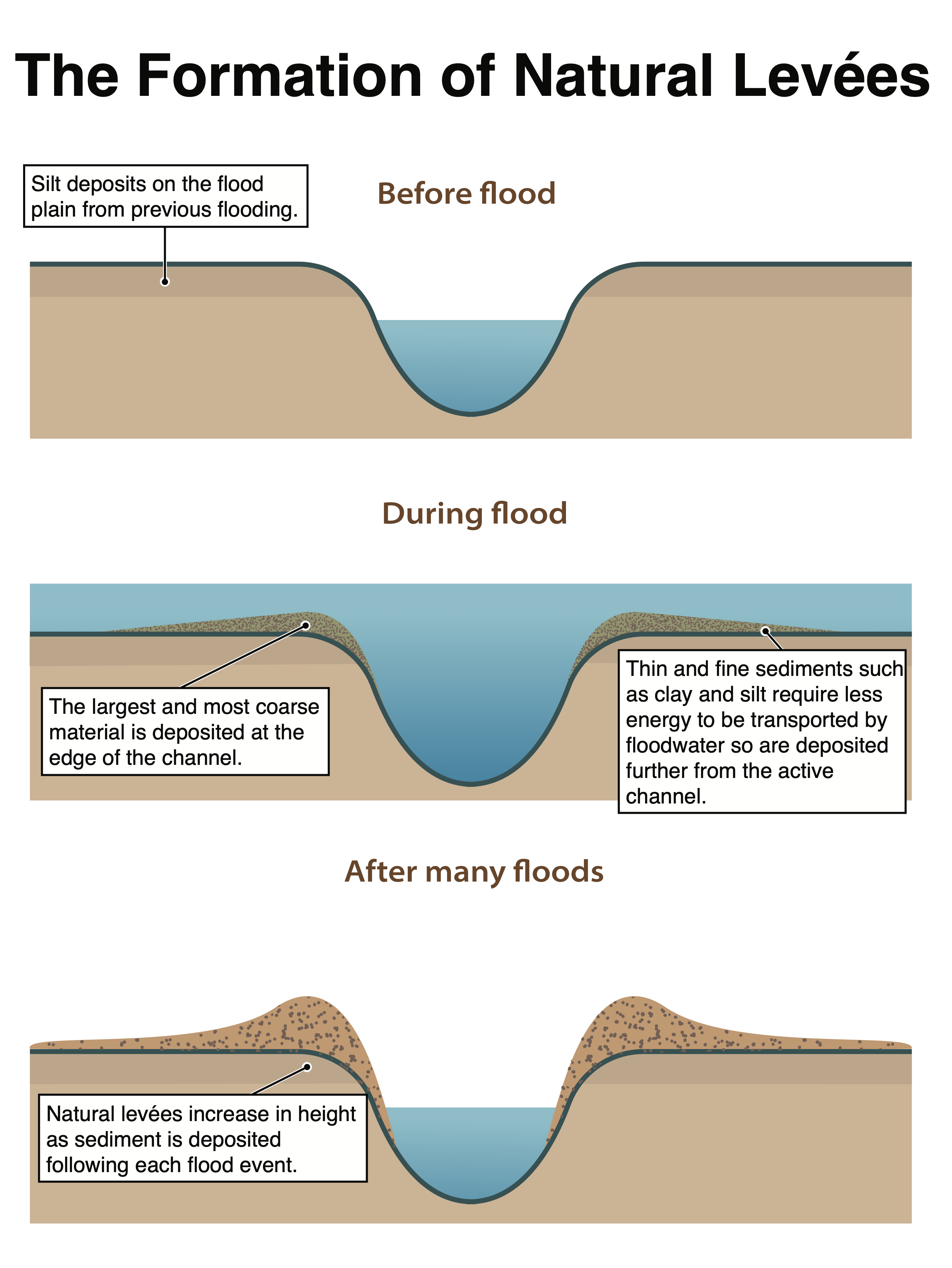
The stages in the formation of a natural levee
Estuaries
What is an estuary?
An estuary is the wide, tidal mouth of a river where it meets the sea. Estuaries are shaped by both river processes and marine processes, and they are important environments for deposition. It combines salt water from the sea and freshwater from a river. As the river meets the sea at high tide, it slows the flow, leading to deposition. Mudflats and salt marshes form in these areas. The mudflats can be seen at low tide but are submerged at high tide. Over time, the mudflats can become colonised by vegetation, forming salt marshes.
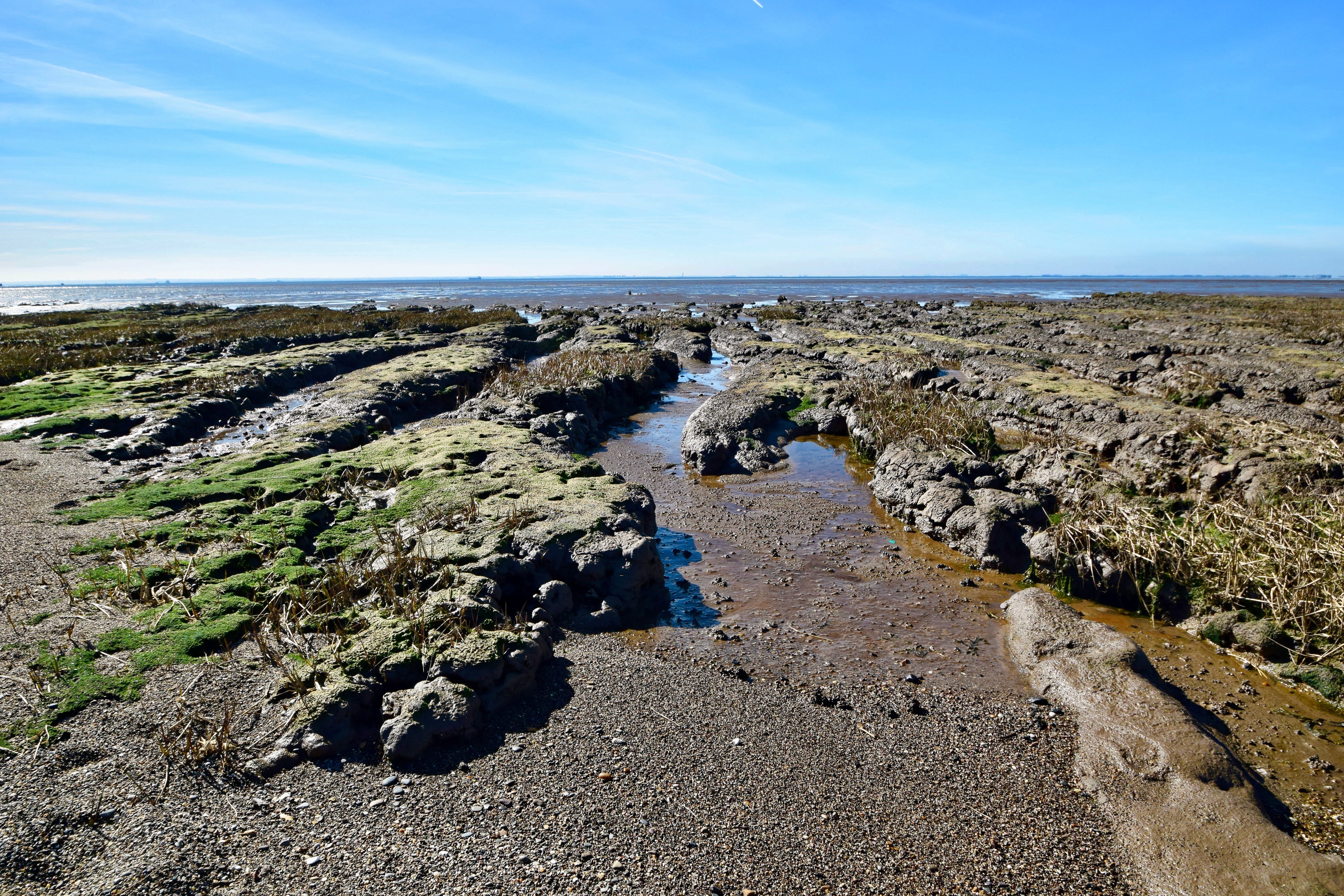
Mudflats along the Humber Estuary.
How do estuaries form?
As a river enters the sea, its velocity decreases sharply, and it loses energy. This causes large amounts of sediment to be deposited. In addition, tidal action pushes seawater upstream, further slowing the river and encouraging deposition.
Fine sediment, such as silt and clay, settles out to form mudflats. Over time, vegetation may colonise these areas, leading to the development of salt marshes. Estuaries are therefore dynamic environments where sediment is constantly deposited and reworked by tides and river flow.
Estuaries are important for wildlife, transport, and industry, but they are also vulnerable to pollution and sea-level rise.
Deltas
What is a delta?
A delta is a low-lying area of deposited sediment found at the mouth of a river, where it enters a sea or lake. Deltas form when large amounts of sediment are deposited faster than waves or tides can remove it.

The Nile Delta
The Nile Delta – source
How do deltas form?
When a river enters still or slow-moving water, such as a sea or lake, its velocity decreases rapidly. This causes the river to lose energy and deposit its load.
The heaviest sediment is deposited first at the river mouth, while finer material is carried further out. Over time, sediment builds up and blocks parts of the channel. As a result, the river splits into smaller channels called distributaries, which spread sediment across a wide area.
Deltas are most likely to form where:
- the river carries a large sediment load
- wave and tidal action is weak
- the water at the river mouth is shallow