Physical Geography of the UK – UK Landscapes
The unique physical geography of the UK has been formed by a range of processes over time.
The UK has some of the most diverse environments for its size. Take a look at the video below to see how well you know the natural environments of the UK.
The video below explores landscapes in the UK in 100 seconds.
The UK in 100 seconds from Friends of the Earth on Vimeo.
The landscape of the UK varies significantly. For example, there are spectacular mountain ranges in Scotland, rolling hills and valleys in many central and southern areas and extensive flat plains in East Anglia.
The physical geography of the UK was formed through geological, fluvial, glacial, erosional and tectonic processes. As a result, there is a vast range of exposed rock types in the UK, which helps explain our varied scenery of uplands and lowlands.
The majority of the UK’s upland areas are located in the north and west of the country. These areas are mainly formed from igneous (volcanic) and metamorphic rock.
Tough igneous and metamorphic rocks, such as granite and slate, form most of the mountains, such as the Grampians and the north-west Highlands in Scotland and the Lake District in northwest England.
Resistant limestone (a sedimentary rock) forms the backbone of England – the Pennines.
In the southwest, ancient granite (an igneous rock) forms Dartmoor and Bodmin Moor.
Bands of chalk and limestone (sedimentary rocks) form extensive asymmetrical ridges called escarpments in southwest England, including the Chilterns, the Cotswolds and the North and South Downs.
Lowlands are typically found around the coast and in the south and east. These areas are mainly made up of sedimentary rock.
Much of East Anglia and Lincolnshire is made up of weak sedimentary clays, forming flat agricultural plains.
Broad valleys, known as vales, occur throughout southern England in between limestone and chalk escarpments.
A rift valley formed by the downward slippage of rock between two faults has created the Central Lowlands of Scotland. The landform was caused by the downwards slippage of rock in between the Highland Boundary Fault to the north and the Southern Uplands to the south.
Many lowland areas correspond with river valleys, including the Thames, Severn and Trent.
The UK has extensive river systems. Most rivers have their source in upland areas and form large river basins. These are large areas of land drained by a river and its tributaries. At 352 km, the longest river in the UK is the River Severn, which has its source in the Cambrian Mountains in Wales. The River Thames is a close second at 344 km.
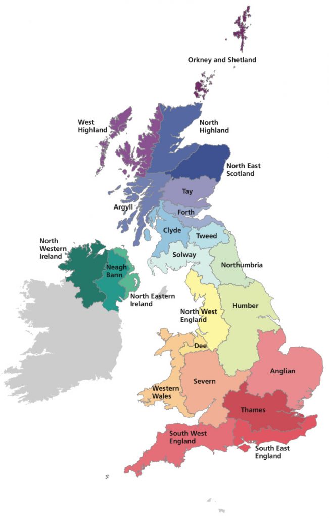
A map to show the main river basin regions in the UK – source gov.uk
Several major English rivers flow eastwards from their source in the Pennine hills, such as the Tyne, Tees and Ouse.
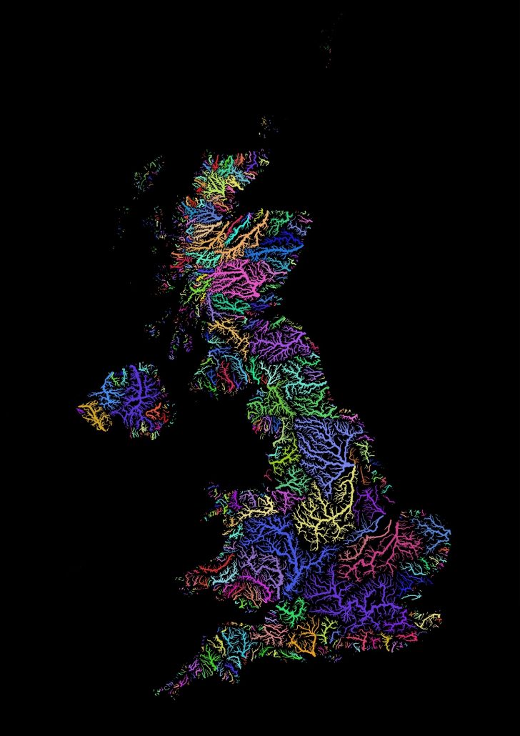
Main drainage basins (areas drained by a river and its tributaries) in the UK – source – unknown
Check your understanding


