Case Study – The Indus River Basin Pakistan
Background Information
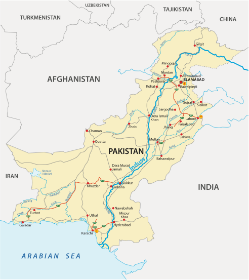
The River and River Basin
The Indus River is one of the longest rivers in the world, originating from the Tibetan Plateau and flowing through China, India, and Pakistan before emptying into the Arabian Sea. The river basin spans four countries: China, India, Afghanistan, and Pakistan, with the majority of its area lying in Pakistan, covering around 70% of the country. The river basin is home to over 200 million people. The river plays a pivotal role in Pakistan’s economy, especially agriculture, as it forms the backbone of the country’s irrigation system. Additionally, the Indus provides the main drinking water supply in Pakistan, and it is also relied on by many heavy industries to support production processes.
The Indus River
The River Indus and its tributaries have been heavily modified to exploit and use its water. Two mega-dams (Tarbela and Mangla) have been constructed, and 320 barrages provide irrigation water and help control water that falls during the annual monsoon. Despite these interventions, heavier monsoon rains continue to cause significant flood events.
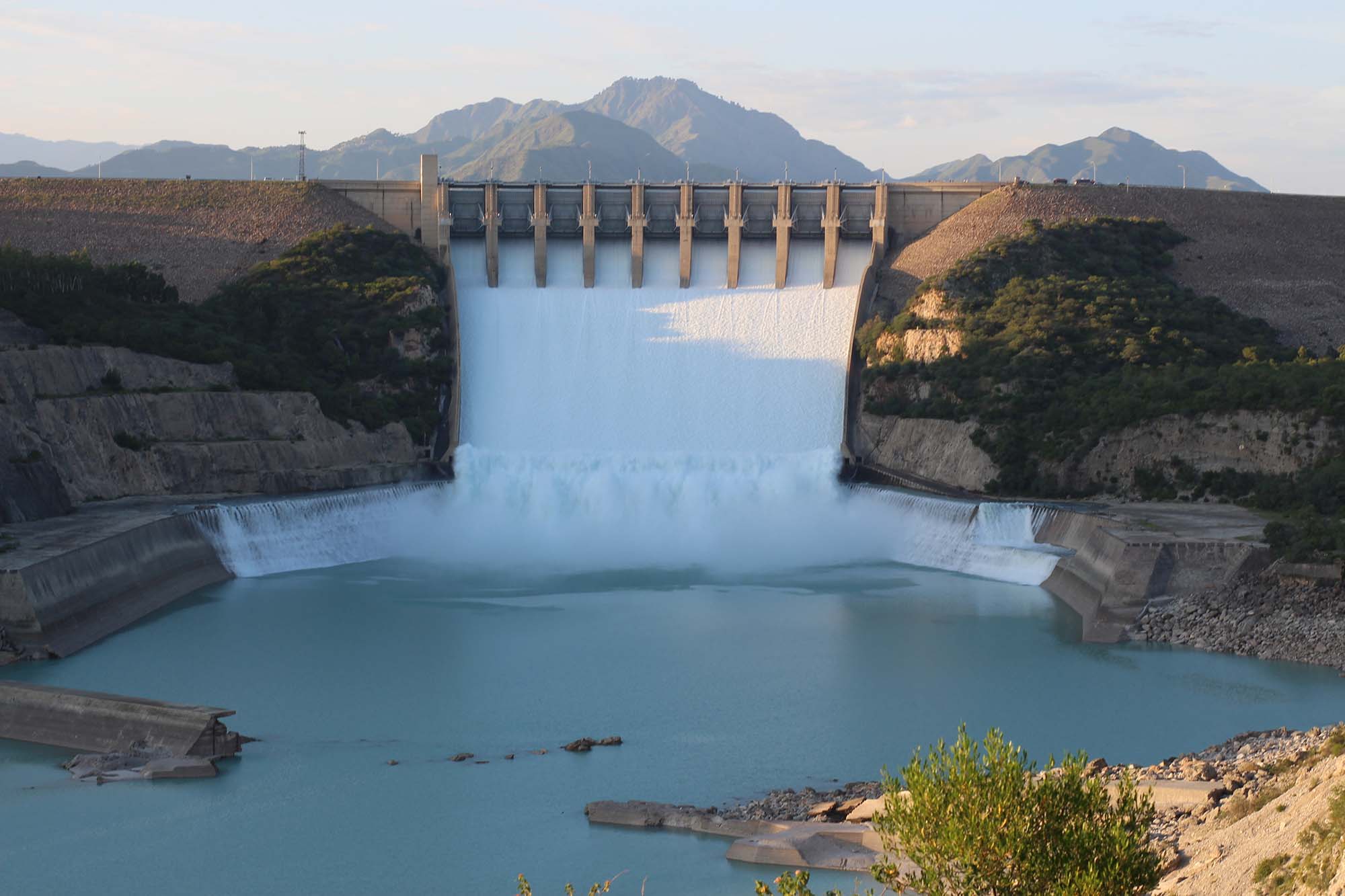
The Tarbela Dam holding back the Tarbela reservoir
The increasing population pressure, effects of climate change, and ongoing deterioration of the basin’s ecosystems have heightened flood risks. This situation is exacerbated by insufficient flood planning and management within the Indus floodplain.
The Indus River plays a pivotal role for countless individuals; thus, its flooding can lead to catastrophic outcomes. From 1950 to 2012, the Indus River basin in Pakistan witnessed 22 significant floods. These calamities resulted in the unfortunate loss of over 9,300 lives, impacted upwards of 10,000 villages, and led to direct economic setbacks of roughly $20 billion.
The 2010 floods stand out as the most detrimental in Pakistan’s history. They swept through every province and region, claiming 1,600 lives and inflicting damages exceeding $10 billion. The floods submerged nearly 38,600 km², destroyed nearly 2 million dwellings, and necessitated over 20 million individuals abandoning their homes and livelihoods. As a result of this disaster, Pakistan’s GDP growth rate plummeted from a previous 4% to a staggering -2.5%, ushering in a period of stunted economic growth.
Opportunities Presented by the River Indus
- Agriculture: The Indus Plains are fertile and support the cultivation of wheat, rice, sugarcane, and cotton. The river provides essential water for irrigation.
- Hydroelectric Power: The river’s flow is harnessed for generating electricity. Projects like the Tarbela and Mangla dams are prime examples.
- Transportation: Historically, the river has been a significant transportation route for goods and people.
- Fisheries: The river and its tributaries support a vibrant fishing industry, providing livelihoods for thousands.
- Tourism: Areas surrounding the river, especially in the northern regions, are picturesque and attract tourists.
Associated Hazards – Flooding
The Indus River frequently floods, especially during the monsoon season during July and August. However, floods, such as those in 2010, combined human and natural factors.
- Natural Causes: Heavy monsoon rains (some areas can receive over 280mm in 36 hours in exceptional circumstances), rapid run-oof from steep valley sides, glacial melts, and snowmelt from the Himalayas.
- Human Causes: Deforestation and degraded ecosystems in the catchment areas leads to increased runoff, urbanisation in floodplain areas, and inadequate maintenance of embankments and drainage canals and many levees could not withstand the sustained flood pressure resulting in large sections failing. The Indus Basin lacks an effective flood management policy.
River Management
Hard Engineering Solutions:
- Dams and Reservoirs: Examples include the Tarbela Dam and Mangla Dam. These structures store excess water and allow controlled release, reducing the risk of flooding downstream. The dams effectively held back floodwater in 2010. However, sedimentation has reduced the storage capacity of both reservoirs.
- Embankments and Levees: Raised structures are built along the riverbanks to prevent floodwaters from spilling into adjacent lands. There are 6000km of artificial levees providing the most flood protection and over 14000 spurs, stone walls or levees constructed to divert water flow at essential locations.
- Channel Straightening: By making the river channel straighter, water can flow faster, reducing the flooding risk in certain areas.
Soft Engineering Solutions:
- Afforestation: Planting trees in the river’s catchment areas can reduce runoff and decrease the risk of flooding.
- Floodplain Zoning: Designating areas near the river as zones where development is restricted or controlled can minimise flood damage.
- Flood Forecasting and Warning Systems: These systems provide early warnings to residents, allowing them to prepare or evacuate in case of impending floods.
- Community Education: Training and educating local communities about flood risks and preparedness measures can significantly reduce the impact of floods.
The Indus River Basin is a vital lifeline for Pakistan, offering numerous opportunities. However, the associated hazards, particularly flooding, pose significant challenges. A mix of hard and soft engineering solutions is crucial for sustainable management and mitigation of risks in the basin.
Summary
Flashcards
Check Your Knowledge
Coming soon