River landforms of erosion and deposition
Features of erosion
Waterfalls
Waterfalls interrupt the continuous profile of a river, ranging greatly in size. Their formation can be due to:
- Differential erosion, where resistant rock lies across the river, causes the softer rock below to erode faster.
- Sea level drops, causing the river mouth to remain elevated, sometimes termed a ‘knick point’.
- Earth movements, especially earthquakes, result in a riverbed drop along fault lines.
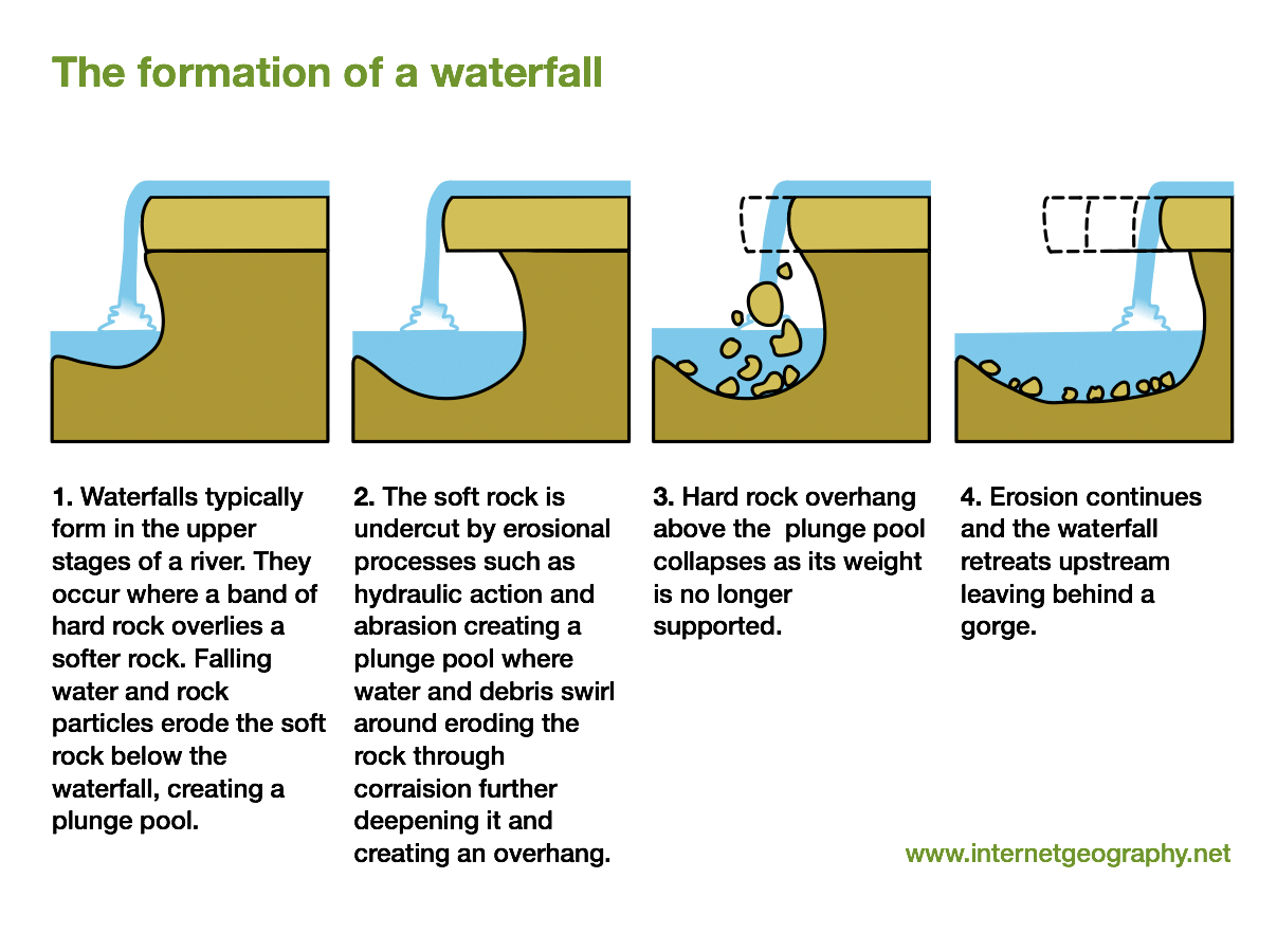
Formation of a waterfall
Potholes
Potholes emerge in river beds overlying rock. They initiate from weak points or faults in the bedrock, leading to differential erosion.
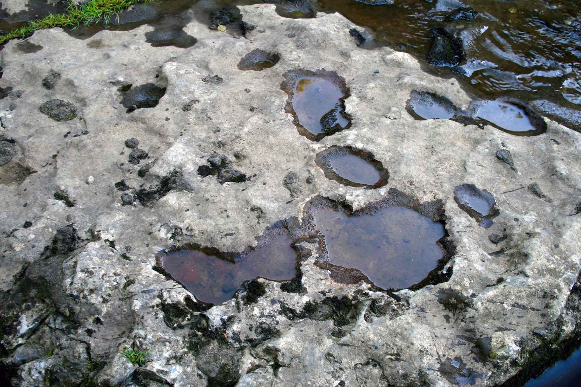
Potholes on the River Ure, close to Ayesgarth Falls in North Yorkshire
Features of erosion and deposition
Meanders and oxbow lakes
Rivers, left undisturbed, seldom flow straight. Their bends are termed meanders. Meanders boast:
- An outer bank, or river cliff, which is deep and where the river is faster and carries larger sediments.
- An inner bank, or slip-off slope, which is shallow, slower, and carries finer sediment.
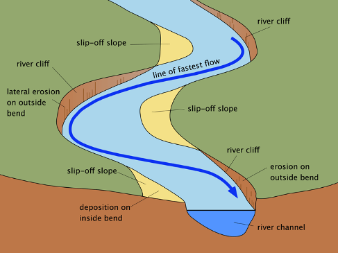
A diagram to show the main features of a meander
Over time, the neck of a meander can narrow, and during floods, the river might breach it, forming an oxbow lake. As time passes, these lakes may dry, leaving oxbow scars.
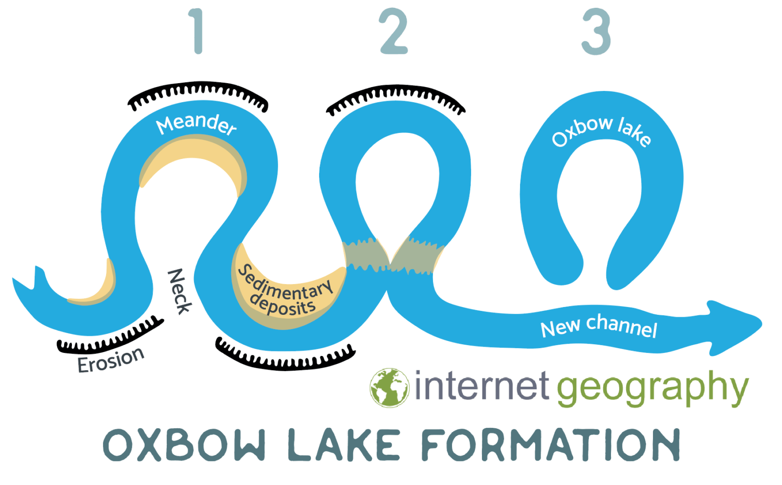
Formation of an oxbow lake
Features of deposition
Levees and floodplains
The broader sections of a river feature flat floodplains formed from sediment deposited during floods. When rivers overflow their banks, they spill out the transported sediment. As the water spreads, it slows down, depositing the sediment, with larger particles settling closer to the river, forming levées.
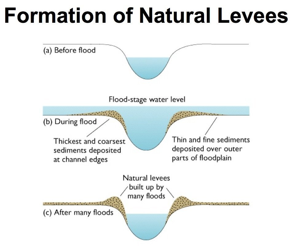
The stages in the formation of a natural levee
A floodplain is an area submerged by water during river floods. When the volume of water in a river surpasses the channel’s ability, it spills over its banks, inundating the adjacent lower grounds. In cases where sea levels drop, the floodplain might experience erosion, resulting in residual river terraces. These terraces offer ideal settlement locations since they sit above the current floodplain level and remain unaffected by floods.
Deltas
Deltas: When rivers meet seas or lakes, they deposit their carried material. The absence of tidal currents can lead to delta formation. Salt in the ocean makes fine clay clump (flocculation), causing it to settle. A delta typically comprises:
- Fore-set beds at the base, formed by heavier material.
- Lighter suspended particles form bottom-set beds.
- Top-set beds, layers of alluvium, deposited over the fore-set beds.
The river might split into distributaries atop the delta, aiding its growth. Vegetation further stabilises the sediment. Deltas can adopt various forms, with the arcuate (like the Nile Delta) and digital (like the Mississippi Delta) being the most prominent.
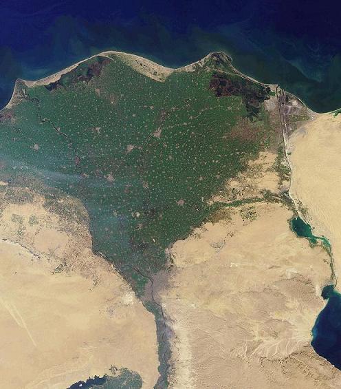
The Nile Delta
Summary
Flashcards
Check Your Knowledge
Coming soon