The interaction of physical and human processes on the Holderness Coast
Edexcel B GCSE Geography > The UK’s Evolving Physical Landscape > The interaction of physical and human processes on the Holderness Coast
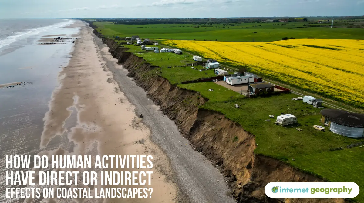
The Holderness Coast is a stretch of coastline in East Yorkshire, running for approximately 61 km from Flamborough Head in the north to Spurn Point in the south, where it meets the Humber Estuary.
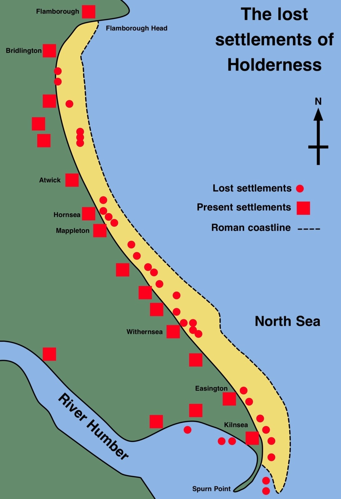
Lost settlements on the Holderness Coast
This coastline is one of the fastest eroding in Europe, with some places retreating by up to 2 metres per year.
The geology, combined with exposure to strong North Sea waves, makes the Holderness Coast especially vulnerable.
The area supports communities, agriculture, tourism, and energy infrastructure, making it a location where the effects of coastal erosion are both significant and far-reaching, both environmentally and economically. This mix of natural and human factors makes Holderness a textbook example of how coastal landscapes evolve under pressure.
Geology: Much of the coastline is made from boulder clay (glacial till), which is soft and easily eroded. It is also prone to slumping, especially after periods of heavy rain.
Wave Energy: The coastline faces the North Sea, which has a long fetch that allows strong, destructive waves to build up. These waves remove material rapidly.
Narrow Beaches: With less sand to absorb wave energy, the cliffs are more vulnerable to erosion.
Longshore Drift: Material is moved southward along the coast by wave action. In some areas, human interference has disrupted this process, leading to issues along the coast.
Several areas along the Holderness Coast have implemented hard engineering strategies to slow down erosion and protect valuable land, infrastructure and communities:
Mappleton
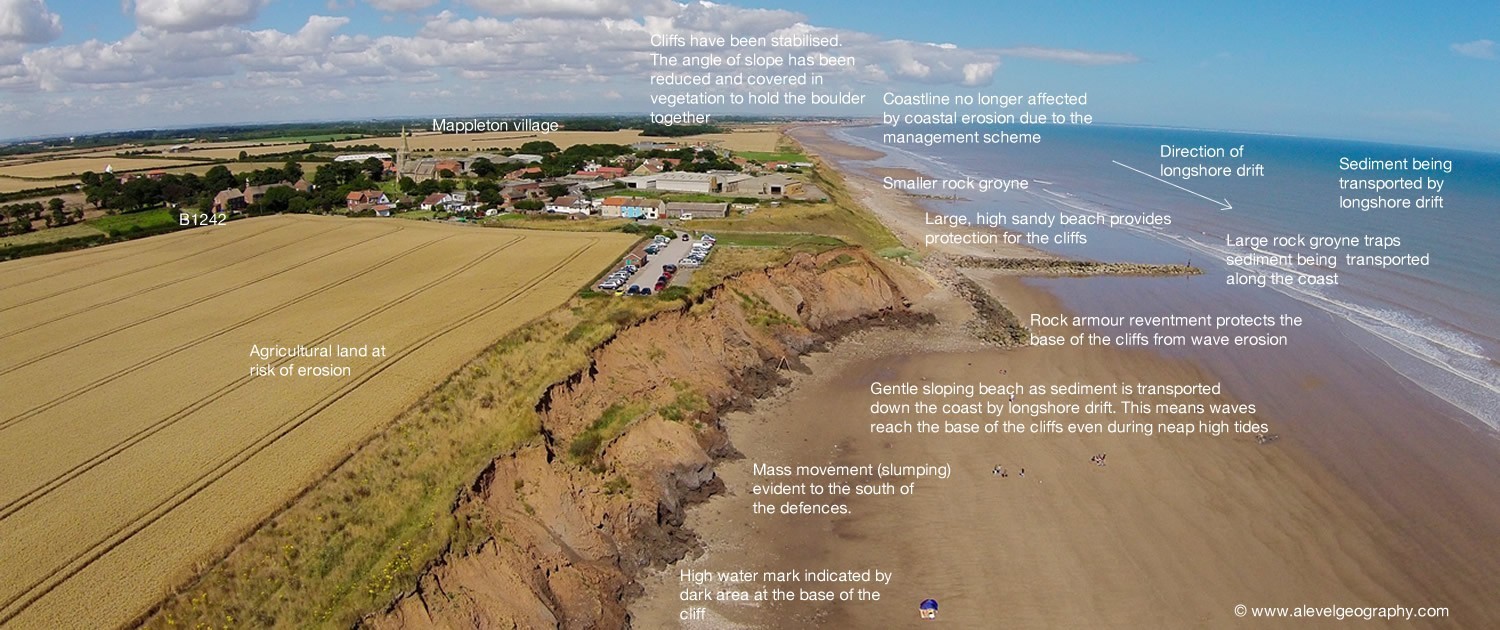
Coastal management strategies at Mappleton.
Hornsea
Sea defences at Hornsea
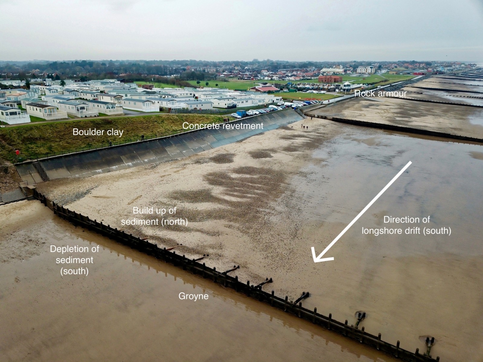
Withernsea
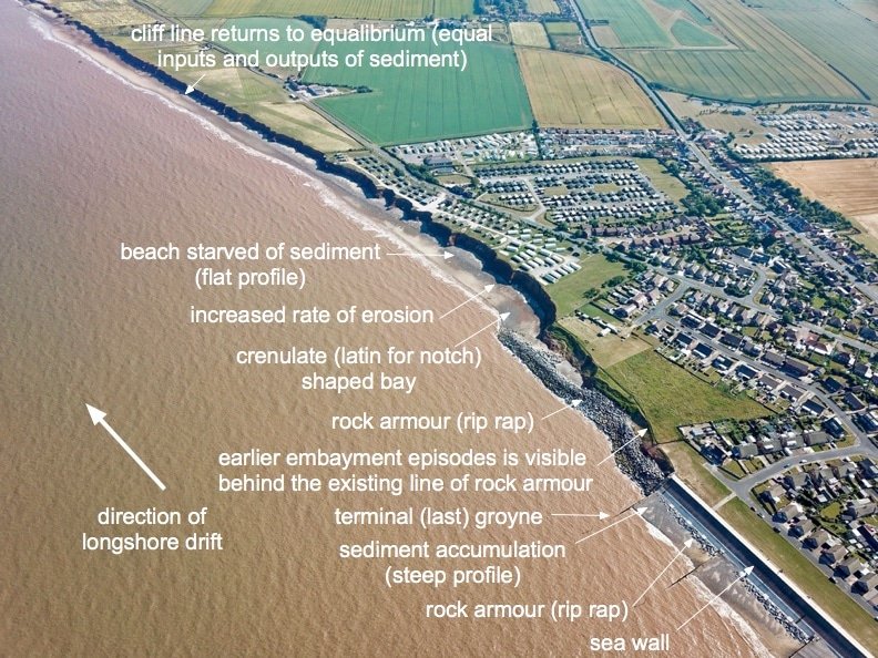
Withernsea – Terminal Groyne Effect
Easington Gas Terminal
Increased erosion south of defended areas, such as Great Cowden, where the interruption of longshore drift has reduced natural beach replenishment.
Loss of land and property, including farmland, holiday parks, and historic villages. Spurn Point, a spit, is under threat due to reduced sediment supply. This has serious consequences for wildlife habitats and coastal ecosystems. Conflict has emerged between those who benefit from defences and those who suffer the consequences further down the coast.