How does a river change along its course?
The Tees, a major river in North East England, covers a drainage area of roughly 1800 square km. Its source lies on the eastern flank of the Pennine mountains, and it flows eastwards towards the North Sea.
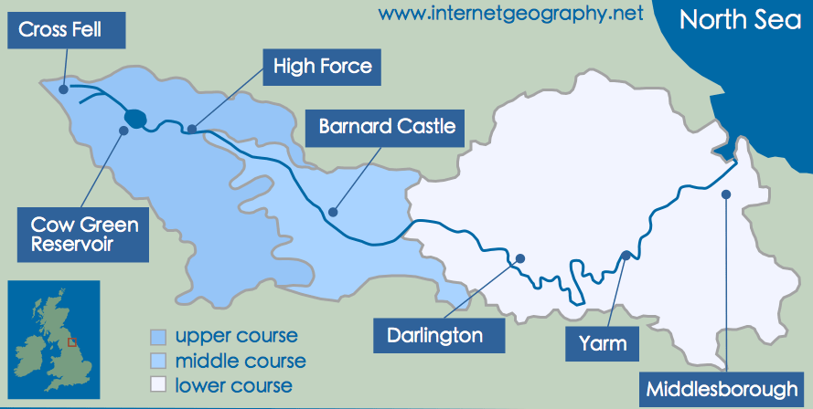
The upper, middle and lower courses of the River Tees
The River Tees experiences most of the standard processes and features of a river’s upper, middle, and lower courses.
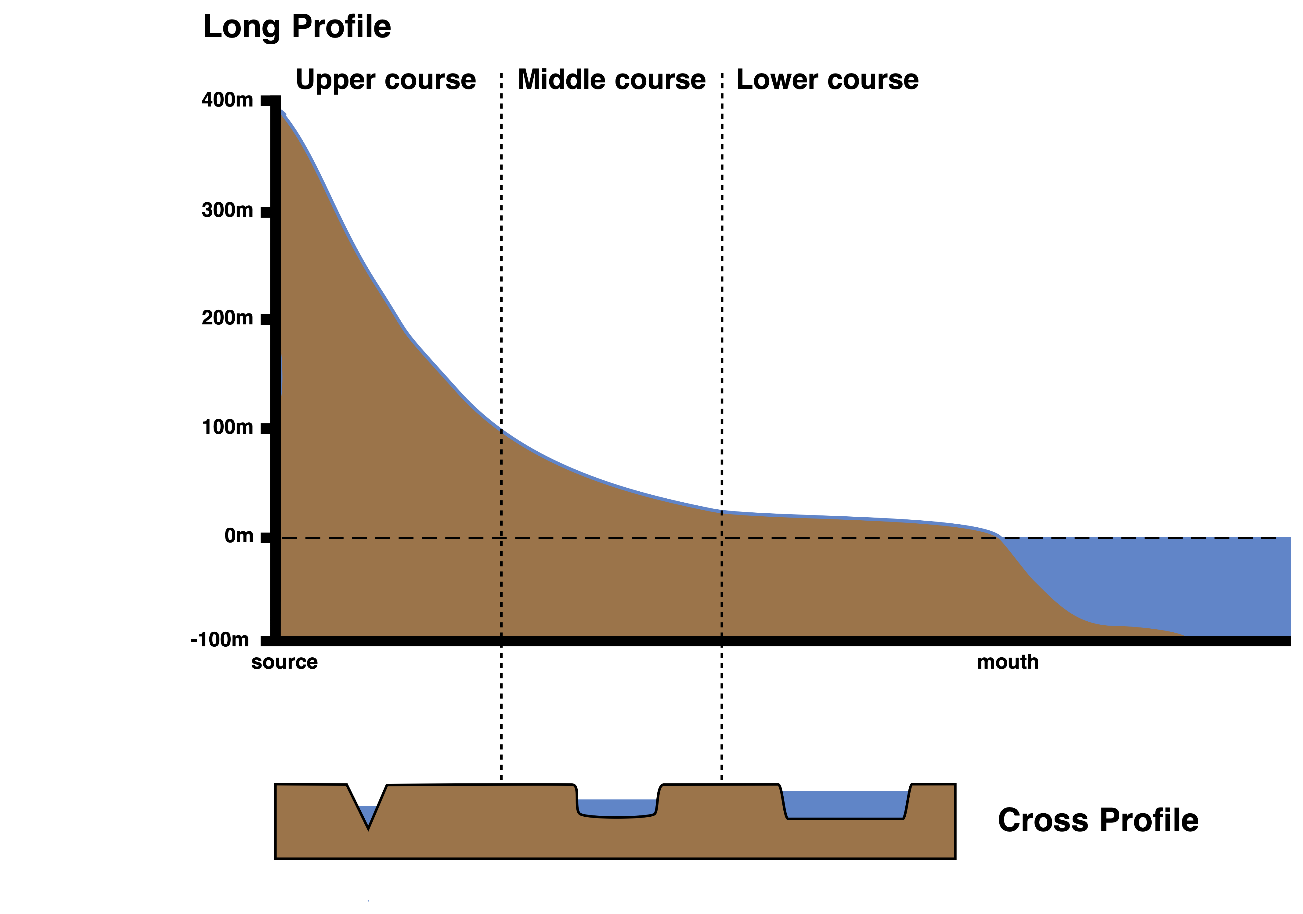
The long and cross profile of the River Tees
The image above illustrates the transition of the Tees’ long and cross profiles from the source to the mouth. Changes from source to mouth include:
- Decreasing gradient
- Increasing depth and width
- Rising volume and velocity
- Amplifying discharge
- Reducing sediment size and becoming more rounded.
Upper Course
This region, primarily composed of moorland, experiences yearly precipitation levels that can surpass 2000mm. The river channel is narrow and shallow, with an uneven bed with sizable angular boulders in certain areas. High friction slows the water flow compared to the wider, deeper, and smoother downstream sections. Vertical erosion has shaped a steep channel gradient and valley sides, leading to remarkable waterfalls and obvious examples of interlocking spurs. High Force, the UK’s tallest waterfall at 21 meters, features a layer of hard dolerite rock overlying softer sandstone and shale, forming an imposing gorge as the waterfall erodes upstream.
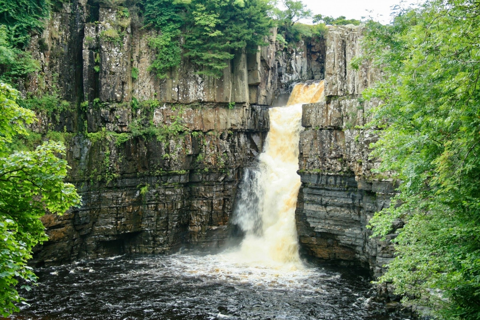
High Force waterfall on the River Tees.
Middle Course
Downstream from Middleton-in-Teesdale, the valley broadens, and the channel slope lessens. Lateral erosion replaces vertical erosion, crafting unique meanders visible near Barnard Castle. Significant tributaries like the rivers Lune, Balder, and Greta join the Tees, leading to a notable increase in water volume.
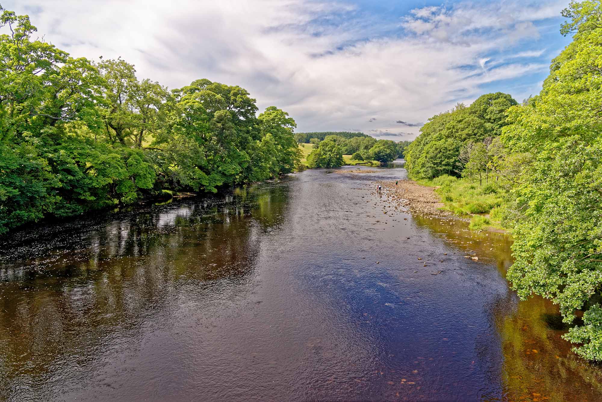
The River Tees at Barnard Castle
Lower Course
At this stage, the channel gradient is mellow, with the river almost at sea level, meandering across a fertile clay plain. Deposition is the leading process. The river forms larger meanders across its extensive floodplain, such as near Yarm. Observable features include oxbow lakes and levees. The original meandering river channel below Stockton has been artificially straightened to facilitate navigation. The Tees mouth forms a large estuary with mudflats and sandbanks.