How do river landscapes change over the course of a river?
Upland River Landforms
Upland areas typically present river landforms like steep V-shaped valleys, high gradients, interlocking spurs, potholes, and features such as waterfalls, rapids, and gorges.
V-shaped valleys
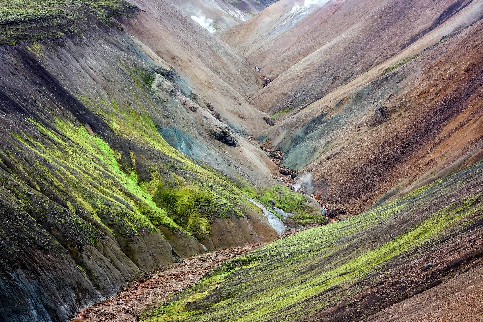
A v-shaped valley in Landmannalaugar rainbow mountains in Iceland
V-shaped valleys are narrow valleys shaped like the letter “V.” They are typically characterised by steep sides that converge at a river running along the valley floor. The sides of the valley are generally uniformly sloped, giving it its distinctive shape. V-shaped valleys are formed by a combination of erosional, weathering and mass movement processes. Vertical erosion dominates the upper course, deepening the river channel. Weathering processes (such as freeze-thaw weathering) act on the sides of the valleys. This loosens rock material, causing it to fall into the river, where it gets transported away. The combination of vertical erosion and weathering leads to the valley’s steep sides. Gravity pulls loosened material down the slope, further steepening the valley sides and forming the distinctive V-shape.
Interlocking spurs
In the upper course, rivers start meandering, leading to concentrated erosion on the outside banks of these small meanders. Over time, this leads to interlocking spurs, which are ridges of high land extending towards the river at right angles. These valleys are typically found in the upper courses of rivers, especially in mountainous regions where the land is steeply sloping.
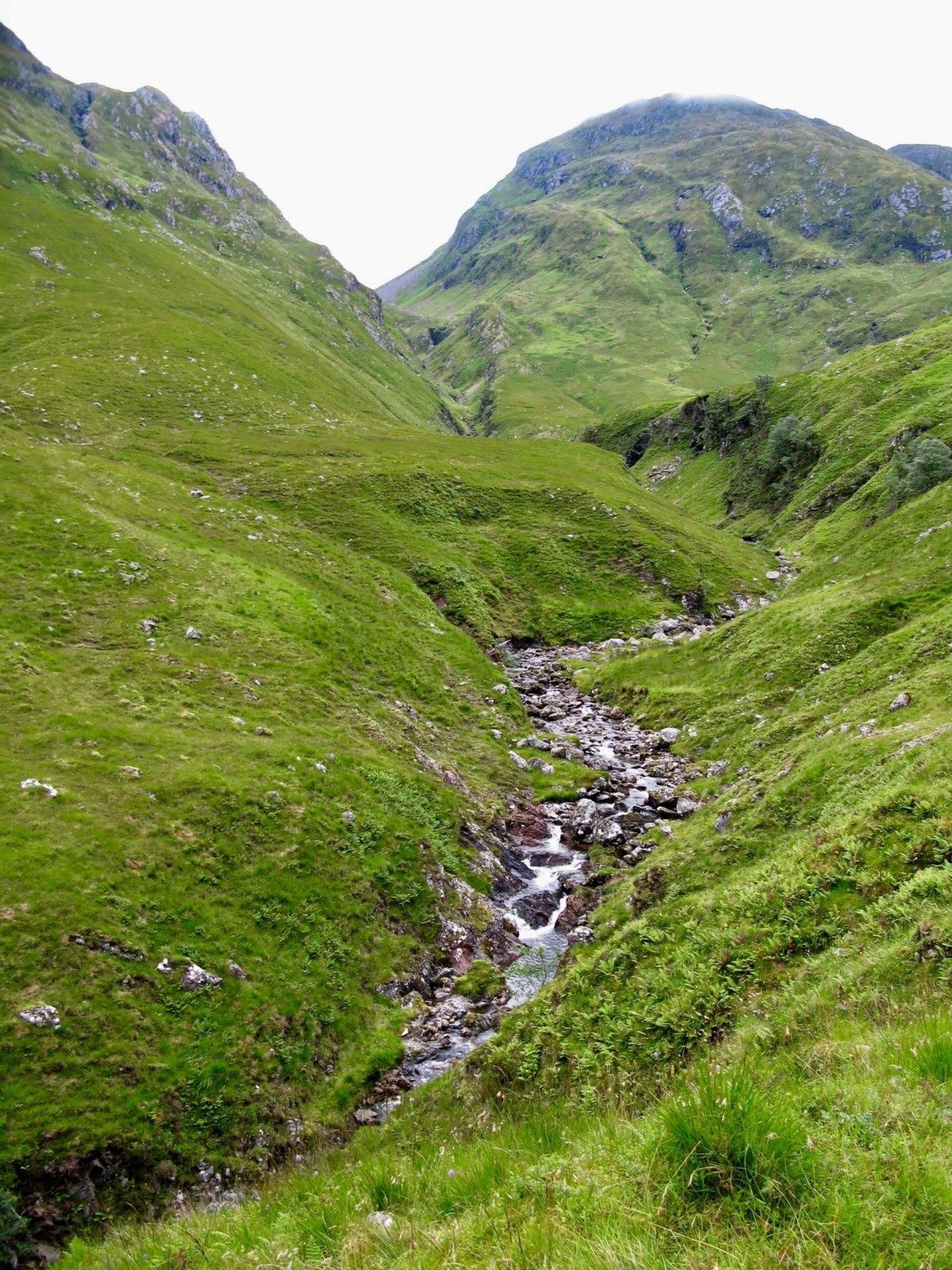
Interlocking spurs in the upper course of a river
Potholes
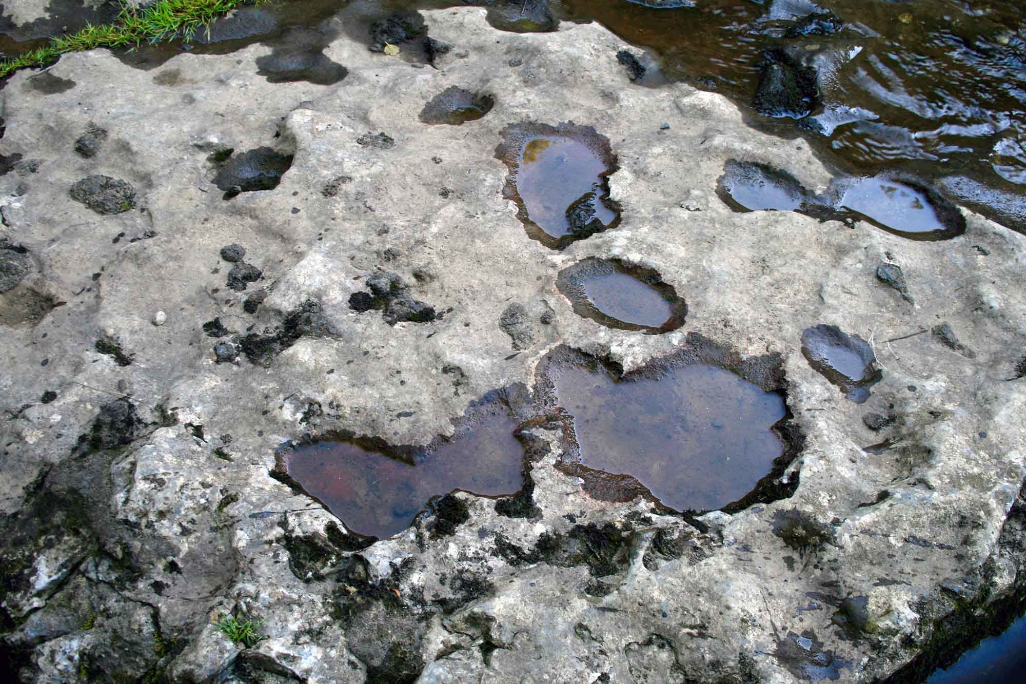
Potholes on the River Ure, close to Ayesgarth Falls in North Yorkshire
Where the river bed is uneven, fast-moving water-carrying pebbles can get temporarily trapped by obstacles. The swirling currents cause the pebbles to rotate, leading to the erosion of circular depressions known as potholes.
Waterfalls and rapids
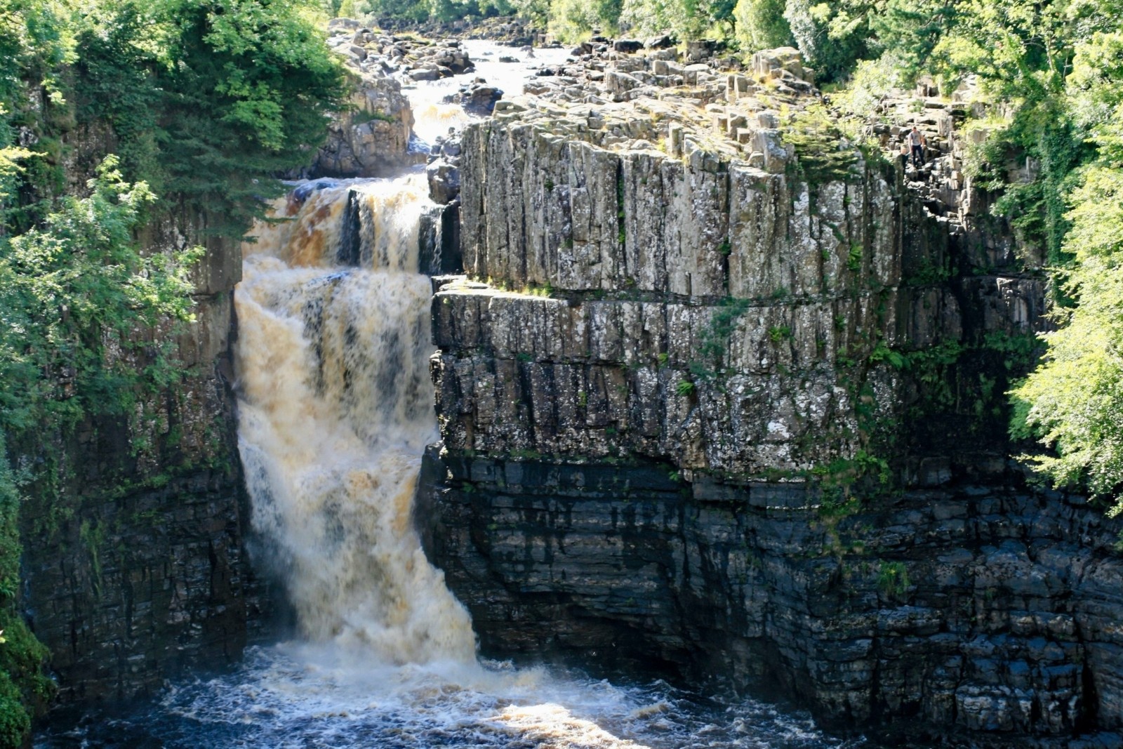
High Force waterfall on the River Tees
Waterfalls occur when there’s a sudden change in the river course due to variations in rock hardness. Waterfalls form when softer rock erodes more quickly than harder rock, leading to an overhang that eventually collapses under hydraulic action and abrasion. The collapsed rocks cause increased erosion in the plunge pool, deepening it. Over time, the waterfall retreats upstream, leaving behind a steep-sided gorge.
Lowland River Landforms
Meanders
As the river gathers water from tributaries, lateral erosion becomes more significant than vertical erosion, leading to larger meanders. Erosion is more pronounced outside the meander, particularly downstream, where the current is faster and more powerful. This process leads to the undercutting and eventual collapse of the outside bank, causing the meander to spread further across the valley.
On the inside of the meander, the current is slower, leading to deposition and forming a slip-off slope or point bar. Over time, meanders slowly change shape and position, widening the valley and eroding the interlocking spurs.
With continued erosion, a meander neck may form, which, when flooded, may lead the river to cut across and shorten its course. Over time, the meander gets cut off from the main course, leaving behind an oxbow lake.
Floodplain
A floodplain is flat land on either side of a river formed by the lateral movement of meanders. The river carries large amounts of suspended material during floods when the discharge is high. As the river overflows its banks and the water spreads across the floodplain, the increase in friction reduces the velocity, causing the suspended material to deposit. This deposition can form natural embankments known as levees next to the river, with the heaviest material deposited nearest to the river and the lightest towards the valley sides. With each subsequent flood, new layers of alluvium build up the height of the floodplain.