Managing the Mekong River – A transboundary water issue
The Mekong River, located in southeast Asia, is the twelfth longest river in the world. Six countries share the river and its tributaries. The source of the river is in China. The river flows southeast to its mouth in the South China Sea in Vietnam. The boundary of the river basin is shown in the map below.
The Mekong River has traditionally experienced seasonal changes in discharge. During the monsoon season, extensive flooding has occurred along the course of the river. Outside of the monsoon season, the region has experienced significant droughts.
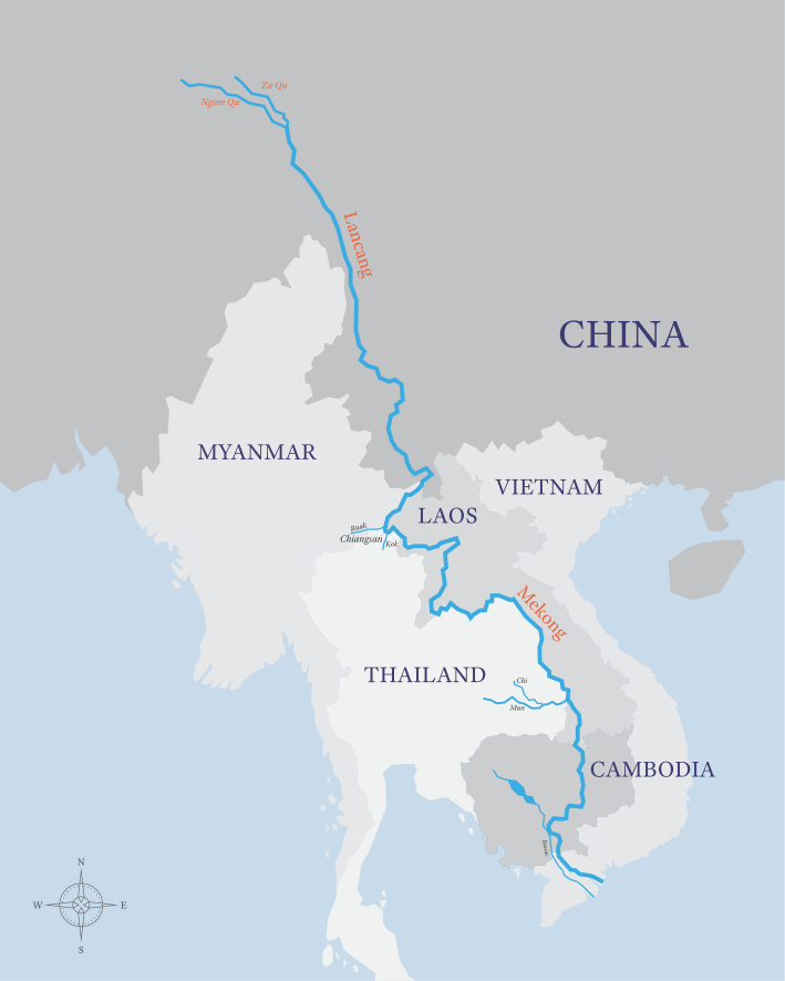
The Mekong River
What are the impacts of building dams on the Mekon River in China?
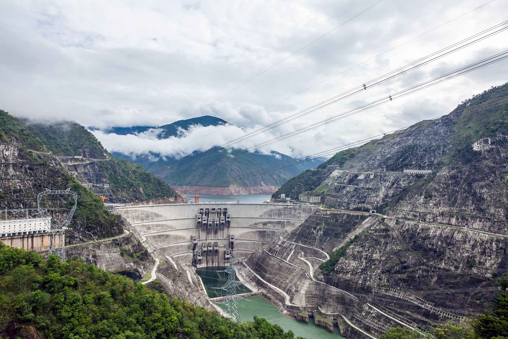
The Xiaowan Dam on The Mekong River in China
Along the course of the River Mekong, each country relies on the river for water supply and food. For example, in Cambodia, fishermen catch around 2 million tonnes of fish a year. Also, flooding during the monsoon season deposits fertile sediment onto the flood plain, which supports 80% of rice production, which depends on these floods. However, constructing dams along the river in China has interfered with the river’s flow, leading to reduced flooding and lower fish stocks. Additionally, the reduced flow of the river has led to sediment banks forming downstream, which has led to larger boats, such as ferries, running aground.
The effects of dam-building projects in China include:
- Land has been flooded to form reservoirs behind dams, leading to the loss of land farmland and the displacement of people (over 200,000 had to be moved when the Xayaburi Dam in Laos was being built between 2010-2019);
- In September 2015, heavy monsoon rain led to dangerously high water levels behind a Chinese-built HEP Nuozhadu Damdam. Water was released to avoid the collapse of the dam, leading to homes being flooded, affecting 1,571 families;
- Cheap hydro-electric power has supported the growth of China’s economy;
- More people and industry have a safe and reliable water supply;
- Water supply is available throughout the year in areas that previously suffered from seasonal drought;
- Jobs in construction and hydroelectric power have provided opportunities for people in China.
The effects of dam-building projects in the lower river basin (Cambodia) include:
- Reduced water levels and river velocity cause increased deposition, which has led to the formation of sandbanks that impede navigation;
- Fish stocks have been reduced, leading to a drop in income for fishermen;
- Monsoon floods are much smaller, meaning less sediment is deposited, reducing the fertility of valuable agricultural land used for rice farming;
- In 2019, fishermen in the Lower Mekon Basin blamed the combination of low monsoon rainfall and the opening of the Xayburi dam on its most severe drought in 100 years;
- Dams are evening the river’s flow, reducing the flood’s size. This harms fishing as the seasonal rise and fall in the river flow is required to spread out fish into lakes and ponds on the flood plain where they are caught.
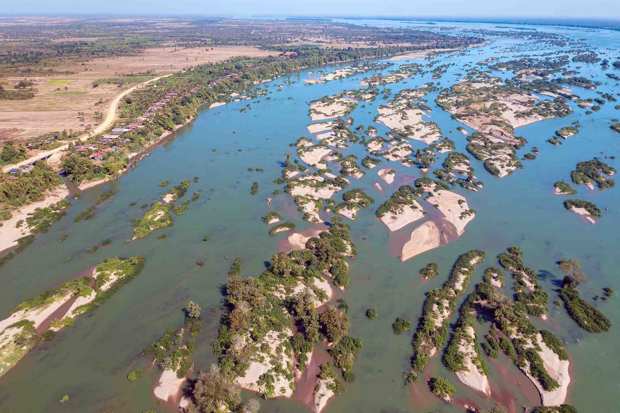
Sand bars and islands on the Mekong River in Cambodia formed by deposition due to reduced discharge.
Dams on international rivers, like the Mekong, can create conflict between the countries dependent on the water. Constructing a dam upstream alters the flow downstream. As more water is used in China, less arrives in Cambodia, risking the rice harvest.
What strategies are being used in Cambodia to reduce flood and drought impact?
The Cambodian government is considering a range of options to reduce the risk of flooding and drought:
- Collecting flood data and issuing forecasts through a flood control centre
- Risk assessing flooding in each community
- Providing advice to communities on how to protect households from flooding
- Constructing defences such as flood walls and embankments
- Building dams to control the flow of water
- Improving planning so homes are not constructed on floodplains
- Coordinating with neighbouring countries about the management of the river
- Run an annual flood conference with neighbouring countries
- Support neighbouring countries with aid during extreme events
Summary
Flashcards
Test Yourself


