The River Tees Case Study – landforms of erosion and deposition
The River Tees is located in the north of England. It flows 137 km (85 miles) east from its source in the Pennines to its mouth on the North Sea coast.
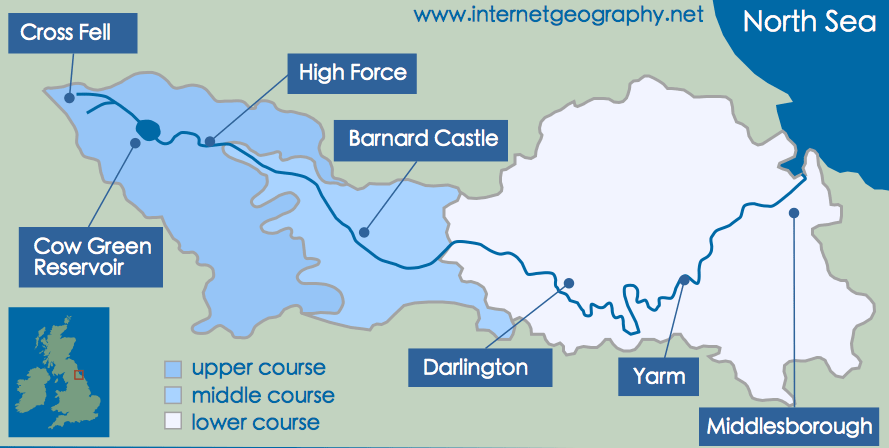
The upper, the middle and lower course of the River Tees
The source of the River Tees is Cross Fell in the Pennines.
The River Tees flows over hard, impermeable rocks in its upper course. Vertical erosion has formed classic V-shaped valleys. The image below shows interlocking spurs close to Cauldron Snout.
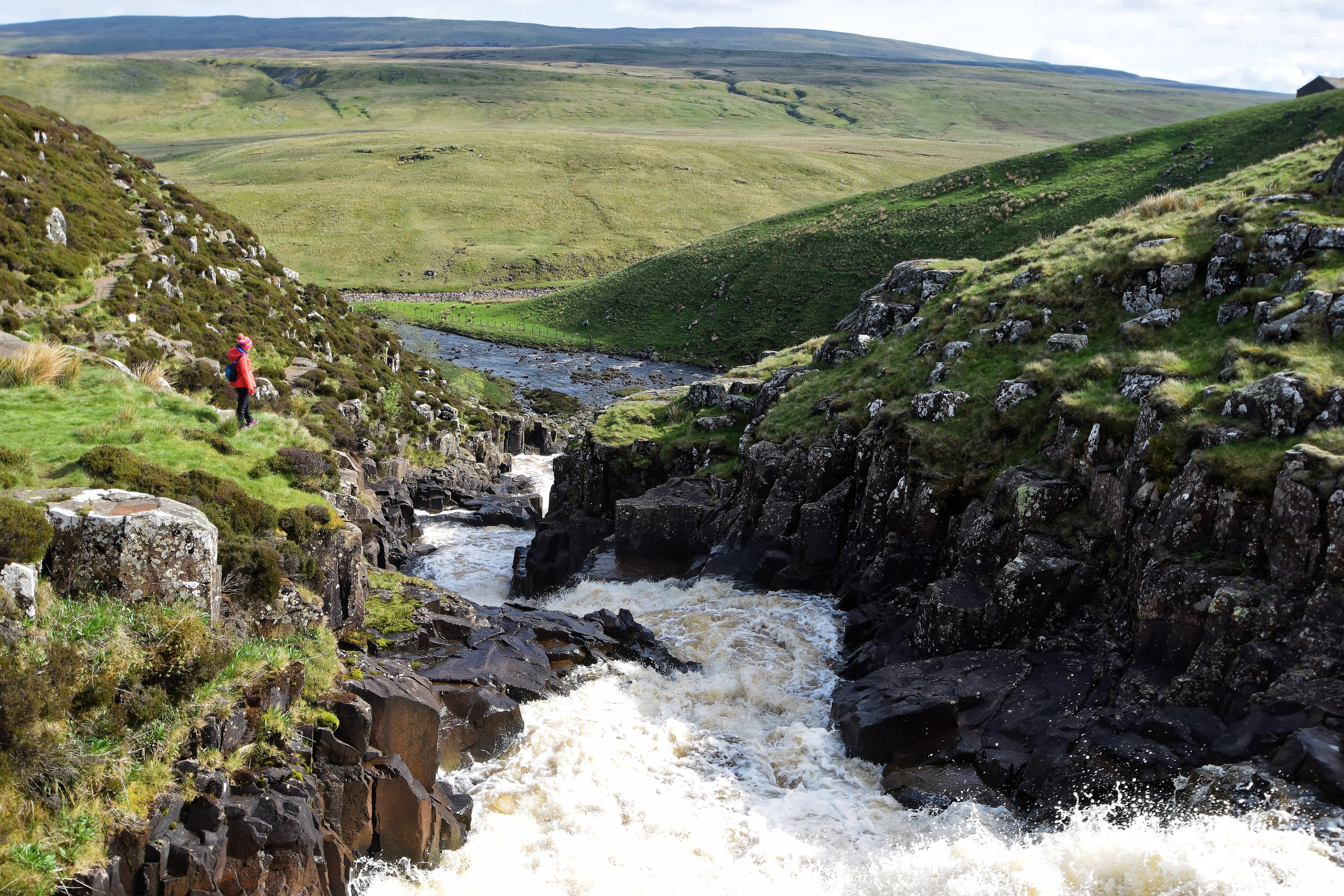
Interlocking spurs close to Cauldron Snout on the River Tees.
The UK’s largest waterfall, High Force, is located in the upper course of the River Tees. An area of hard rock, called Whin Sill (or Whinstone), is located above a layer of soft rocks (sandstone and shale), and together they create the waterfall.
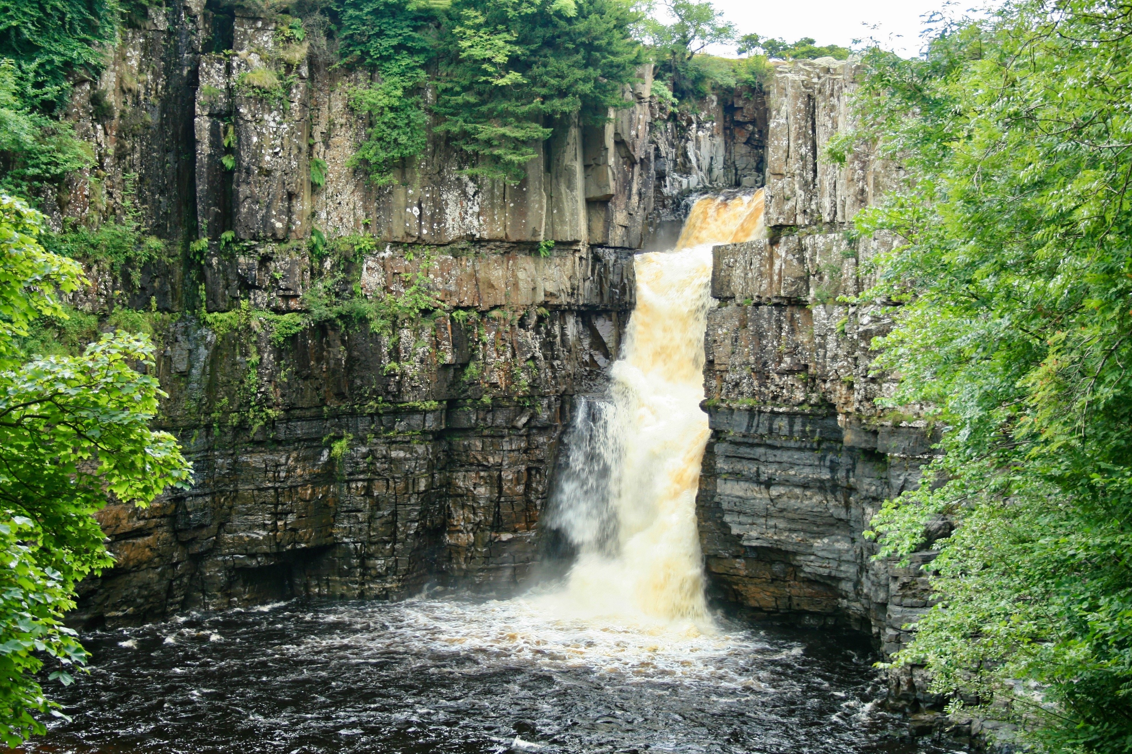
High Force waterfall on the River Tees.
As the River Tees reaches its middle course, lateral erosion overtakes vertical erosion, evidenced by winding meanders. Meanders in the lower course are much larger. Oxbow lakes have formed in some areas. Evidence of past flooding can be seen in the naturally formed levees.
The River Tees has a large estuary with mudflats and sandbanks in the lower course.


Use the images below to explore related GeoTopics.