Holderness Coast Landforms
The Holderness Coast in East Yorkshire stretches 61 kilometres from Flamborough Head in the North to Spurn Point in the South.
The coastline is one of the fastest eroding in Europe, leading to the formation of a range of coastal landforms characterised by erosion and deposition.
The Geology of the Holderness Coast
Underlying the Holderness Coast is bedrock made up of Cretaceous Chalk. However, in most places, this is covered by glacial till deposited over 18,000 years ago. This soft boulder clay is being rapidly eroded.
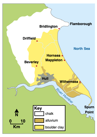
The geology of the Holderness Coast
Landforms of erosion and deposition on the Holderness Coast
Selwicks Bay, Flamborough
Flamborough Head is a headland that juts out into the North Sea. It is formed from chalk, a resistant rock.
Several bays are located along Flamborough Head, where the sea has eroded weaknesses in the chalk cliffs. Selwicks Bay is one example. The bay contains a range of coastal landforms of erosion and deposition.
The cliffs here are formed from chalk. Overlying the chalk is a layer of boulder clay.
Erosional processes, including hydraulic action and abrasion, have formed many coastal landforms within Selwicks Bay, including steep cliffs, wave-cut notches, a wave-cut platform, a stack known locally as Stack Adam, and coastal arches.
Landforms of deposition at Flamborough are limited to small beaches formed by the erosion and weathering of cliff material. These beaches consist of chalk from collapsed cliffs and weathering, pebbles from the eroded boulder clay, and sand that has formed from abrasion and attrition.
Landforms of deposition
Hornsea
Beaches have formed along the Holderness Coast due to the deposition of sand and shingle transported by longshore drift. The eroded material is transported from north to south along the coast. Beach material has accumulated at locations such as Hornsea, Withernsea, and Mappleton due to the construction of wood and stone groynes, which trap sediment.
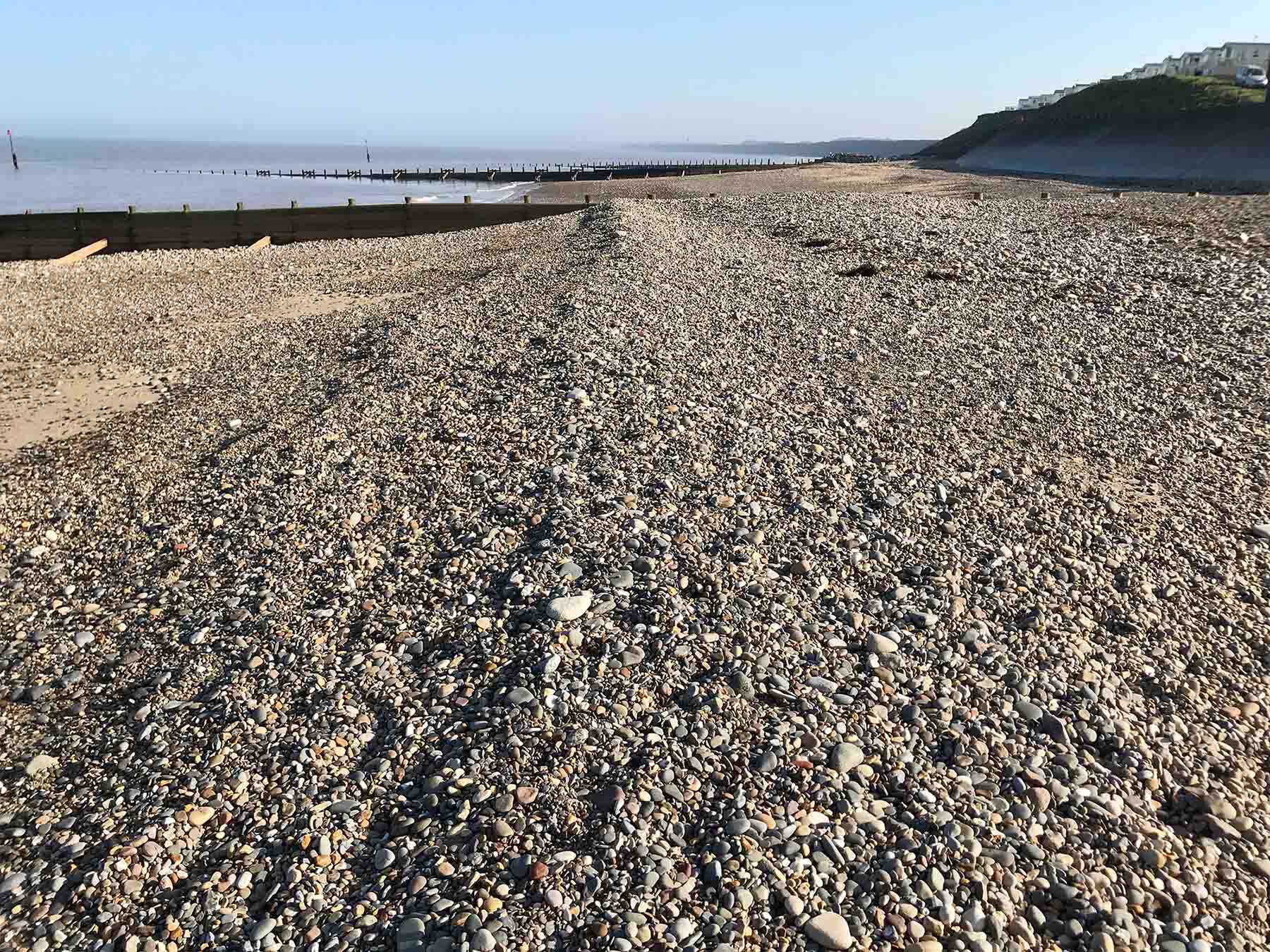
Sand and shingle beach at Hornsea
Spurn Point
In contrast to Flamborough Head, Spurn Point is home to a wide range of coastal landforms of deposition. Spurn Point is a coastal spit formed by the deposition of sediment transported along the Holderness Coast from north to south by longshore drift.
Where the coastline changes direction, material has been deposited to form the sandy spit.
Spurn Point is curved, with a hooked end, because the wind and waves coming from a secondary direction push the tip of the land in that direction, giving it this unique appearance.
Beach material is blown up the beach by the wind, forming sand dunes, which stretch almost the length of Spurn Point and have helped stabilise the spit.
Salt marshes have formed behind Spurn Point, as the River Humber deposits silt and mud in this sheltered estuary area.