Skills Plus Baseline 1 OS Maps
If you are here, it’s probably because you need to work on some of the Ordnance Survey (OS) skills covered in Skills Plus Baseline 1.
Study the information below (you might find it helpful to make notes or revision cards) and attempt the interactive activities to help improve your geographical skills.
Four Figure Grid References
Grid references allow people to locate places on a map accurately. Every OS map has a grid of faint blue lines printed on it. The lines that run from top to bottom are called eastings. Those that run horizontally from left to right are called northings.
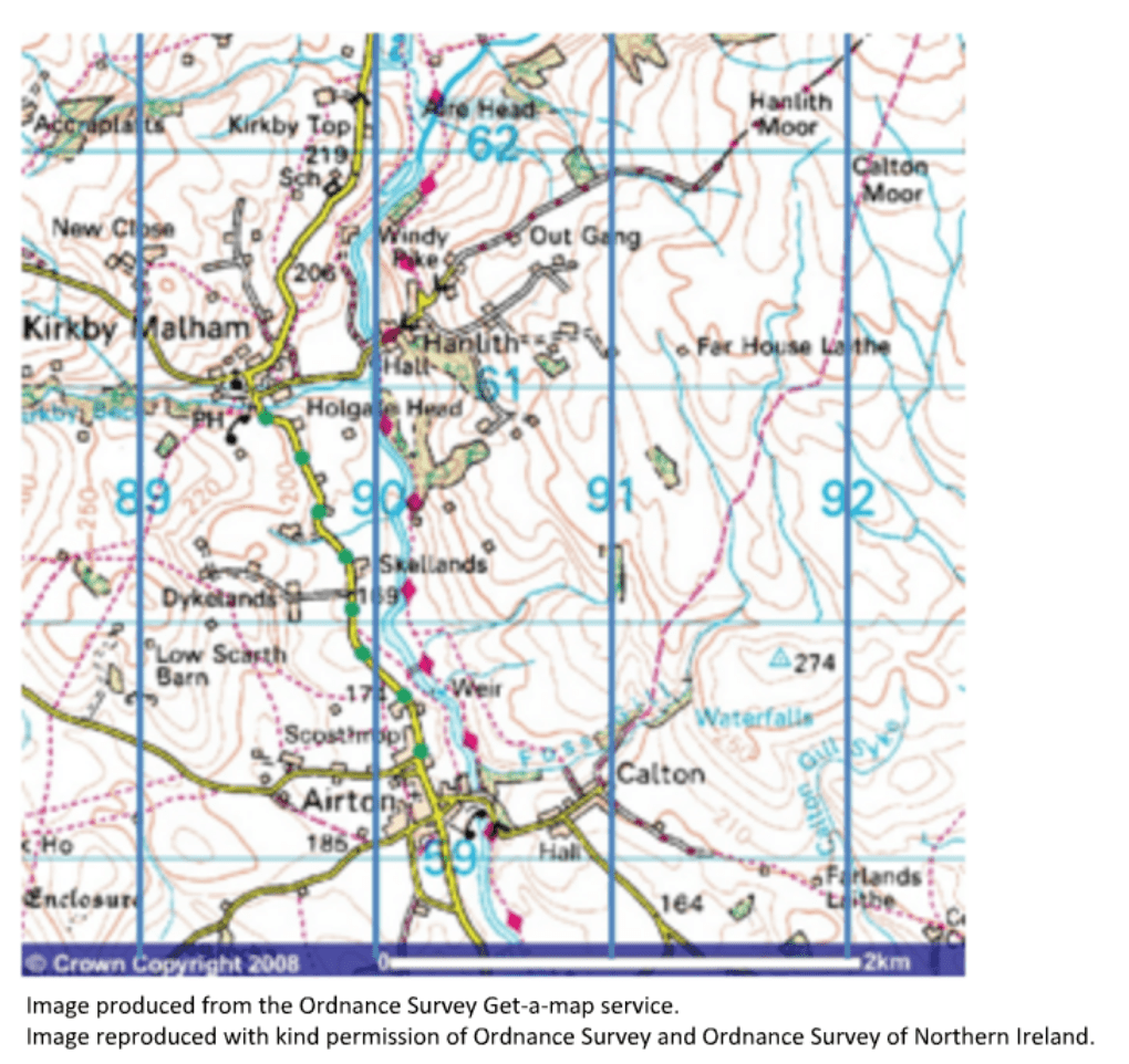
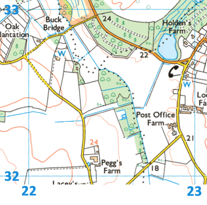
Look at the Ordnance Survey map below. Notice the blue squares that overlay the map.
An OS map extract showing grid squares
Eastings are the vertical lines that run from the bottom of the map to the top. They show you how far east you must go.
Eastings are the blue lines that run from the bottom to the top of the map.
Northings are the horizontal lines that run from the left to the right of the map. They show you how far north you must go.
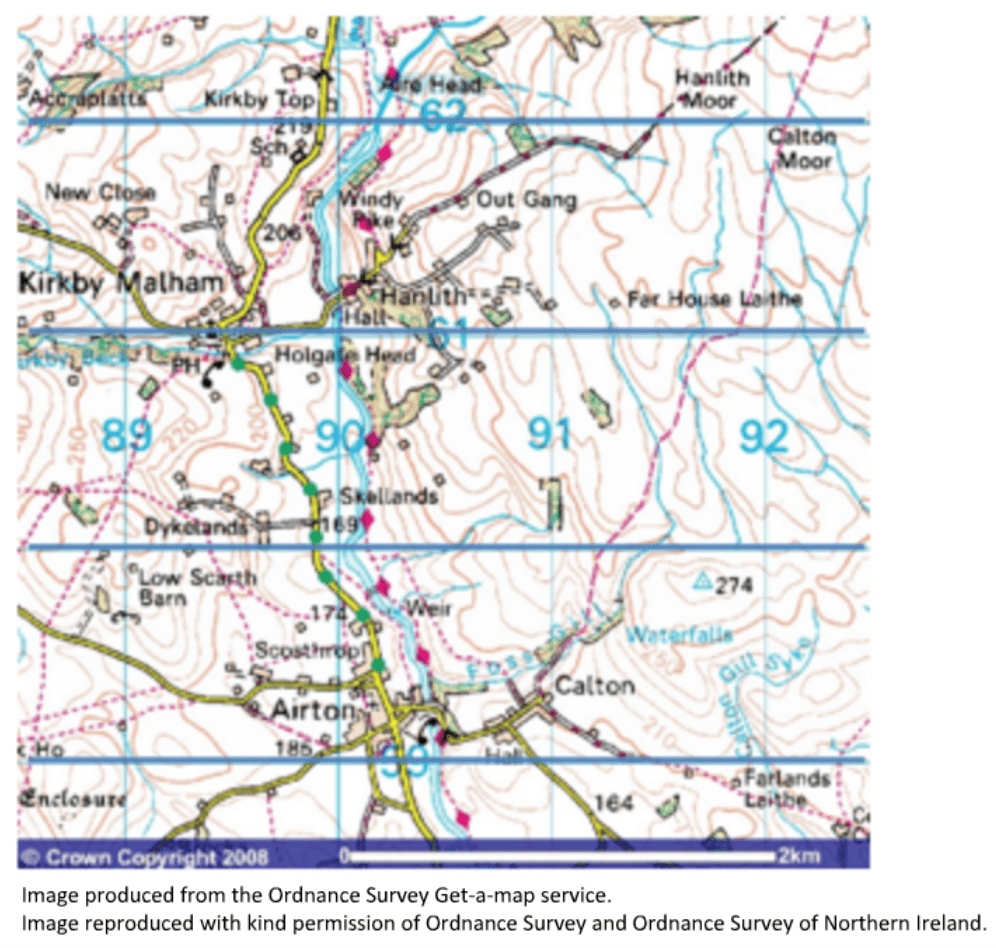
The northings are horizontal lines running from the map’s left to the right.
When giving a grid reference, the eastings are presented first, followed by the northings. A common way of remembering the order of the grid reference numbers is by saying along the corridor and up the stairs.
Along the corridor (the numbers going across first – the eastings) and up the stairs (the numbers going up the map – the northings)
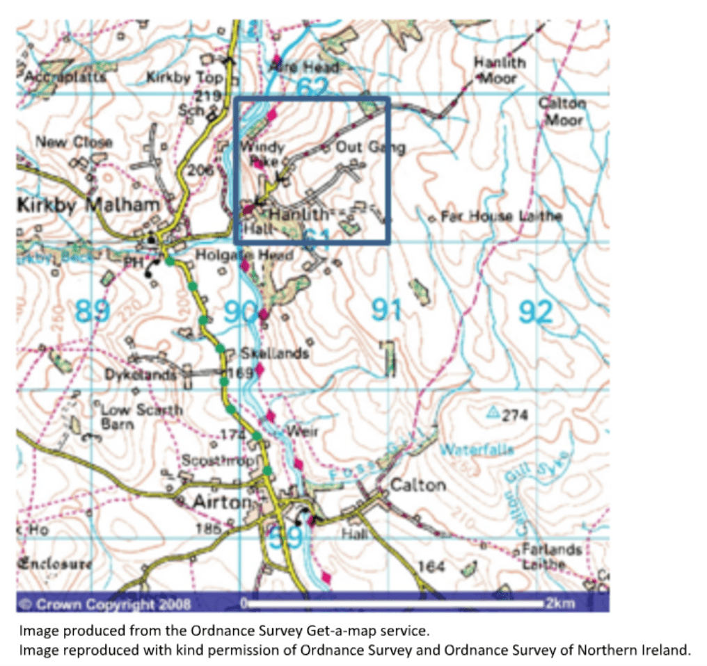
The four-figure grid reference for the square below is 9061.
Activity
Drag and drop the labels below to their correct grid square.
Six Figure Grid References
A grid square can contain a large area of land. Using six-figure grid references helps identify an exact location within a grid square.
The extract below shows grid square 2232. As you can see, the grid square contains lots of features. To identify an exact location within the grid square, we can use a 6-figure grid reference. We will use a six-figure grid reference to identify the precise location of Pegg’s Farm.
A grid square from an OS map
We will add a second grid on top of the grid square to illustrate how 6-figure grid references work. If you were doing this, you could use measurements (rather than draw a whole grid on top!).
The image below shows grid square 2232 with a grid added to it.
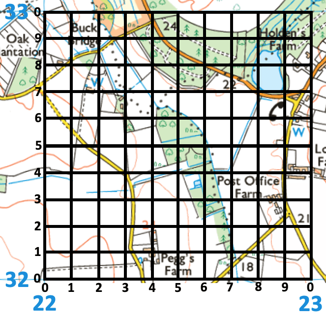
The same grid square with a further grid added to illustrate how to take 6-figure grid references
We can see that the main farm building for Pegg’s Farm (don’t take the reading from the name; use the building) lies on the 4th line. Therefore, the eastings reference is 224. The northings line is 1. Therefore, the northings reference is 321. Put them together, and you get 224321. This is the 6-figure grid reference for Pegg’s Farm.
When you complete these, you will not have an additional grid. However, you can mark the grid square on the map using a pencil and ruler to divide it up along the bottom (eastings) and the side (northings). As you use 6-figure grid references more often, you will become more skilled at identifying a location without needing to divide the grid square. The examiner will usually award a mark if you are 1 digit out e.g. if you put 223321 instead of 224321 for the location of Pegg’s Farm.
The interactive diagram below shows some locations marked for the same grid square above. Try to work out the 6-figure grid reference for each, then click the icon to see if you are right. Remember, it’s ok if you are 1 out.
Activity
Identify the 6-figure grid references for the locations shown on the map. Click the icon to see if you are correct.