
Home > Geotopics > Birmingham > Birmingham’s City Structure
Birmingham’s City Structure
The photograph below shows Birmingham’s Central Business District (CBD). This area primarily comprises department stores, speciality and variety goods retailers, offices, banks, theatres, and hotels.
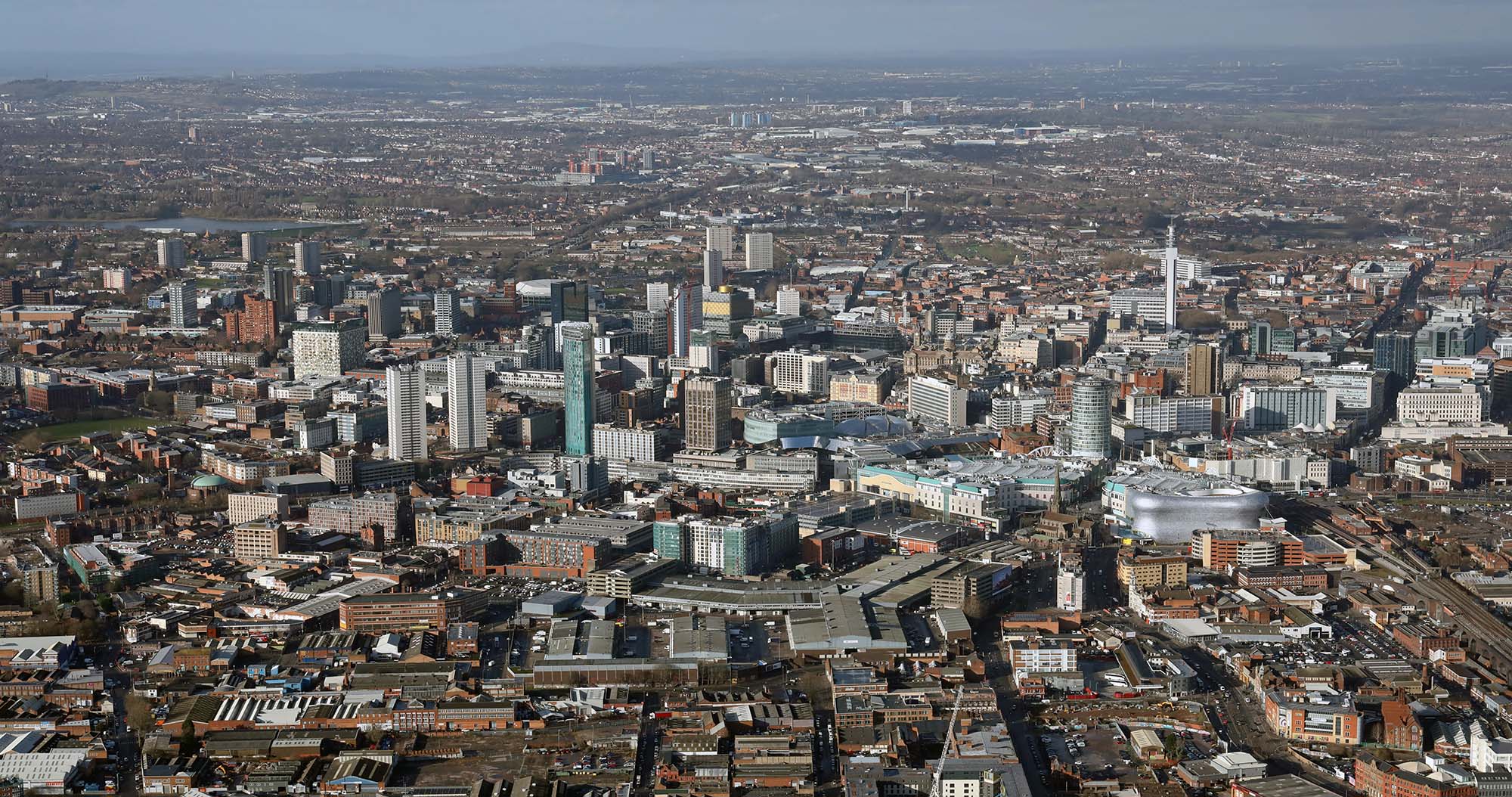
Birmingham’s central business district (CBD)
The CBD forms the city’s heart and centre for local government. Due to recent redevelopment initiatives, most structures in the CBD, such as the Bull Ring shopping centre, are relatively new. The environment within the CBD is of high quality, featuring patches of open green spaces. The expensive land prices have led to high building density, with structures situated closely together. Buildings here are taller than in other parts of the city as it is cheaper to build upwards than outwards.
Surrounding the CBD are the inner city areas, many of which were initially constructed in the 19th century and later redeveloped in the 1970s under Comprehensive Development Areas (CDAs) schemes. Any remaining buildings from the late 1800s are terraced housing, back-to-backs and factories (e.g. Digbeth). Tower block flats or high-density terraces characterise these areas. There’s a scarcity of shops and factories, a few churches, and minimal green spaces.
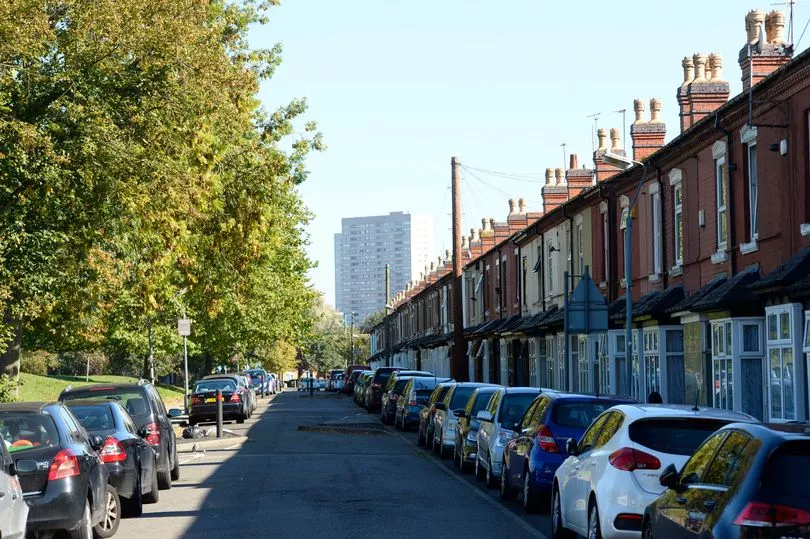
Terraced housing and high-rise flats in Birmingham’s inner city
Some redevelopment has occurred in the inner city, such as Brindley Place – canal side. There are also derelict factories due to deindustrialisation and decentralisation.
Beyond the inner city lie the suburbs, which encompass a significant portion of the city’s area. The suburbs vary throughout the city from the more affluent outer suburbs of Sutton Coldfield (high cost, low density, large open spaces, such as Sutton Park) to less affluent inner suburbs of Washwood Heath (inter-war housing, some gated parks).
While some suburbs originated in the 19th century, most developed between the 1930s and 1960s. Some serve as council housing centres (many of which have been privately acquired), while others were established as private estates (owner-occupied). Here, the building density is lower, and the predominant land use is housing, interspersed with a few shops and ample high-quality green spaces.
The city’s industrial zones are distinctly visible, emanating outward from the city centre, with two notable ones extending towards the east and northeast. The suburban industrial areas also play a pivotal role in the city’s geographical composition, typically near a main roadway.
Lastly, the urban-rural fringe, a blend of countryside closely connected to the city, is found along Birmingham’s northern and southern peripheries. A greenbelt protects the rural-urban fringe and has some villages, such as Shenstone.


Related Topics
Use the images below to explore related GeoTopics.