Distribution of population and the major cities in the UK
Population distribution in the UK is uneven.
If you know the physical geography of the UK, you will have a good understanding of population distribution in the UK. The relief (shape of the land) significantly impacts the distribution of the population. Low-land areas are densely populated, whereas upland areas have a low population density. Most urban areas have developed in lowland areas because they are easier to build on and have favourable climates, e.g. Birmingham.
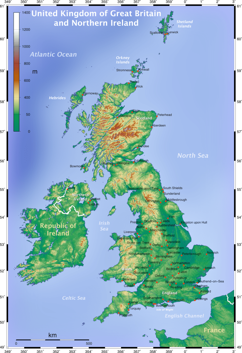
A map to show the physical geography of the UK and Ireland
The map below shows the population distribution in the UK.
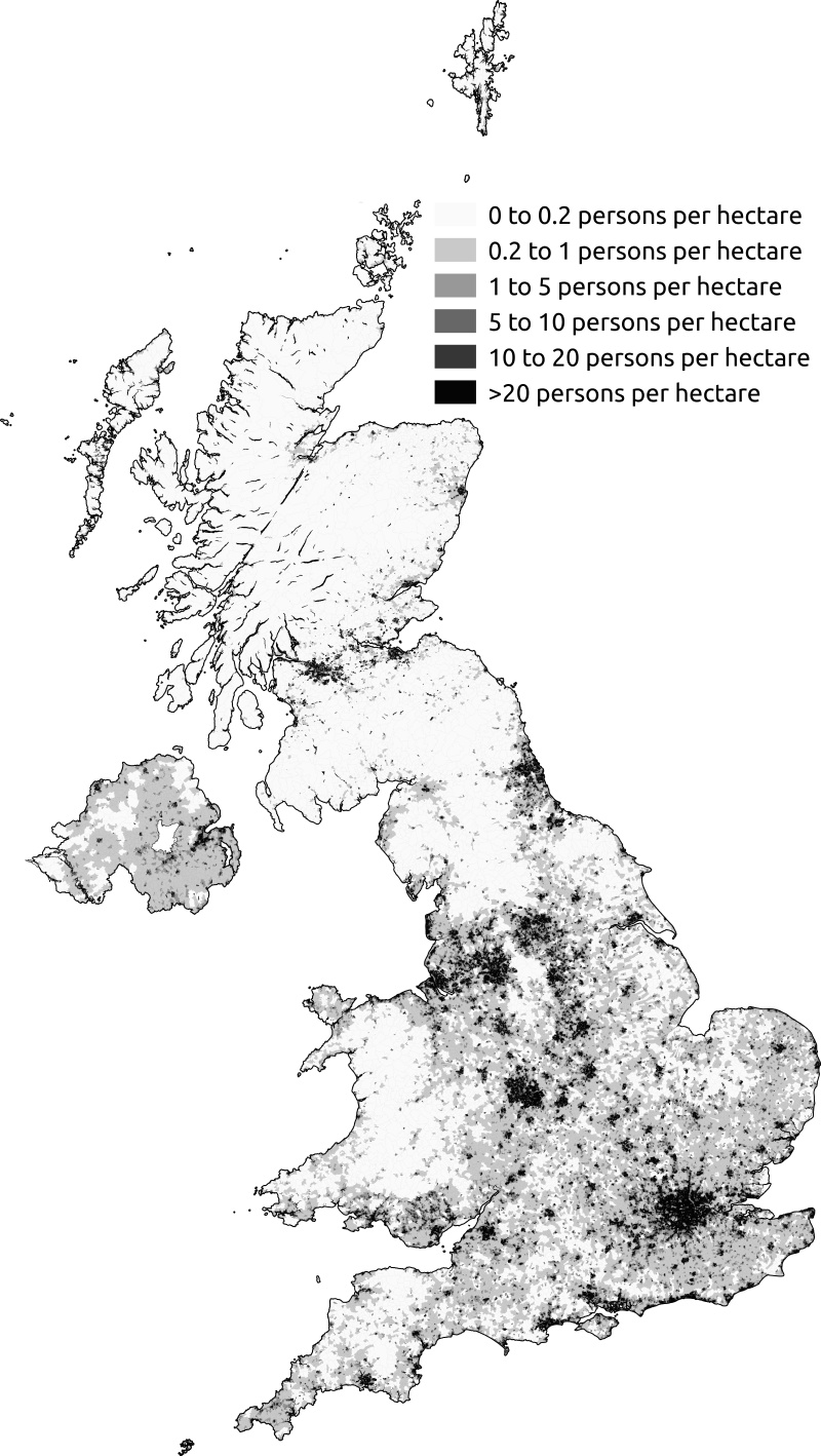
Population density in the UK based on the 2011 UK census.
The UK is one of the most urbanised countries in the world, with 82 per cent of people living in cities. This is typical of most high-income countries (HICs) that underwent urbanisation during the nineteenth and twentieth centuries. It differs in low-income countries (LICs), such as Nigeria, which is still rapidly urbanising today.
The UK’s population density is 260 people per square kilometre (km2), ranging from about 5,000/km2 in London to less than 10/km2 in northern Scotland. This makes us one of Europe’s more densely populated countries – more crowded than France, for example, but less crowded than the Netherlands.
Upland areas, such as northern Scotland, tend to be sparsely populated because they are difficult to build on, and the climate is often cold and wet. Also, these areas are difficult to farm and lack natural resources.
Some coastal locations have a high population density. This is particularly the case close to estuaries because harbours can be constructed. In the past, this enabled the fishing industry to develop and supported the development of ports to enable trading.
Urban areas have also developed where there are large reserves of natural resources. This includes iron ore and coal, e.g. Newcastle and Leeds.
Population density is high in the southeast of England due to the favourable climate and proximity to the capital city of the UK, London. The city has many industries and is a global financial centre. The map below illustrates the differences in population density and is based on data from the 2021 census.
The most densely populated areas in the UK are where the majority of its cities are located. Typically, these cities can be found in low-lying regions, such as coastal or riverside locations, where they have historically grown due to farming, trade, and industry support.
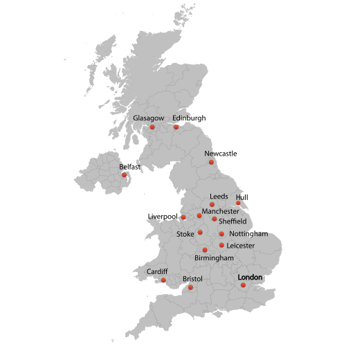
Major UK Cities
The South East of England is experiencing the most significant economic growth, resulting in the fastest-growing cities. London has seen the most significant increase in population, with over a million new residents in the twenty-first century. In contrast, Sunderland, located in the North East of England, is the only major UK city experiencing a population decline. This is attributed to the decline of industry and job loss, which has forced residents to move away in search of work.


Use the images below to explore related GeoTopics.