The Impact of Coastal Management at Hornsea
On Monday, 10th October, the Internet Geography drone took to the air at Hornsea on the Holderness Coast to investigate the impact of coastal management.
You are welcome to download and use the images on this page in your classroom. Please contact us if you would like to purchase a licence to use these images in commercial or shared resources.
By Anthony Bennett
Hornsea is a town on the Holderness Coast in the East Riding of Yorkshire. Due to the extensive coastal management, the town is frequently used as a case study and fieldwork location by schools across the UK.
The cliffs at Hornsea consist of boulder clay. Where the cliffs are not protected, the soft geology erodes rapidly to the north and south of the town, particularly in the winter when the prevailing northeasterly winds bring destructive waves.
Rates of erosion are significantly higher to the south of the town. Nowhere is this more evident than in Hornsea’s Golden Sands Caravan Park. The land here is downdrift of the defences at Hornsea, and beach material is not replenished as groynes trap sediment along the protected seafront.
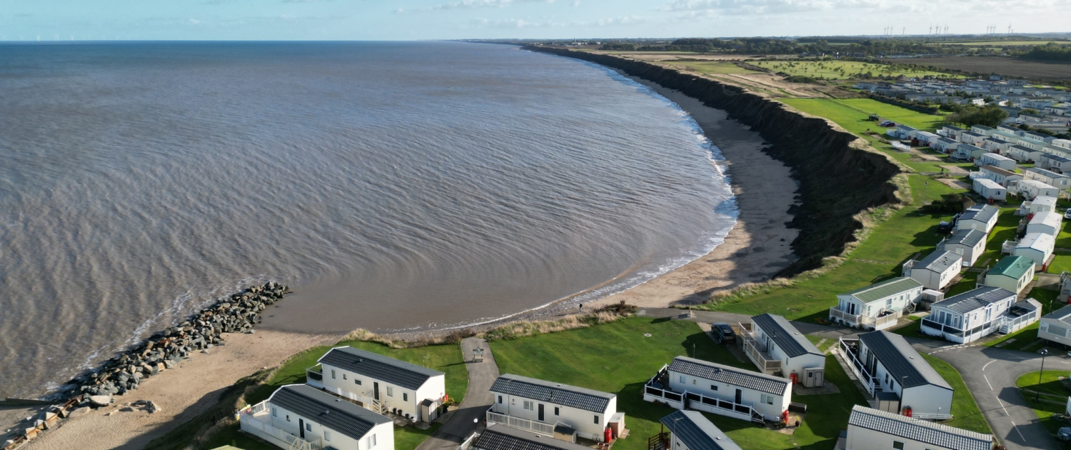
An aerial view of the impact of terminal groyne syndrome on Golden Sands Holiday Park
The image above encapsulates the advantages and disadvantages of coastal management. Approximately half of the leisure park is protected by groynes and rock armour. Along this section of the park, mass movement along the cliffs is limited to small mudflows caused by surface runoff. There has been no evidence of slumping along this stretch of the coast for many years, and the static caravans have remained in place for a considerable amount of time. The wooden groynes trap sediment transported along the coast and retain a wide, sandy beach which protects the cliffs from erosion. The recently installed rock armour provides added protection by absorbing wave energy and is particularly effective during the winter.
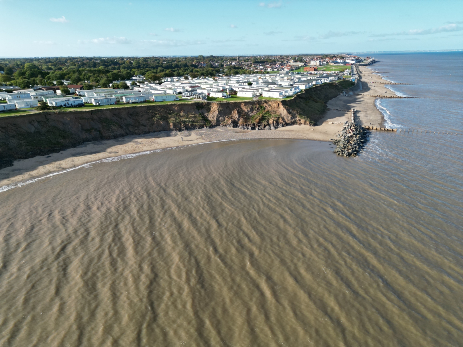
While the coastal defences in Hornsea have effectively protected the town, the erosion rate to the south (downdrift) has increased rapidly. A significant embayment has formed. As beach material is transported south along the Holderness Coast, it has not been replenished as it is trapped by the groynes fronting Hornsea. The beach here has been starved of material, meaning waves reach the base of the cliff even during neap tides, increasing the rate of erosion.
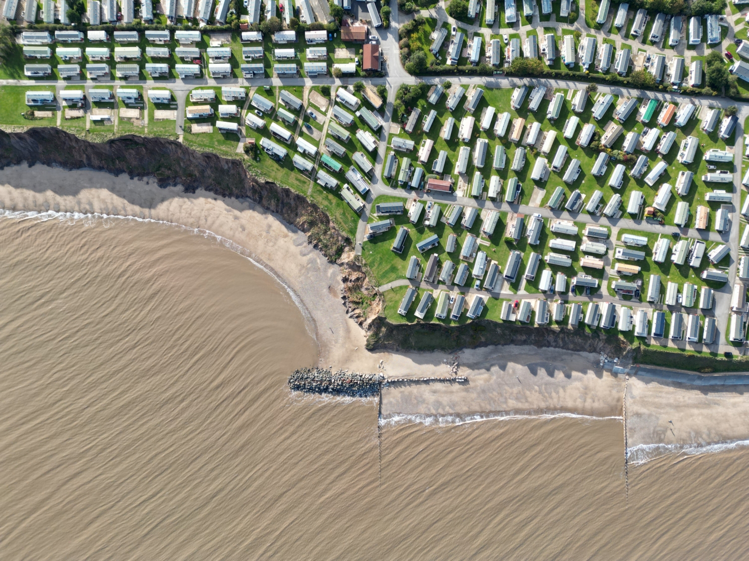
The impact of terminal groyne syndrome on Golden Sands Holiday Park – Changes between March 2019 and October 2022
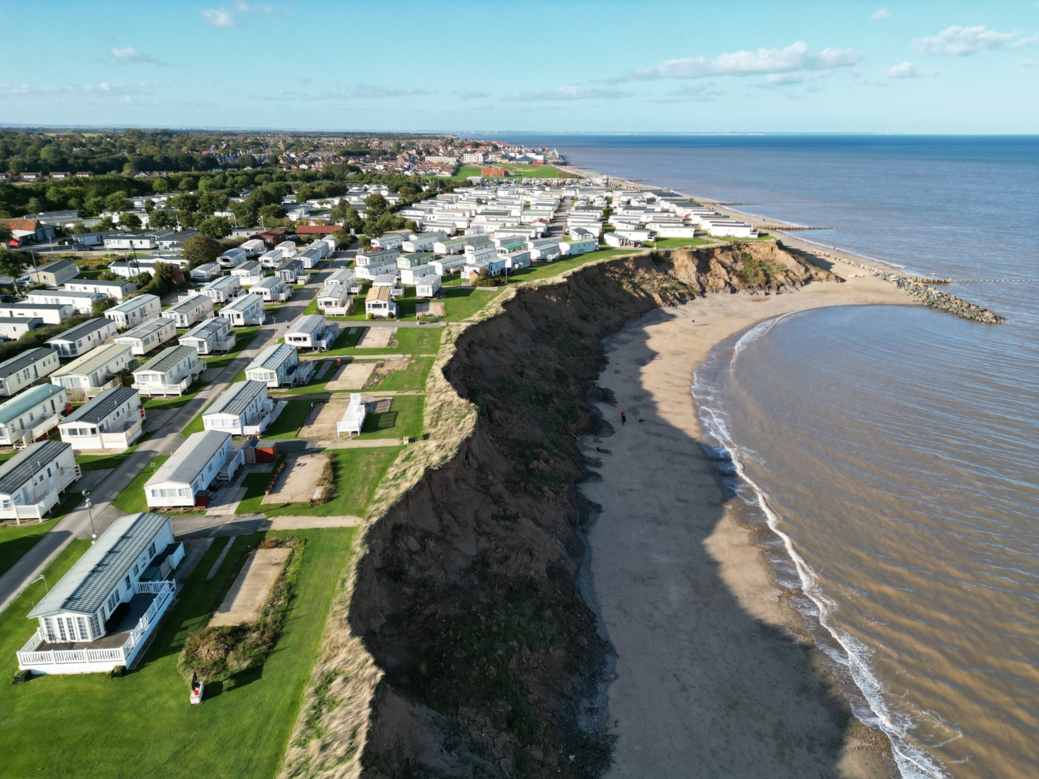
In 2019 there were three rows of static caravans in front of the access road in the foreground of the image above. A significant mass movement event occurred in March 2019 when a crack formed eight metres from the cliff edge and extended 50 metres along the cliff front. Slumping was responsible for this. As the beach below is starved of material, waves erode the base of the cliffs. This, combined with heavy rainfall, led to large-scale slumping. At the time, one of the three rows of caravans was relocated. More recently, the second row has been relocated. The empty concrete pitches and decking are evidence of the previous occupants.
The impact of terminal groyne syndrome on Golden Sands Holiday Park
Changes between March 2019 and October 2022
The view north illustrates the extent of the embayment south of the coastal defences
A pattern of terminal groyne syndrome has occurred further south along the Holderness Coast at Mappleton and Withernsea. At the latter, a 500m rock armour extension has been constructed to reduce erosion, and tackle embayment, protecting the main road linking settlements to the south of the town. However, to the south of Hornsea, the land is of relatively low value as it is used for leisure and mainly agriculture. Consequently, there is little incentive to extend coastal management here.
The Shoreline Management Plan for the area is to continue to hold the line and maintain the current defences along the seafront at Hornsea. To the south of Hornsea, no management intervention or defences will be constructed on the currently undefended frontages according to the plan.
As part of the Coastal Transition Accelerator Programme (CTAP), the East Riding of Yorkshire (along with North Norfolk) has received funding to work with communities on the coast that cannot sustainably be defended from coastal erosion. The programme will explore how we can adapt to the effects of climate change on the coast. However, it remains to be seen whether any funding will be used to support those affected by accelerated erosion rates to the south of the defences at Hornsea.
Interested in seeing more images of this area? Take a look at this collection of 360° images of the area explored in this article.
We can only develop and publish open-access resources like this with the support of Internet Geography Plus subscribers. If you would like to support developments like this on Internet Geography, please consider taking out an Internet Geography Plus subscription (you get access to hundreds of editable resources to use in your classroom) or treat us to a coffee (all contributions are invested into the site – we don’t actually like coffee).


