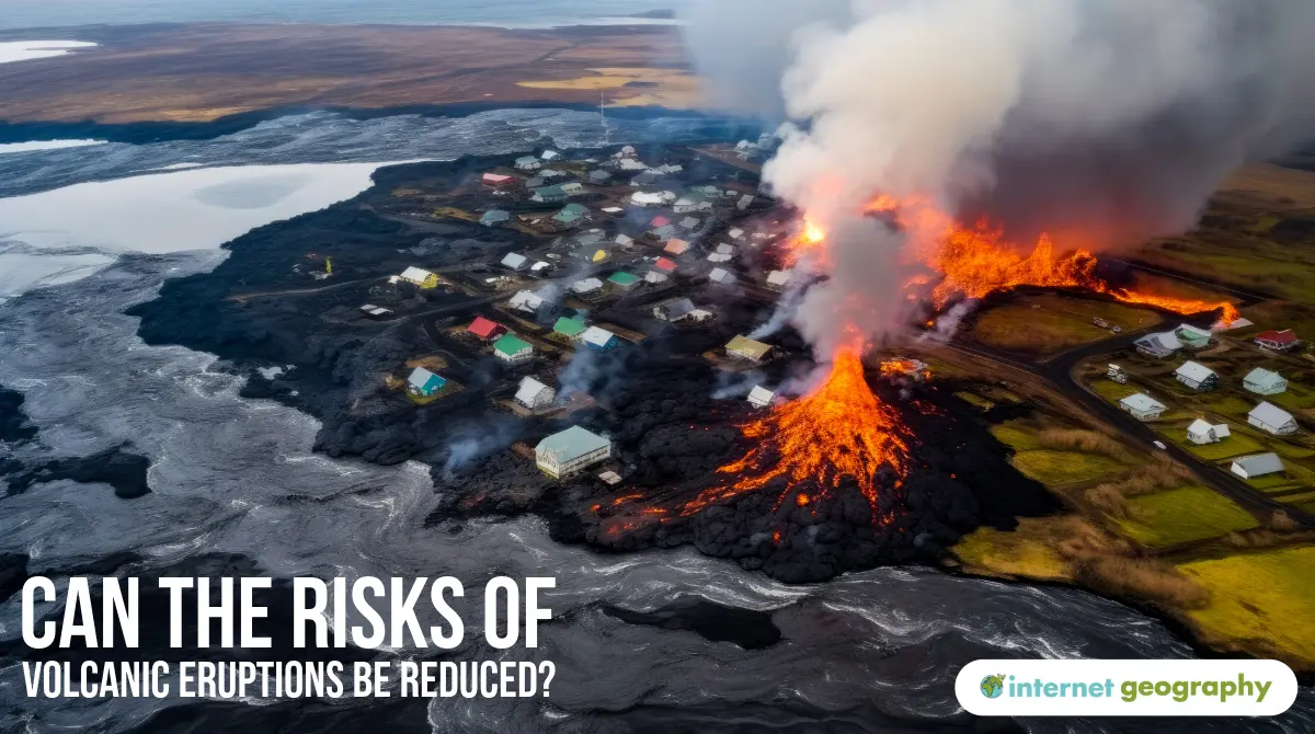
Can the risks of volcanic eruptions be reduced?
Volcanoes are natural hazards that can be unpredictable; several strategies are used to reduce the risk.
MONITORING
There are several ways to monitor the risk of volcanic eruptions. Before volcanic eruptions, volcanoes tend to change shape as magma rises through them. Tiltmeters and satellites (through GPS) are used to detect changes in the surface shape of a volcano.
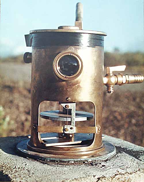
Tiltmeter on Mau Loa, Hawaai
Monitoring levels of gas around the volcano, such as radon and sulphur gases, is also used as these are often released before volcanic activity. Thermal heat sensors can be utilised to detect changes in the surface temperature of the volcano. As magma rises, this causes an increase in the surface temperature of the volcano. As magma rises, it can cause minor earthquakes. Seismometers and lasers are used to monitor the Earth’s movements that can often occur before a volcanic eruption.
PREDICTION
By monitoring the movement of tectonic plates and changes in the volcano’s surface, scientists can predict the likelihood of a volcanic eruption and forecast which areas should be prepared for it. Predicting when a volcano is at risk of eruption allows time for evacuation plans to be put into effect.
PROTECTION
Protecting people and settlements from volcanic hazards is one of the most challenging strategies for reducing risk. Unlike earthquakes, the movement of lava flows, lahars (mudflows), and ash clouds cannot easily be stopped or resisted by buildings. Therefore, evacuation remains the most effective and widely used method of protection during volcanic eruptions.
However, in some cases, efforts have been made to protect infrastructure and limit damage from lava flows:
- In Iceland, one of the most notable successes occurred during the 1973 eruption of Eldfell on the island of Heimaey. Lava threatened to block the island’s vital harbour. In response, emergency crews pumped seawater directly onto the lava flow for over four months, slowing its advance. This cooled and hardened the lava, successfully redirecting the flow and saving the harbour—although around 400 buildings (about a fifth of the town) were destroyed.
- More recently, during the 2021 eruption of Fagradalsfjall on the Reykjanes Peninsula, Icelandic authorities established barriers and earthen walls to redirect and contain lava flows, thereby protecting roads and nearby infrastructure. Although the eruption occurred in a relatively remote area, the response showed how Iceland combines physical protection with real-time monitoring and public communication to reduce risk.
Iceland also invests heavily in building design, especially in areas prone to ashfall and earthquakes. Reinforced roofs and air filtration systems help protect homes, schools, and public buildings from ash damage and improve air quality.
While these protective methods cannot entirely prevent volcanic activity, they can help mitigate damage to key infrastructure and enhance safety for nearby communities. Combining physical protection with early warning systems and evacuation planning is the most effective way to reduce risk.
PLANNING
One of the most effective ways of reducing the risk of a volcanic eruption is to have an evacuation plan. This involves ensuring evacuation strategies are in place, along with emergency shelter and food supplies being planned for.
Based on monitoring data, exclusion zones can be established to ensure that people are evacuated from areas likely to be affected before an eruption.
Local people can also be educated about actions they can take to reduce the risk of loss of life or injury. People are taught that if they are unable to be evacuated, they should do what they can to protect themselves, e.g., go indoors to avoid falling ash and rock.