Using the measurement tool in Google My Maps
Google My Map has a powerful measurement tool that can be used to investigate distance on maps. It can be used in a range of ways including:
- identifying locations that are equal distances apart for fieldwork e.g. river sampling locations
- measuring the impact of coastal erosion
- calculating the length of lava flows
- calculating distance between places, both straight line and following a route
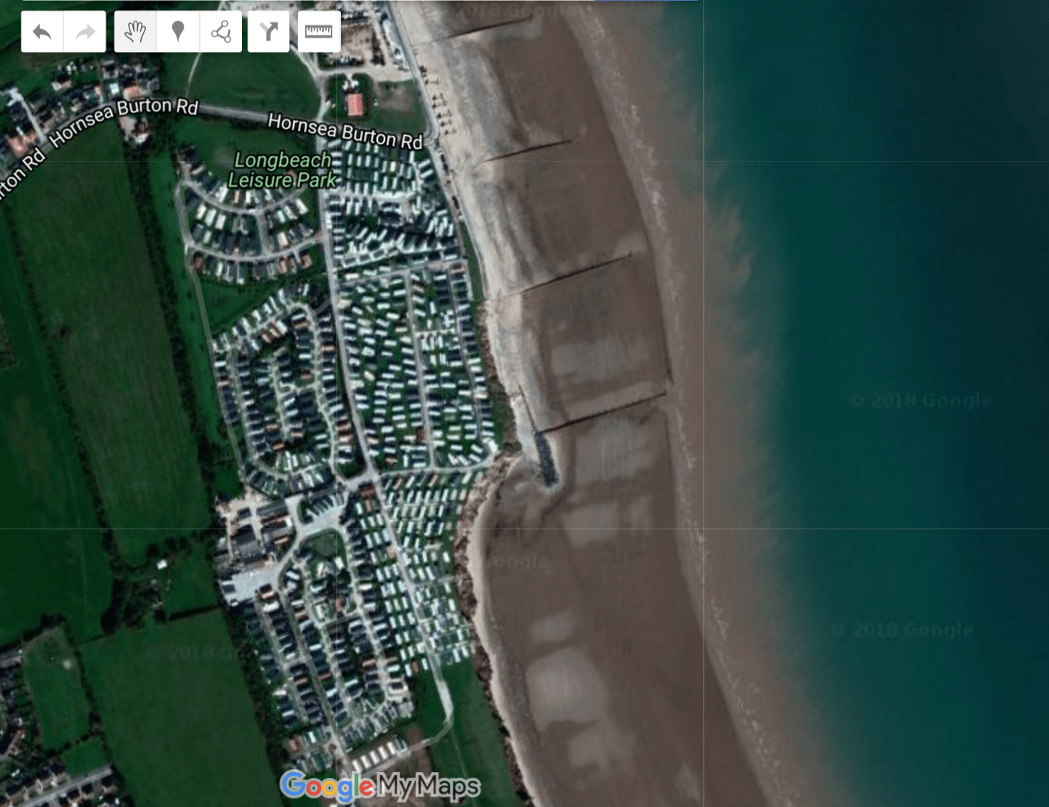
In this example, we are going to use the measurement tool to identify the impact of coastal protection to the south of Hornsea.
I’ve located the coastline to the south of Hornsea in Google My Maps. I’ve set the map to satellite image so we can clearly see the coastline.
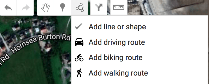
I am now going to use the line tool to draw a line to show approximately where the coastline once was. To do this click the Add Line button.
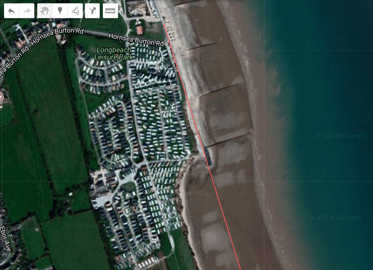
I’ve now drawn a line to illustrate the approximate location of the former coastline.
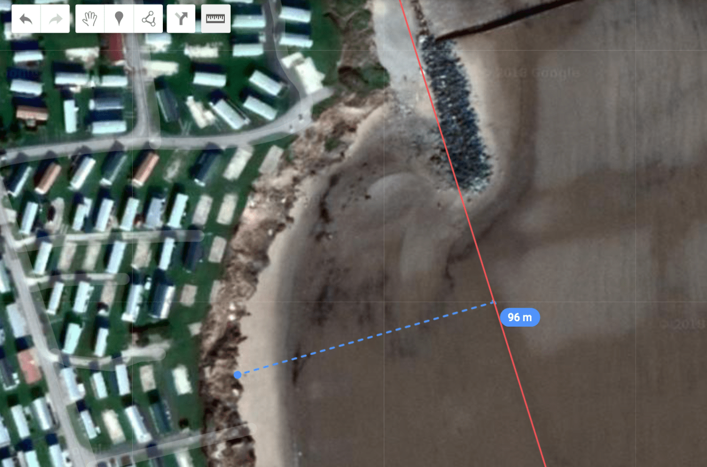
You can now zoom in an use the measurement tool to measure the amount of coastline that has been lost to erosion. The measurement tool is a square icon that looks like a ruler. Click it then drag a line to measure the distance between the former coastline and the cliffs.
Below is the map I’ve created.
Need to share your map? Take a look at our guide here.
Take look at the other Google My Maps tutorials for more ideas on how you can use the app for presenting data.
If you are looking to further the develop the use of Google Apps in your classroom or school our friends over at Cre8tiveIt.solutions can provide support and training with the use of Google Suite, Google Drive, Google Edu and Google Classroom.
Anthony Bennett


Leave a Reply
Want to join the discussion?Feel free to contribute!