Internet Geography Geography PLC+
Today we’ve launched our first in a series of new PLC resources to support teachers and students with revision. Internet Geography PLC+ has been designed to overcome one of the biggest weaknesses traditional PLCs have presented to teachers and students.
Personal Learning Checklists are typically used in one of two ways. Either they are completed by the teacher, based on the evidence they have of each student, or they are completed by the student, choosing red, amber or green for how confident they feel about each aspect of the unit. The former is time-consuming, while the latter is susceptible to students being over or under-confident resulting in them not directing revision effectively.
Our new PLC+ resources have been designed to support students in making more accurate judgments on their PLCs, support their revision, and improve their exam technique.
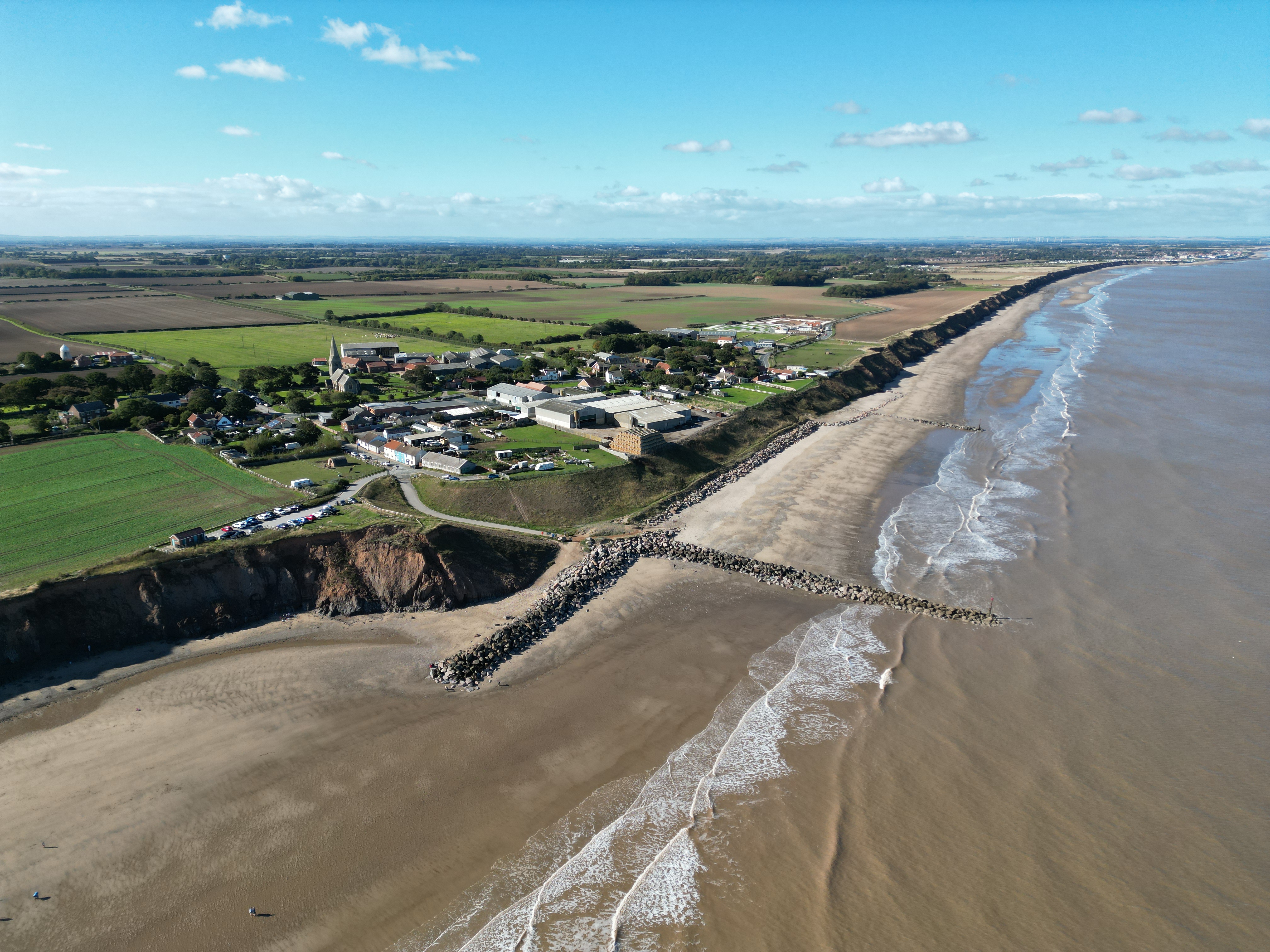
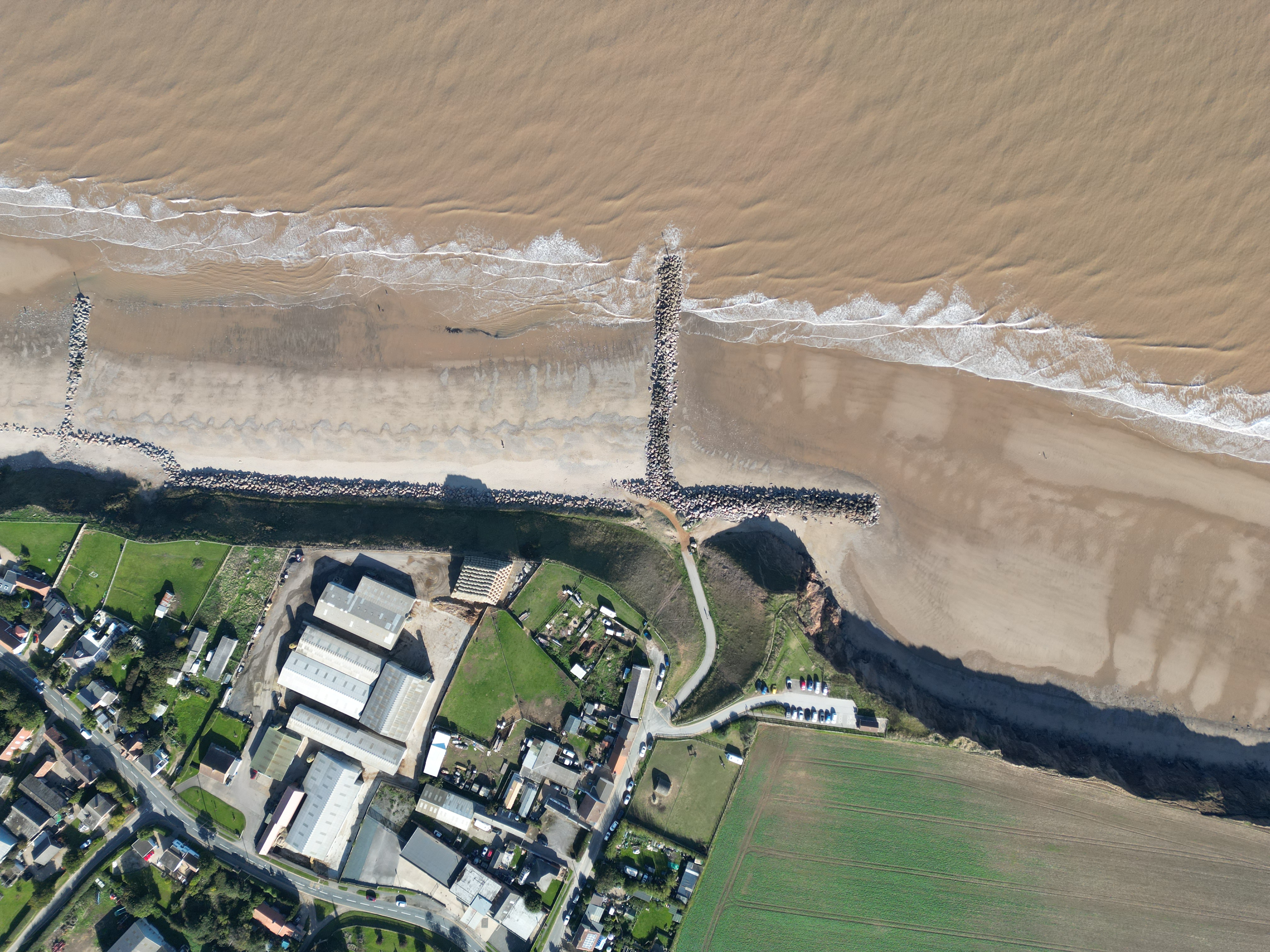
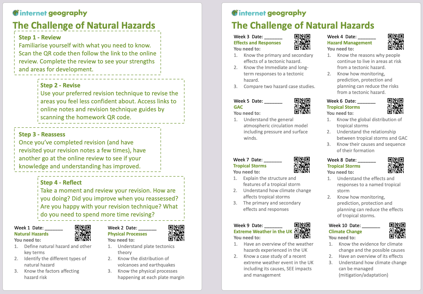
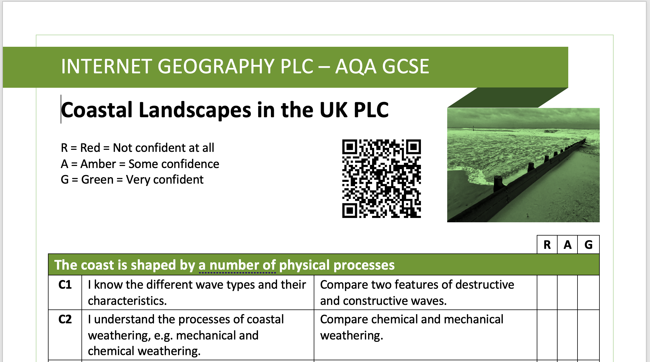
Our first PLC+ covers the AQA GCSE Geography Coastal Landscapes in the UK. As you can see from the image below, we’ve made some tweaks to the traditional PLC.

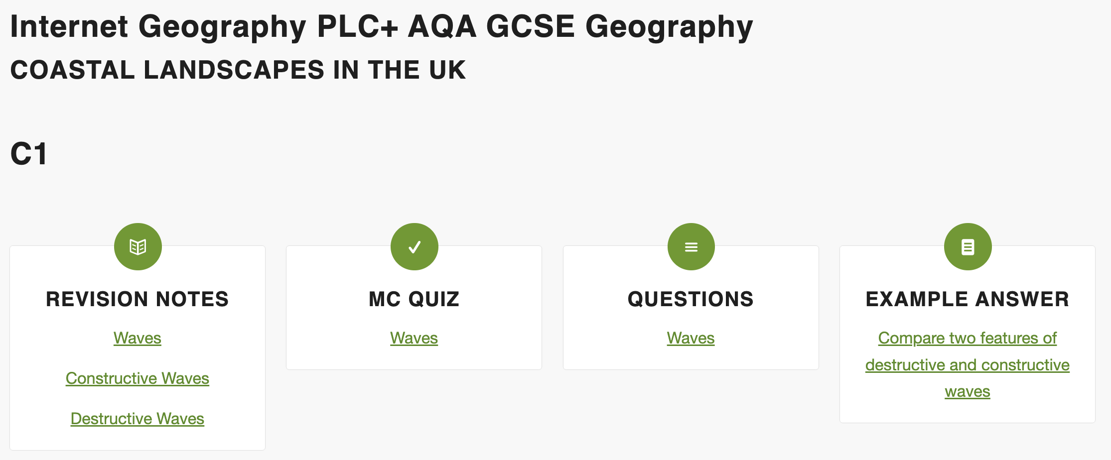
Firstly, each section of the PLC has a code. For example, C1 covers Waves. We’ve included a code so that when teaching Waves, this code could be displayed for the students, who then record it, providing them with a reference point in their notes for revision (they could go through their exercise books and do this retrospectively).
Secondly, we’ve added an exam-style question to each section of PLC+. When students are grading/RAG rating each section of the new PLC, they are to reflect on how well they would be able to answer the question. As students complete their PLC, you might want to challenge them to see what they would include in a particular answer to see how accurate their RAG score is!
Thirdly, we’ve added a QR code to a comprehensive collection of online resources on Internet Geography (free to access) to support revision and assist students in completing the exam-style questions on the PLCs.
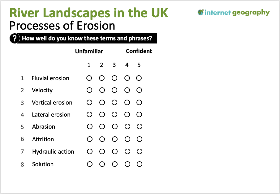
Scanning the QR code takes your students to a page dedicated to the unit on Internet Geography. Each unit page contains links to online notes (for revision), a multiple-choice quiz, a short answer quiz and an example answer to each exam question on the PLC. The image below shows an extract from the Coastal Landscapes in the UK PLC+ page.
Internet Geography PLC+ Online Resources
The online resources can be used in a range of ways, for example:
- Students can complete the multiple-choice quiz and short answer questions before completing PLC+
- Students can complete the example exam questions before filling in the PLC or demonstrate they are at Green by completing the exam question. Once they have completed the question, they can go online and check their answer against the mark scheme/example.
- If students are Red/Amber, they can go online, read through the online notes, produce revision resources then check their knowledge using the quizzes. Finally, they can complete the exam questions and assess themselves against the online examples.
We are developing PLC+ resources for each AQA GCSE Geography unit over the coming months. PLC+ will also be made available as E-PLCs (Google/MS Sheets). We’ll then move on to other specifications.
Internet Geography Plus subscribers can now download the first editable PLC+ covering Coastal Landscapes in the UK. In addition, there is also a PowerPoint that can be used to present PLC+ to students.
Log in or subscribe to Internet Geography Plus.
Please let us know if you have any thoughts, comments or feedback about PLC+, we love hearing from you!